more stats
1,273 ft
Distance
-250 ft
Descent
00:01:39
Avg time
-250 ft
Altitude change
3,804 ft
Altitude min
4,054 ft
Altitude max
4,054 ft
Altitude start
3,806 ft
Altitude end
-19.6%
Grade
-49.2%
Grade max
-3.3%
Grade min
1,273 ft
Distance down
00:01:39
Avg time

Scarecrow (Upper) Details

  • Activities
    • Mountain Bike
    • E-Bike
  • Riding Area
    Killington Bike Park
    Killington, Vermont
  • Difficulty Rating
  • Voted Difficulty
    Black Diamond (1 vote)
  • Local Popularity
    50 in Mountain Biking [+]
    • 30 in E-Biking
  • Global Ranking
    #58296 in Mountain Biking
  • Trail Type
    Singletrack
  • Bike Type
    DH, AM
  • Trail Visibility
    Always easy to follow
  • eBike Allowed
    Yes up to Class 1
  • TTFs on Trail
    Rock Garden
  • Lighting
    No
  • OSM Way

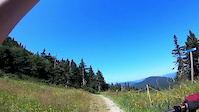
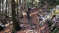
Starts out pretty wide but has a lot of loose rocks until you get into the berms where they are a bit rocky too, but more embedded rocks and brake bumps will rattle you a bit. From there you dump out to the resort service road to pedal to the next section. Here you choose to stay left on the road or dump right into the expert section which is a massive rock garden.

This upper section continues onto the double track to where you can hit Steel Panther or continue on the road a bit further and drop down the bottom of Scarecrow

Access Info

Take Off The Top down from the Gondola and watch for the trail sign to the left.

Bike Park

Traditionally Indigenous Territory

Recent Activity on Trail

Past Week
  • 0 rides
  •  
6 Months
  • 78 rides
  • 29 miles avg distance
All
  • 535 rides
  • Last: Sep 14, 2026
c1c2c3c4
January
February
March
April
May
June
July
August
September
October
November
December
update trails status or condition

Scarecrow (Upper) Trail Reports

statusdatedescription
Aug 21, 2026 @ 5:13pm (America/New_York)
Aug 21, 2026
Trailers running fast and true one of my favorite trails nothing to complain about on scarecrow short of a ram derailer and gear changer battery...
Aug 16, 2026 @ 11:54am (America/New_York)
Aug 16, 2026
Jul 26, 2026 @ 12:35pm (America/New_York)
Jul 26, 2026
Jul 25, 2026 @ 10:48am (America/New_York)
Jul 25, 2026
Jul 12, 2026 @ 6:49am (America/New_York)
Jul 12, 2026
more »
Status:
on Aug 21, 2026
Ideal
Avg: 4.07 (7 votes)
Your vote: 0

view (4,142)
close
      Directions to scarecrow-upper trailhead (43.605090, -72.816780)

      Photos

      11 more »
      mtb
      789 |
      Sep 3, 2015 @ 10:50am
      Sep 3, 2015
      mtb
      795 |
      Sep 22, 2015 @ 7:08am
      Sep 22, 2015
      mtb
      162 |
      Jul 3, 2017 @ 10:02am
      Jul 3, 2017
      mtb
      315 |
      Aug 12, 2018 @ 6:16pm
      Aug 12, 2018

      Videos

      4 more »
      Killington - Scarecrow and Steel Panther
      mtb
      6:05 | 744 | Aug 31, 2018 , Killington
      youtuber Scarecrow & Steel Panther in the Rain
      mtb
      485 | Oct 16, 2017 , Killington
      scarecrow
      mtb
      4:27 | 86 | May 30, 2020 , Killington
      Sending at Killington
      mtb
      0:59 | 80 | Oct 20, 2018 , Killington

      Routes with this trail

      11 miles 4,003 ft 12 Race
      Created based on map posted for the Stans Enduro race posted on the Maxxis Eastern States Cup website....
      4.2
      7 Ratings
      5 14%
      4 86%
      3
      2
      1

      Reviews / Comments

      No reviews yet, be the first to write a review or ask a question.
      Use trail reports to comment on trail conditions.


      We hope you've been enjoying Trailforks!

      Create a FREE account to view all trail reviews and much more.

      • By StephaneMarceauTF Pro TRAILFORKS & contributors
      • #44387 - 3,179 views

      Frequently Asked Questions

      Where is Scarecrow (Upper) located?
      Scarecrow (Upper) is located in Killington Bike Park, Killington, Vermont, United States. It is part of the Killington Bike Park trail network. The trailhead is located at coordinates 43.60509, -72.81678.
      How hard is Scarecrow (Upper)?
      Scarecrow (Upper) is rated as Black Diamond difficulty. The average grade is 19.6%.
      What is the elevation gain for Scarecrow (Upper)?
      The trail has 250 ft of elevation descent. The elevation ranges from 3,804 ft to 4,054 ft.
      How long is Scarecrow (Upper)?
      Scarecrow (Upper) is 1,273 ft long. The trail type is singletrack.
      Are dogs allowed on Scarecrow (Upper)?
      There is no information about dogs being allowed on Scarecrow (Upper). Check with local trail managers or the trail page for the latest access rules.
      How do I access Scarecrow (Upper)? Where is the closest parking trailhead?
      The closest parking and trailhead locations to Scarecrow (Upper) are: View all parking locations in the area.
      How long does it take to ride Scarecrow (Upper)?
      Based on recorded activities, it takes an average of 1 minute to ride Scarecrow (Upper). The trail is 1,273 ft long. Actual times will vary based on fitness level, conditions, and pace. View recent activity logs for more details.
      How busy is Scarecrow (Upper)?
      Scarecrow (Upper) is a moderately popular trail. There have been 3,570 recorded activities on this trail. The trail has received 4,142 check-ins. View recent activity on this trail.

      Hit the Trail

      Open in App

      Get this trail on your phone instantly.

      open trail in app

      Download Trail

      Save to wishlist, Garmin & download.
      save the trail

      Find Related Routes

      Find routes and users activities that include this trail.
      find routes for this trail

      You must enter a description before submitting.