close
-
Layers w
- Weather Layers
- Pro
- Pro
- Pro
- Pro
- Pro
- Pro
- More Layers
- Pro
- Pro
- Pro
- Pro
-
Upgrade to

3D
Trail Conditions
- Unknown
- Snow Groomed
- Snow Packed
- Snow Covered
- Snow Cover Partial
- Freeze/thaw Cycle
- Icy
- Prevalent Mud
- Wet
- Variable
- Ideal
- Dry
- Very Dry
Trail Flow (Ridden Direction)
Trailforks scans users ridelogs to determine the most popular direction each trail is ridden. A good flowing trail network will have most trails flowing in a single direction according to their intension.
The colour categories are based on what percentage of riders are riding a trail in its intended direction.
The colour categories are based on what percentage of riders are riding a trail in its intended direction.
- > 96%
- > 90%
- > 80%
- > 70%
- > 50%
- < 50%
- bi-directional trail
- no data
Trail Last Ridden
Trailforks scans ridelogs to determine the last time a trail was ridden.
- < 2 days
- < 1 week
- < 2 weeks
- < 1 month
- < 6 months
- > 6 months
Trail Ridden Direction
The intended direction a trail should be ridden.
- Downhill Only
- Downhill Primary
- Both Directions
- Uphill Primary
- Uphill Only
- One Direction
Contribute Details
Colors indicate trail is missing specified detail.
- Description
- Photos
- Description & Photos
- Videos
Trail Popularity ?
Trailforks scans ridelogs to determine which trails are ridden the most in the last 9 months.
Trails are compared with nearby trails in the same city region with a possible 25 colour shades.
Think of this as a heatmap, more rides = more kinetic energy = warmer colors.
- most popular
- popular
- less popular
- not popular
ATV/ORV/OHV Filter
Max Vehicle Width
inches
US Cell Coverage
Legend

Radar Time
Activity Recordings
Trailforks uses anonymized public activity data.
?
Activity Recordings
Trailforks uses anonymized public activity data.
?
Personal Heatmap
▶
Activity Types
all
/
none
▶
Options
2
Date range
month
–
Winter Trails
Warning
A routing network for winter maps does not exist. Selecting trails using the winter trails layer has been disabled.
Missing Trails
Most Popular
Least Popular
Trails are colored based on popularity. The more popular a trail is, the more red. Less popular trails trend towards green.
Jump Magnitude Heatmap
Heatmap of where riders jump on trails. Zoom in to see individual jumps, click circles to view jump details.
BC Backroad Status
![map legend]()
Service Road Atlas is a free to use, community-driven service for viewing and creating reports on the numerous back-country service roads around B.C. and Alberta.

Slope Aspect
Direction the slope faces
Trails Deemphasized
Trails are shown in grey.
Only show trails with no bike usage.
Suggested Layers
Based on selected activity type
Save the current map location and zoom level as your default home location whenever this page is loaded.
Save
No description for Wallula has been added yet!
Login or register to submit one.
Activities Click to view
- Mountain Bike
56 trails
- E-Bike
54 trails
- Gravel Bike
0 trails
- Adaptive Bike
- Hike
57 trails
- Trail Running
56 trails
Region Details
- 3
- 16
- 28
- 8
Region Status
Open as of Jun 7, 2026Local Trail Association
Stats
- Avg Trail Rating
- Trails (view details)
- 56
- Trails Mountain Bike
- 56
- Trails E-Bike
- 54
- Trails Horse
- 1
- Trails Hike
- 57
- Trails Trail Running
- 56
- Trails Observed Trials
- 1
- Total Distance
- 24 miles
- Total Descent Distance
- 9 miles
- Total Descent
- 3,782 ft
- Total Vertical
- 891 ft
- Highest Trailhead
- 1,244 ft
- Reports
- 263
- Photos
- 222
- Ridden Counter
- 1,226
Sub Regions
-
Wallula Scablands
- 16
- 28
- 8
Popular Wallula Mountain Biking Trails
• 100 ★ 3.0 • 1,427 ft • 121 ft • 119 •
This trail provides access to the Wallula Scablands trail network from the "History of Wallula" parking lot on Hwy 730. After leaving the parking lot, bear right at the first intersection and ride up the canyon until you reach a short...
• 100 ★ 4.7 • 1,680 ft • 0 ft • 103 •
This trail is fun and flowy and has a couple of steeper sections than make it a lot more fun to descend than to climb
• 95 ★ 5.0 • 2 miles • 606 ft • 63 •
is the central trail in the Wallula scablands trail network, which lies on land owned by Whitman College. It consists of a single track trail that follows an old jeep road.
• 95 ★ 4.0 • 3,409 ft • 30 ft • 49 •
This trail connects to the end of . It starts off fairly flat, then 3 tight switchbacks take you to a fun slalom turn descent.
• 90 ★ 5.0 • 3,520 ft • 82 ft • 47 •
This is a popular trail that goes by the "Lonesome Juniper", a popular destination for hikers. A grunty short climb gets you to the top of the mesa where there's great views and a few short rocky sections. Connects to Half Pipe.
• 95 ★ 4.4 • 1 mile • 4 ft • 46 •
This super fun trail follows the bottom of the principal north-trending drainage in the Wallula Scabland trail network. It's mostly flowy but contains a few small rock drops (1-2 ft) and some short techy . Best ridden downhill if you...
• 90 ★ 4.7 • 2,589 ft • 52 ft • 31 •
This is the rock climber's access trail along the base of the basalt cliff. It connects to the . For most of its length the trail features a steep drop-off to one side. A fall in the downhill direction would not be pleasant and could...
• 85 ★ 0.0 • 2,657 ft • 71 ft • 30 •
This trail loops around several rocky buttes and offers great views of the Columbia and the . It features a techy rock garden, some exposed side hill, and a few punchy climbs. Best ridden clockwise unless you want to ride uphill through...
Wallula Mountain Bike Routes
★ 4.0 • 11 miles • 1,940 ft • 17 • Loop •
This tour links some of Wallula's greatest hits into a single-cross country style route with plenty of...
9 miles • 1,287 ft • 7 • Loop •
This route provides a nice introduction to the riding at Wallula and avoids some of the more strenuous...
12 miles • 1,933 ft • 13 • Loop •
A great introduction to the Wallula Scablands.
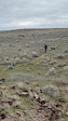
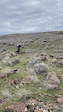
Photos of Wallula Mountain Bike
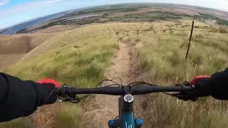
Videos of Wallula Mountain Bike
trail: On the rocks
0:49 |
38 |
Feb 24, 2024

trail: Overflow
0:11 |
25 |
Feb 24, 2024

trail: Overflow
0:19 |
24 |
Feb 24, 2024

trail: On the rocks
0:11 |
20 |
Feb 24, 2024

trail: On the rocks
0:23 |
18 |
Feb 24, 2024
trail: On the rocks
0:14 |
17 |
Feb 24, 2024
trail: Turbinator
7:51 |
135 |
May 28, 2024 , Wallula

trail: Mesa Ventosa
3:11 |
112 |
May 18, 2024 , Wallula
Recent Trail Reports
| status | trail | date | condition | info | user |
|---|---|---|---|---|---|
| Midway | Jun 7, 2026 @ 6:09am (America/Boise) Jun 7, 2026 | Dry | dbierwi440 | ||
| Approach | Jun 7, 2026 @ 6:09am (America/Boise) Jun 7, 2026 | Dry | dbierwi440 | ||
| Grandview Mesa | May 20, 2026 @ 6:04am (America/Boise) May 20, 2026 | Ideal | dbierwi440 | ||
| Diagonal | May 7, 2026 @ 6:14am (America/Boise) May 7, 2026 | Variable | dbierwi440 | ||
| Lower Loop | Apr 10, 2026 @ 8:38am (America/Boise) Apr 10, 2026 | Ideal | dbierwi440 | ||
| The Knob | Mar 27, 2026 @ 10:02am (America/Los_Angeles) Mar 27, 2026 | Unknown | dbierwi440 | ||
| Trunkline | Mar 15, 2026 @ 8:09pm (America/Los_Angeles) Mar 15, 2026 | Ideal | bizango-x | ||
| Rimrock | Mar 15, 2026 @ 8:09pm (America/Los_Angeles) Mar 15, 2026 | Ideal | bizango-x | ||
| On the rocks | Mar 15, 2026 @ 8:08pm (America/Los_Angeles) Mar 15, 2026 | Ideal | bizango-x | ||
| Catwalk | Mar 15, 2026 @ 8:05pm (America/Los_Angeles) Mar 15, 2026 | Ideal | bizango-x |
Activity Feed
| username | action | type | title | date |
|---|---|---|---|---|
| ScarpaCO | wishlist | trail | activity #96711970 | Jun 10, 2026 @ 7:03pm 2 days |
| dbierwi440 | add | report | activity #96478187 and 1 more | Jun 7, 2026 @ 10:48am Jun 7, 2026 |
| dbierwi440 | add | photo | activity #96469153 | Jun 7, 2026 @ 9:17am Jun 7, 2026 |
| dbierwi440 | add | photo | activity #96452913 and 9 more | Jun 7, 2026 @ 6:12am Jun 7, 2026 |
| dbierwi440 | add | report | activity #95114487 and 1 more | May 20, 2026 @ 9:39am May 20, 2026 |
Recent Comments
| username | type | title | comment | date |
|---|---|---|---|---|
| trail | Most of this trail is green/blue (the first... | Mar 15, 2026 @ 8:08pm Mar 15, 2026 | ||
| trail | Easy, but a nice trail with good views. | Mar 15, 2026 @ 8:04pm Mar 15, 2026 | ||
| trail | There is a trail up, but I didn’t see a loop... | Mar 15, 2026 @ 8:03pm Mar 15, 2026 | ||
| trail | Super cool setting! Not really “hard”, but... | Mar 15, 2026 @ 8:02pm Mar 15, 2026 | ||
| trail | Definitely the most interesting trail with a... | Nov 8, 2025 @ 12:35pm Nov 8, 2025 |
Local Badges
-

Completionist0 awarded -

10 Blue Trails12 awarded -

Epic Mountain Bike Climb 2k1 awarded -

Climbing 10k Badge0 awarded -

Mountain Biking 100k Badge0 awarded -

Epic Ride Descent 2k1 awarded
Activity Type Stats
| activitytype | trails | distance | descent | descent distance | total vertical | rating | global rank | state rank | photos | reports | routes | ridelogs |
|---|---|---|---|---|---|---|---|---|---|---|---|---|
| Mountain Bike | 56 | 23 miles | 3,780 ft | 9 miles | 892 ft | #4,314 | #1,456 | 148 | 263 | 4 | 319 | |
| E-Bike | 54 | 22 miles | 3,297 ft | 9 miles | 886 ft | #4,365 | #1,419 | 262 | 3 | 42 | ||
| Horse | 1 | #1,828 | 40 | |||||||||
| Hike | 57 | 24 miles | 3,783 ft | 9 miles | 892 ft | #3,577 | #1,256 | 75 | 263 | 3 | 32 | |
| Trail Running | 56 | 23 miles | 3,507 ft | 9 miles | 886 ft | #6,297 | #2,036 | 263 | 2 | 5 | ||
| Observed Trials | 1 | 2 miles | 43 ft | 1,529 ft | 568 ft | #284 | 44 | 1 |
Frequently Asked Questions About Wallula
▼
What are the best places to ride in Wallula?
Wallula has 1 areas to explore for mountain biking. The top rated areas are:
▼
What are the highest rated mountain biking trails in Wallula?
The highest rated mountain biking trails in Wallula are:
- Trunkline (4.2/5)
- Back down (4.2/5)
- Gully (4.2/5)
- Grandview Mesa (4.1/5)
- Grandview Shortcut (4.1/5)
▼
What is the best time of the year to ride in Wallula?
Based on ride log data, the most popular months to ride in Wallula are:
- September (2 activities)
- August (1 activities)
- October (1 activities)
▼
Where can I park to ride in Wallula?
There are 1 parking locations listed in Wallula. The most popular parking spots are:
Activities
Trails
- By WillieJacobsz
 Trailforks SBP SWW & contributors
 - Admins: apply
- #53981 - 3,043 views
- wallula activity log | embed map of Wallula mountain bike trails | wallula mountain biking points of interest
Downloading of trail gps tracks in kml & gpx formats is enabled for Wallula.
You must login to download files.