close
-
Layers w
- Weather Layers
- Pro
- Pro
- Pro
- Pro
- Pro
- Pro
- More Layers
- Pro
- Pro
- Pro
- Pro
-
Upgrade to

3D
Trail Conditions
- Unknown
- Snow Groomed
- Snow Packed
- Snow Covered
- Snow Cover Partial
- Freeze/thaw Cycle
- Icy
- Prevalent Mud
- Wet
- Variable
- Ideal
- Dry
- Very Dry
Trail Flow (Ridden Direction)
Trailforks scans users ridelogs to determine the most popular direction each trail is ridden. A good flowing trail network will have most trails flowing in a single direction according to their intension.
The colour categories are based on what percentage of riders are riding a trail in its intended direction.
The colour categories are based on what percentage of riders are riding a trail in its intended direction.
- > 96%
- > 90%
- > 80%
- > 70%
- > 50%
- < 50%
- bi-directional trail
- no data
Trail Last Ridden
Trailforks scans ridelogs to determine the last time a trail was ridden.
- < 2 days
- < 1 week
- < 2 weeks
- < 1 month
- < 6 months
- > 6 months
Trail Ridden Direction
The intended direction a trail should be ridden.
- Downhill Only
- Downhill Primary
- Both Directions
- Uphill Primary
- Uphill Only
- One Direction
Contribute Details
Colors indicate trail is missing specified detail.
- Description
- Photos
- Description & Photos
- Videos
Trail Popularity ?
Trailforks scans ridelogs to determine which trails are ridden the most in the last 9 months.
Trails are compared with nearby trails in the same city region with a possible 25 colour shades.
Think of this as a heatmap, more rides = more kinetic energy = warmer colors.
- most popular
- popular
- less popular
- not popular
ATV/ORV/OHV Filter
Max Vehicle Width
inches
US Cell Coverage
Legend

Radar Time
Activity Recordings
Trailforks uses anonymized public activity data.
?
Activity Recordings
Trailforks uses anonymized public activity data.
?
Personal Heatmap
▶
Activity Types
all
/
none
▶
Options
2
Date range
month
–
Winter Trails
Warning
A routing network for winter maps does not exist. Selecting trails using the winter trails layer has been disabled.
Missing Trails
Most Popular
Least Popular
Trails are colored based on popularity. The more popular a trail is, the more red. Less popular trails trend towards green.
Jump Magnitude Heatmap
Heatmap of where riders jump on trails. Zoom in to see individual jumps, click circles to view jump details.
BC Backroad Status
![map legend]()
Service Road Atlas is a free to use, community-driven service for viewing and creating reports on the numerous back-country service roads around B.C. and Alberta.

Slope Aspect
Direction the slope faces
Trails Deemphasized
Trails are shown in grey.
Only show trails with no bike usage.
Suggested Layers
Based on selected activity type
Save the current map location and zoom level as your default home location whenever this page is loaded.
Save
No description for Williams has been added yet!
Login or register to submit one.
Activities Click to view
- Mountain Bike
81 trails
- E-Bike
51 trails
- Gravel Bike
0 trails
- Adaptive Bike
0 trails
- Winter Fat Bike
0 trails
- Horse
58 trails
- Hike
80 trails
- Trail Running
79 trails
- Dirtbike/Moto
45 trails
- ATV/ORV/OHV
45 trails
- Snowshoe
6 trails
Region Details
- 32
- 32
- 12
- 5
Region Status
Caution as of Jun 9, 2026Local Trail Association
Stats
- Avg Trail Rating
- Trails (view details)
- 82
- Trails Mountain Bike
- 81
- Trails E-Bike
- 51
- Trails Horse
- 58
- Trails Hike
- 80
- Trails Trail Running
- 79
- Trails Dirtbike/Moto
- 45
- Trails Observed Trials
- 2
- Trails ATV/ORV/OHV
- 45
- Trails Snowshoe
- 6
- Trails Nordic Ski
- 3
- Total Distance
- 236 miles
- Total Descent
- 15,564 ft
- Total Vertical
- 4,689 ft
- Highest Trailhead
- 9,259 ft
- Reports
- 151
- Photos
- 79
- Ridden Counter
- 897
Popular Williams Mountain Biking Trails
• 95 ★ 4.2 • 6 miles • 507 ft • 48 •
Popular black diamond difficulty singletrack. This multi-use trail can be used both directions and has a hard overall physical rating with a 507 ft black diamond climb. Trail visibility is sometimes hard to follow. On average it takes 1 hour50 minutes to complete this trail.
• 100 ★ 3.3 • 4 miles • 1,720 ft • 46 •
Popular black diamond difficulty singletrack. This multi-use trail can be used both directions and has a hard overall physical rating with a 1,720 ft black diamond climb. Trail visibility is always easy to follow. On average it takes 54 minutes to complete this trail.
• 70 ★ 4.0 • 2,267 ft • 0 ft • 31 • • hike
This is a connector to the . Easy to navigate and well marked.
• 5 ★ 3.6 • 4 miles • 21 ft • 28 •
This trail starts in ponderosa pine and oak thickets. As it crosses West Cataract Creek, it goes through stands of aspen and fir carpeted by a dense ground cover of ferns, Oregon grape and Arizona wild rose. At several places on the...
• 5 ★ 4.0 • 5 miles • 696 ft • 22 •
Less popular black diamond difficulty singletrack. This multi-use trail can be used both directions and has a hard overall physical rating with a 696 ft black diamond climb. Trail visibility is sometimes hard to follow. On average it takes 1 hour30 minutes to complete this trail.
• 75 ★ 0.0 • 2 miles • 3 ft • 20 •
Popular green difficulty dirt/gravel road. This multi-use trail can be used both directions and has a moderate overall physical rating with a 3 ft blue climb. Trail visibility is always easy to follow. On average it takes 13 minutes to complete this trail.
• 80 ★ 4.0 • 4,915 ft • 37 ft • 17 • • hike
Moderate challenging trail that takes you to the Clover Springs. It will connect up with Clover Springs Trail and can connect up and , Best to access this trail from the Ranger Station via .. about 4/10th mile.
Williams Mountain Bike Routes
2 miles • 166 ft • 1 • Loop •
9 miles • 2,034 ft • 3 • Out & Back •
2 miles • 298 ft • 3 • Out & Back •
7 miles • 454 ft • 10 • Loop •
This is the easier loop of the Spring Valley Trails. There are some portions that can be difficult to...
8 miles • 2,415 ft • 2 • Out & Back •
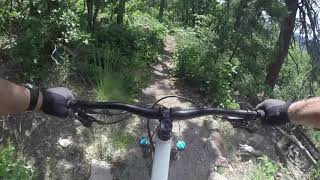
Photos of Williams Mountain Bike
Videos of Williams Mountain Bike

trail: Benham Trail
10:03 |
510 |
Jun 29, 2019
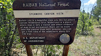
trail: South Sycamore Rim
0:45 |
211 |
Jun 19, 2019

trail: Bill Williams Fire road
9:32 |
421 |
Jul 13, 2019 , Williams
trail: Bill Williams Fire road
6:24 |
334 |
Jul 13, 2019 , Williams
Recent Trail Reports
| status | trail | date | condition | info | user |
|---|---|---|---|---|---|
| Bill Williams | Oct 26, 2025 @ 6:59pm (America/Phoenix) Oct 26, 2025 | Ideal | MattLane1 | ||
| Benham Trail | Sep 17, 2025 @ 5:28pm (America/Vancouver) Sep 17, 2025 | Dry | nicbikes | ||
| Williams reservoir loop | Jul 27, 2024 @ 2:37am Jul 27, 2024 | Variable | Mechead | ||
| South Sycamore Rim | May 28, 2024 @ 3:31pm May 28, 2024 | Dry | Ghostrydr | ||
| Buckskinner Trail | Aug 20, 2023 @ 4:16am Aug 20, 2023 | Variable | wharding | ||
| Spring Valley Trail | May 15, 2023 @ 7:20pm May 15, 2023 | Dry | mmallozzi | ||
| Sycamore Rim North | Jun 13, 2022 @ 1:34pm Jun 13, 2022 | Dry | Jetlite | ||
| Dow Spring Trailhead Access | Jun 3, 2022 @ 10:38pm Jun 3, 2022 | Unknown | Solerider | ||
| Davenport Hill | Mar 26, 2022 @ 8:29am Mar 26, 2022 | Variable | SoonerBikeNut | ||
| Jawbone Meadow | Oct 30, 2021 @ 4:18pm Oct 30, 2021 | Unknown | Jam3056 |
Activity Feed
| username | action | type | title | date |
|---|---|---|---|---|
| AshleyMTNjBZ | wishlist | trail | activity #97924152 and 1 more | Jun 27, 2026 @ 11:45am 13 hours |
| Kennethvonsnickelfritz | wishlist | trail | activity #96521985 | Jun 7, 2026 @ 10:51pm Jun 7, 2026 |
| carlsen | wishlist | trail | activity #95658540 | May 27, 2026 @ 1:35pm May 27, 2026 |
| John1o7UYG | ridden | trail | activity #95285599 | May 22, 2026 @ 7:38pm May 22, 2026 |
| Mubs70 | ridden | trail | activity #95175645 | May 21, 2026 @ 8:01am May 21, 2026 |
Recent Comments
| username | type | title | comment | date |
|---|---|---|---|---|
| trail | Nice trail down with less obstacles requiring... | Apr 30, 2026 @ 10:53am Apr 30, 2026 | ||
| trail | For bikes this trail is more of blue with the... | Apr 30, 2026 @ 10:51am Apr 30, 2026 | ||
| trail | Difficult trail to ride either direction due... | Apr 30, 2026 @ 10:48am Apr 30, 2026 | ||
| trail | Recently cleared of downed trees on the entire... | Jun 7, 2025 @ 10:33am Jun 7, 2025 | ||
| trail | This trail was way more mellow than I... | Aug 12, 2024 @ 7:38am Aug 12, 2024 |
Local Badges
-

Epic Ride Climb 2k22 awarded -

Climbing 10k Badge3 awarded -

Climbing 100k Badge0 awarded -

Epic Ride Descent 2k22 awarded -

Descent 10k Badge3 awarded -

Descent 100k Badge0 awarded
Activity Type Stats
| activitytype | trails | distance | descent | descent distance | total vertical | rating | global rank | state rank | photos | reports | routes | ridelogs |
|---|---|---|---|---|---|---|---|---|---|---|---|---|
| Mountain Bike | 81 | 235 miles | 15,433 ft | 87 miles | 4,688 ft | #1,363 | #517 | 57 | 150 | 11 | 1,370 | |
| E-Bike | 51 | 163 miles | 5,600 ft | 55 miles | 2,726 ft | #1,087 | #812 | 130 | 2 | 95 | ||
| Horse | 58 | 172 miles | 7,854 ft | 63 miles | 3,307 ft | #177 | #410 | 12 | 3 | 13 | ||
| Hike | 80 | 235 miles | 15,509 ft | 87 miles | 4,688 ft | #731 | #336 | 22 | 115 | 12 | 549 | |
| Trail Running | 79 | 232 miles | 15,030 ft | 86 miles | 4,688 ft | #739 | #277 | 114 | 9 | 79 | ||
| Dirtbike/Moto | 45 | 157 miles | 5,446 ft | 53 miles | 2,726 ft | #192 | #114 | 8 | 2 | 8 | ||
| Observed Trials | 2 | 4 miles | 92 ft | 1 mile | 443 ft | 5 | ||||||
| ATV/ORV/OHV | 45 | 162 miles | 5,643 ft | 54 miles | 4,409 ft | #101 | #51 | 9 | 1 | 7 | ||
| Snowshoe | 6 | 62 miles | 4,833 ft | 22 miles | 4,688 ft | #431 | #133 | 5 | 1 | 5 | ||
| Nordic Ski | 3 | 57 miles | 2,028 ft | 17 miles | 3,307 ft | 3 | 1 | 8 |
Frequently Asked Questions About Williams
▼
What are the highest rated mountain biking trails in Williams?
The highest rated mountain biking trails in Williams are:
- South Sycamore Rim (4.1/5)
- Davenport Hill (4/5)
- Clover Spring Trail Connector (4/5)
- Sycamore Rim North (4/5)
- Buckskinner Trail (4/5)
▼
What is the best time of the year to ride in Williams?
Based on ride log data, the most popular months to ride in Williams are:
- June (55 activities)
- August (48 activities)
- July (47 activities)
▼
Where can I park to ride in Williams?
There are 4 parking locations listed in Williams. The most popular parking spots are: View all parking and trailhead locations on the map to plan your visit.
▼
What is the longest trail in Williams?
The longest trail in Williams is bixler to bill williams loop at 17.6 km. View all trails sorted by distance.
Activities
Trails
Points of Interest
- By schillingsworth
 TRAILFORKS HTA & contributors
 - Admins: AZT, chainslapAZ, schillingsworth, jeffgicklhorn, jpmcghee, msmcfate, cemoorelife, Schwinnshralper26
- #8636 - 11,242 views
- williams activity log | embed map of Williams mountain bike trails | williams mountain biking points of interest
Downloading of trail gps tracks in kml & gpx formats is enabled for Williams.
You must login to download files.