7.8 miles
Distance
1,319 ft
Climb
-1,309 ft
Descent
741 ft
High Point

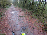
fun route around Cherry valley

You're coming down, cyclops, funner and bobcat alley are downhill trails

Detailed Description
Cherry Valley is a 8 mile moderately popular intermediate route located near Duvall Washington. This mountain bike only route can be used one direction and has a moderate overall physical rating. This route includes 12 trails. This route climbs 1,319 ft with a max elevation of 741 ft then descends -1,309 ft.
Local Trail Association
Local trail association
Evergreen Mountain Bike Alliance | EMBA (evergreenmtb.org)
Please consider joining or donating to the local riding association to support trail development & maintenance.
donate to earn trail karma!

10 Reviews & Comments


We hope you've been enjoying Trailforks!

Create a FREE account to view route comments and much more.

Trails in Route

Black Label1,414 ft
No Road656 ft
Waterbars Up!4,990 ft
Cyclops2,986 ft
Bobcat Alley1,043 ft
Elevator1,759 ft
Funner2,687 ft
Escorlator Road Climb1,509 ft
Escorlator1,089 ft
Sooner or Later1,086 ft
On Borrowed Time1,345 ft
Black Label1,680 ft

Details

  • Riding area
  • Primary Activity
    Mountain Bike
  • Difficulty rating
    Blue
  • Route Type
    Loop
  • eBike Allowed
  • Bike type
    AM, XC
  • Direction
    One Direction
  • Physical rating
    Moderate
  • Ridelogs
    4
More Stats for Cherry Valley mountain bike route
  • Avg time
    1 hr 55 min
  • Altitude min
    292 ft
  • Altitude start
    292 ft
  • Altitude end
    302 ft
  • Grade max
    -49.4%
  • Grade min
    50%
  • Distance climb
    4 miles
  • Distance down
    3 miles
  • Distance flat
    2,904 ft
no votes yet
close
3D
Trail Conditions
  • Unknown
  • Snow Groomed
  • Snow Packed
  • Snow Covered
  • Snow Cover Partial
  • Freeze/thaw Cycle
  • Icy
  • Prevalent Mud
  • Wet
  • Variable
  • Ideal
  • Dry
  • Very Dry
Trail Flow (Ridden Direction)
Trailforks scans users ridelogs to determine the most popular direction each trail is ridden. A good flowing trail network will have most trails flowing in a single direction according to their intension.
The colour categories are based on what percentage of riders are riding a trail in its intended direction.
  • > 96%
  • > 90%
  • > 80%
  • > 70%
  • > 50%
  • < 50%
  • bi-directional trail
  • no data
Trail Last Ridden
Trailforks scans ridelogs to determine the last time a trail was ridden.
  • < 2 days
  • < 1 week
  • < 2 weeks
  • < 1 month
  • < 6 months
  • > 6 months
Trail Ridden Direction
The intended direction a trail should be ridden.
  • Downhill Only
  • Downhill Primary
  • Both Directions
  • Uphill Primary
  • Uphill Only
  • One Direction
Contribute Details
Colors indicate trail is missing specified detail.
  • Description
  • Photos
  • Description & Photos
  • Videos
Trail Popularity ?
Trailforks scans ridelogs to determine which trails are ridden the most in the last 9 months. Trails are compared with nearby trails in the same city region with a possible 25 colour shades. Think of this as a heatmap, more rides = more kinetic energy = warmer colors.
  • most popular
  • popular
  • less popular
  • not popular
ATV/ORV/OHV Filter
Max Vehicle Width
inches
US Cell Coverage
Legend
cell carrier legend

Radar Time
x Activity Recordings
Trailforks users anonymized public ridelogs from the past 6 months.
  • mountain biking recent
  • mountain biking (>6 month)
  • hiking (1 year)
  • moto (1 year)
Activity Recordings
Trailforks users anonymized public skilogs from the past 12 months.
  • Downhill Ski
  • Backcountry Ski
  • Nordic Ski
  • Snowmobile
Winter Trails
Warning A routing network for winter maps does not exist. Selecting trails using the winter trails layer has been disabled.
x Missing Trails
Most Popular
Least Popular
Trails are colored based on popularity. The more popular a trail is, the more red. Less popular trails trend towards green.
Jump Magnitude Heatmap
Heatmap of where riders jump on trails. Zoom in to see individual jumps, click circles to view jump details.
Trails Deemphasized
Trails are shown in grey.
disable
Only show trails with NO bikes.
enable

Save the current map location and zoom level as your default home location whenever this page is loaded.

Save
Trail transparency
7
8
10
205
Cyclops in 2023
Cyclops in 2023
trail: Cyclops
274 | comments: 0 | favs:
Jan 28, 2023
Routine run down Cyclops Jan 20, 2023
MTB Cherry Valley, Funner
trail: Funner
5:44 | 615 | comments: 0 | favs:
Nov 24, 2020

Recent Trail Reports Along Route

statustraildateconditiondescription
Elevator
May 9, 2025 @ 1:16am
May 9, 2025
Funner
May 9, 2025 @ 1:15am
May 9, 2025
needs a little brushing in 2 or 3 spots but otherwise running great
Cyclops
May 9, 2025 @ 1:14am
May 9, 2025
top 2/3 are clear and running fast. bottom 1/3 still needs some brushing but no issues if you don't mind a narrow trail with limited sight lines.
Bobcat Alley
May 9, 2025 @ 1:12am
May 9, 2025
dirt is good but heavily overgrown. ready for a spring trim
Black Label
Apr 28, 2025 @ 9:17am
Apr 28, 2025
more reports »
  • By BendiqTF Pro & contributors
  • #23678 - 1,104 views