

22.9 miles
Distance
2,495 ft
Climb
-4,645 ft
Descent
2,577 ft
High Point
-2,149 ft
Altitude change
91 ft
Altitude min
2,260 ft
Altitude start
112 ft
Altitude end
-1.8%
Grade
-42.5%
Grade max
60.6%
Grade min
7 miles
Distance climb
14 miles
Distance down
2 miles
Distance flat

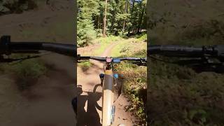
Flow Trail in Aptos, 23+miles in the beautiful forest, got myself lost there years ago, no mo

Detailed Description
Flow n some Mo is a 23 mile moderately popular intermediate route located near Santa Cruz California. This mountain bike only route. This route includes 18 trails. This route climbs 2,495 ft with a max elevation of 2,577 ft then descends -4,645 ft.
Tags

Trail Issues on Route

  • Minor Issue / Yellow: 2 trails (newest: Oct 20, 2026)

Local Trail Association

Local trail association
Santa Cruz Mountains Trail Stewardship (santacruztrails.org)
Please consider joining or donating to the local riding association to support trail development & maintenance.
Donate to earn trail karma!

Stats

  • Distance
    23 miles
  • Avg time
    4 hr 47 min
  • Altitude change
    -2,149 ft
  • Altitude min
    91 ft
  • Altitude start
    2,260 ft
  • Altitude end
    112 ft
  • Climb
    2,495 ft
  • Descent
    -4,645 ft
  • Grade
    -1.8%
  • Grade max
    -42.5%
  • Grade min
    60.6%
  • Distance climb
    7 miles
  • Distance down
    14 miles
  • Distance flat
    2 miles

41 Reviews & Comments


We hope you've been enjoying Trailforks!

Create a FREE account to view all route reviews and much more.

Trails in Route

Details

no votes yet
close
Trail transparency
  • Singletrack
  • Unpaved
mtb
2,281 | 2 faves
mtb
4,303 | 1 comments | 2 faves
mtb
1,564
mtb
969

Recent Trail Reports Along Route

statustraildateconditiondescription
Sulphur Springs Road
Oct 31, 2026 @ 9:28am (America/Los_Angeles)
Oct 31, 2026
Beautifully smooth after the resurfacing. Lots of water bars introduced, which are low enough to not be a hazard traveling in either direction. reporter
Ridge Trail
Oct 20, 2026 @ 12:29pm (America/Los_Angeles)
Oct 20, 2026
brushing needed - open sightline reporter
Corral Trail
Oct 20, 2026 @ 11:35am (America/Los_Angeles)
Oct 20, 2026
saw work drains need nick reporter
Corral Road
Oct 17, 2026 @ 8:50am (America/Los_Angeles)
Oct 17, 2026
Tree blocking vehicle access about halfway along the corral fire road section. 16-20” dia. Ride under. Chainsaw needed. reporter
Flow Trail 6
Sep 11, 2026 @ 11:04am (America/Los_Angeles)
Sep 11, 2026
more reports »
  • By krustyjake & contributors
  • #19026 - 1,224 views

Hit the Trail

Open in App

Get this route on your phone instantly.

Download Route

Save to wishlist, Garmin & download.