
Open in App
Get this route on your phone instantly.
RATING – INTERMEDIATE
TIME – 90 TO 120 MINUTES
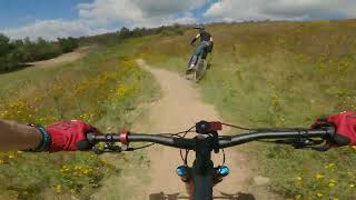
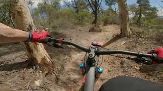
Loop 4 is a full lap of Stromlo Forest Park’s mountain bike trails, riding the CORC Main Trunk Trail all the way. The climb takes you up towards Mt Stromlo and the descent to the Western side of the mountain is where the trails are much rockier and tree cover is more prevalent. At Slickrock junction you have a choice of turning left for the full loop (19km) or right for a superb descending short cut (14km). Returning along the northern trails through Wombat Junction you will have a flowing descending finish to the car park. To negotiate this trail you will need a good level of fitness with the technical skills to match. The climb is demanding in places and the descent and other areas are peppered with rocks and other obstacles.
We hope you've been enjoying Trailforks!
Create a FREE account to view route comments and much more.
| 2,464 ft | |||||
| 1 mile | |||||
| 2 miles | |||||
| 2,126 ft | |||||
| 1,296 ft | |||||
| 1,496 ft | |||||
| 3,133 ft | |||||
| 1,086 ft | |||||
| 1,266 ft | |||||
| 942 ft | |||||
| 4,859 ft | |||||
| 1,627 ft | |||||
| 2 miles | |||||
| 3,225 ft | |||||
| 4,793 ft | |||||
| 896 ft | |||||
| 4,541 ft | |||||
| 2,110 ft | |||||
| 1,476 ft | |||||
| 3,048 ft | |||||
| 2,451 ft | |||||
| 1,047 ft | |||||
| 2,733 ft | |||||
| 1,860 ft | |||||
| 2 miles | |||||
| 4,626 ft | |||||
| 1 mile |

Service Road Atlas is a free to use, community-driven service for viewing and creating reports on the numerous back-country service roads around B.C. and Alberta.
Save the current map location and zoom level as your default home location whenever this page is loaded.
Save