7.9 miles
Distance
2,702 ft
Climb
-2,704 ft
Descent
1,853 ft
High Point
-2 ft
Altitude change
728 ft
Altitude min
730 ft
Altitude start
728 ft
Altitude end
-104.8%
Grade max
48.5%
Grade min
5 miles
Distance climb
3 miles
Distance down
1,932 ft
Distance flat

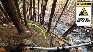
If you are in the area for a good time but not a long time, this route will show you the best copper mountain has to offer. Of course, it depends on your opinion but this route features three descents that span the entire riding area and also include some of the most unique trail features on copper mountain.

Detailed Description
Magic is a 8 mile less popular expert route located near Terrace British Columbia. This mountain bike only route. This route includes 49 trails. This route climbs 2,702 ft with a max elevation of 1,853 ft then descends -2,704 ft.

Trail Issues on Route

  • Significant Issue / Amber: 1 trail (newest: Mar 13, 2024)
Local Trail Association
Local trail association
Terrace Off Road Cycling Association (www.torcanorth.com)
Please consider joining or donating to the local riding association to support trail development & maintenance.
Donate to earn trail karma!

Stats

  • Distance
    8 miles
  • Avg time
    1 hr 28 min
  • Altitude change
    -2 ft
  • Altitude min
    728 ft
  • Altitude start
    730 ft
  • Altitude end
    728 ft
  • Climb
    2,702 ft
  • Descent
    -2,704 ft
  • Grade max
    -104.8%
  • Grade min
    48.5%
  • Distance climb
    5 miles
  • Distance down
    3 miles
  • Distance flat
    1,932 ft

4 Reviews & Comments


We hope you've been enjoying Trailforks!

Create a FREE account to view route comments and much more.

Trails in Route

4 noobs4,232 ft
Access Road1 mile
Lucky Seven4,944 ft
Seven to Packhorse Connector686 ft
Packhorse361 ft
4 noobs4,180 ft
Access Road5,013 ft
Your mom3,366 ft
Packhorse440 ft
Access Road167 ft
4 noobs4,177 ft
Access Road2,480 ft
Packhorse1,952 ft
Lil jump run404 ft
Leftovers935 ft

Details

  • Riding area
  • Primary Activity
    Mountain Bike
  • Difficulty rating
    Black Diamond
  • Ridelogs
    20
no votes yet
close
3D
Trail Conditions
  • Unknown
  • Snow Groomed
  • Snow Packed
  • Snow Covered
  • Snow Cover Partial
  • Freeze/thaw Cycle
  • Icy
  • Prevalent Mud
  • Wet
  • Variable
  • Ideal
  • Dry
  • Very Dry
Trail Flow (Ridden Direction)
Trailforks scans users ridelogs to determine the most popular direction each trail is ridden. A good flowing trail network will have most trails flowing in a single direction according to their intension.
The colour categories are based on what percentage of riders are riding a trail in its intended direction.
  • > 96%
  • > 90%
  • > 80%
  • > 70%
  • > 50%
  • < 50%
  • bi-directional trail
  • no data
Trail Last Ridden
Trailforks scans ridelogs to determine the last time a trail was ridden.
  • < 2 days
  • < 1 week
  • < 2 weeks
  • < 1 month
  • < 6 months
  • > 6 months
Trail Ridden Direction
The intended direction a trail should be ridden.
  • Downhill Only
  • Downhill Primary
  • Both Directions
  • Uphill Primary
  • Uphill Only
  • One Direction
Contribute Details
Colors indicate trail is missing specified detail.
  • Description
  • Photos
  • Description & Photos
  • Videos
Trail Popularity ?
Trailforks scans ridelogs to determine which trails are ridden the most in the last 9 months. Trails are compared with nearby trails in the same city region with a possible 25 colour shades. Think of this as a heatmap, more rides = more kinetic energy = warmer colors.
  • most popular
  • popular
  • less popular
  • not popular
ATV/ORV/OHV Filter
Max Vehicle Width
inches
US Cell Coverage
Legend
cell carrier legend

Radar Time
Activity Recordings
Trailforks uses anonymized public activity data. ?
Activity Recordings
Trailforks uses anonymized public activity data. ?
Personal Heatmap
Activity Types
all / none
Options
2
Date range month
Winter Trails
Warning A routing network for winter maps does not exist. Selecting trails using the winter trails layer has been disabled.
Missing Trails
Most Popular
Least Popular
Trails are colored based on popularity. The more popular a trail is, the more red. Less popular trails trend towards green.
Jump Magnitude Heatmap
Heatmap of where riders jump on trails. Zoom in to see individual jumps, click circles to view jump details.
BC Backroad Status

Service Road Atlas is a free to use, community-driven service for viewing and creating reports on the numerous back-country service roads around B.C. and Alberta.

map legend
Slope Aspect
Direction the slope faces
Flat N NE E SE S SW W NW
Trails Deemphasized
Trails are shown in grey.
disable
Only show trails with no bike usage.
Enable
Suggested Layers
Based on selected activity type

    Save the current map location and zoom level as your default home location whenever this page is loaded.

    Save
    Trail transparency
    • Singletrack
    • Unpaved
    26
    229
    295
    141
    youtuber DON'T RIDE HERE...
    DON'T RIDE HERE...
    trail: Your mom
    42:51 | 48 | comments: 0 | favs:
    Dec 10, 2025
    Slippery wet wood
    Slippery wet wood
    trail: Your mom
    5:08 | 73 | comments: 0 | favs:
    Mar 21, 2025

    Recent Trail Reports Along Route

    statustraildateconditiondescription
    Packhorse
    May 18, 2026 @ 8:35pm (America/Vancouver)
    May 18, 2026
    Bridges have been rebuilt and trail is rideable Huge thanks to whoever has been doing all the work!
    Your mom
    May 18, 2026 @ 8:33pm (America/Vancouver)
    May 18, 2026
    4 bridges section has been bypassed and a bridge has been installed on the lower section, trail is now rideable from top to bottom Some of the wooden structures could use some maintenance but the trail still rides good
    Lucky Seven
    May 3, 2026 @ 9:21pm (America/Vancouver)
    May 3, 2026
    Recently tidied up and good to go! reporter
    Leftovers
    Jul 24, 2025 @ 7:23am
    Jul 24, 2025
    This trail is open again. It has a huge lily pad and a few drops and jumps. This trail has double black features. Best not to hit anything blind.
    4 noobs
    Jul 2, 2025 @ 1:10pm
    Jul 2, 2025
    more reports »
    • By lovetoridebikesTF Pro & contributors
    • #26534 - 704 views

    Hit the Trail

    Open in App

    Get this route on your phone instantly.

    Download Route

    Save to wishlist, Garmin & download.