11.4 miles
Distance
1,776 ft
Climb
-1,772 ft
Descent
2,612 ft
High Point
2 ft
Altitude change
885 ft
Altitude min
885 ft
Altitude start
886 ft
Altitude end
-67.1%
Grade max
48.3%
Grade min
7 miles
Distance climb
5 miles
Distance down
384 ft
Distance flat

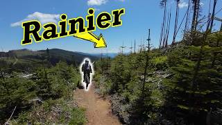
PT Figure 8 from Hwy 18. Park in the gravel lot off of Hwy 18 and head up Rattlesnake Mtn Rd until you get to the Canyon Creek Bridge. Head up Raging Tiger to the end. Take the road up to Raging Ridge to PT. Option: after the 1st road crossing on PT, head right (Dr. Phil) for an easier route or head left for the much rowdier original PT route. Climbing Option: use Dash connector to climb Upward Mobility to Raging Ridge instead of the road segment.

Detailed Description
PT8 is a 11 mile popular expert route located near Snoqualmie Washington. This mountain bike only route can be used one direction and has a moderate overall physical rating. This route includes 4 trails. This route climbs 1,776 ft with a max elevation of 2,612 ft then descends -1,772 ft.
Local Trail Association
Local trail association
Evergreen Mountain Bike Alliance | EMBA (evergreenmtb.org)
Please consider joining or donating to the local riding association to support trail development & maintenance.
Donate to earn trail karma!

Stats

  • Distance
    11 miles
  • Avg time
    2 hr 6 min
  • Altitude min
    885 ft
  • Altitude start
    885 ft
  • Altitude end
    886 ft
  • Climb
    1,776 ft
  • Descent
    -1,772 ft
  • Grade max
    -67.1%
  • Grade min
    48.3%
  • Distance climb
    7 miles
  • Distance down
    5 miles
  • Distance flat
    384 ft

11 Reviews & Comments


We hope you've been enjoying Trailforks!

Create a FREE account to view route comments and much more.

Trails in Route

Details

  • Riding area
  • Primary Activity
    Mountain Bike
  • Difficulty rating
    Black Diamond
  • Route Type
    Loop
  • eBike Allowed
  • Bike type
    DH, AM, XC, RD
  • Direction
    One Direction
  • Physical rating
    Moderate
  • Ridelogs
    37
Avg: 3 (1 votes)
close
3D
Trail Conditions
  • Unknown
  • Snow Groomed
  • Snow Packed
  • Snow Covered
  • Snow Cover Partial
  • Freeze/thaw Cycle
  • Icy
  • Prevalent Mud
  • Wet
  • Variable
  • Ideal
  • Dry
  • Very Dry
Trail Flow (Ridden Direction)
Trailforks scans users ridelogs to determine the most popular direction each trail is ridden. A good flowing trail network will have most trails flowing in a single direction according to their intension.
The colour categories are based on what percentage of riders are riding a trail in its intended direction.
  • > 96%
  • > 90%
  • > 80%
  • > 70%
  • > 50%
  • < 50%
  • bi-directional trail
  • no data
Trail Last Ridden
Trailforks scans ridelogs to determine the last time a trail was ridden.
  • < 2 days
  • < 1 week
  • < 2 weeks
  • < 1 month
  • < 6 months
  • > 6 months
Trail Ridden Direction
The intended direction a trail should be ridden.
  • Downhill Only
  • Downhill Primary
  • Both Directions
  • Uphill Primary
  • Uphill Only
  • One Direction
Contribute Details
Colors indicate trail is missing specified detail.
  • Description
  • Photos
  • Description & Photos
  • Videos
Trail Popularity ?
Trailforks scans ridelogs to determine which trails are ridden the most in the last 9 months. Trails are compared with nearby trails in the same city region with a possible 25 colour shades. Think of this as a heatmap, more rides = more kinetic energy = warmer colors.
  • most popular
  • popular
  • less popular
  • not popular
ATV/ORV/OHV Filter
Max Vehicle Width
inches
US Cell Coverage
Legend
cell carrier legend

Radar Time
Activity Recordings
Trailforks uses anonymized public activity data. ?
Activity Recordings
Trailforks uses anonymized public activity data. ?
Personal Heatmap
Activity Types
all / none
Options
2
Date range month
Winter Trails
Warning A routing network for winter maps does not exist. Selecting trails using the winter trails layer has been disabled.
Missing Trails
Most Popular
Least Popular
Trails are colored based on popularity. The more popular a trail is, the more red. Less popular trails trend towards green.
Jump Magnitude Heatmap
Heatmap of where riders jump on trails. Zoom in to see individual jumps, click circles to view jump details.
BC Backroad Status

Service Road Atlas is a free to use, community-driven service for viewing and creating reports on the numerous back-country service roads around B.C. and Alberta.

map legend
Slope Aspect
Direction the slope faces
Flat N NE E SE S SW W NW
Trails Deemphasized
Trails are shown in grey.
disable
Only show trails with no bike usage.
Enable
Suggested Layers
Based on selected activity type

    Save the current map location and zoom level as your default home location whenever this page is loaded.

    Save
    Trail transparency
    • Singletrack
    66
    110
    73
    219
    youtuber Raging River Guide || A Destination Trail System!
    Raging River Guide || A Destination Trail System!
    trail: PT (Lower)
    32:19 | 72 | comments: 0 | favs:
    Nov 11, 2024
    youtuber Raging River Guide || A Destination Trail System!
    Raging River Guide || A Destination Trail System!
    32:19 | 106 | comments: 0 | favs:
    Nov 11, 2024

    Recent Trail Reports Along Route

    statustraildateconditiondescription
    Raging Tiger
    May 30, 2026 @ 9:45am (America/Vancouver)
    May 30, 2026
    PT (Upper)
    May 12, 2026 @ 2:17pm (America/Los_Angeles)
    May 12, 2026
    PT (Lower)
    Apr 19, 2026 @ 7:26pm (America/Los_Angeles)
    Apr 19, 2026
    All clear
    PT (alt route)
    May 9, 2025 @ 7:48pm
    May 9, 2025
    more reports »
    • By I5-TrollTF Pro EMBA-Staff & contributors
    • #22416 - 3,363 views

    Hit the Trail

    Open in App

    Get this route on your phone instantly.

    Download Route

    Save to wishlist, Garmin & download.