13.2 miles
Distance
2,810 ft
Climb
-2,794 ft
Descent
3,136 ft
High Point
16 ft
Altitude change
1,070 ft
Altitude min
1,076 ft
Altitude start
1,093 ft
Altitude end
-62.2%
Grade max
56.9%
Grade min
8 miles
Distance climb
5 miles
Distance down
1,867 ft
Distance flat

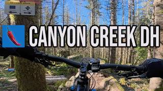
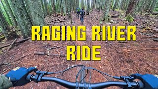
Raging River loop to Ridge line, then down back through Canyon Creek downhill and Poppin Tops lower - to Flow State all the way back.

Detailed Description
Raging Loop is a 13 mile popular intermediate route located near Snoqualmie Washington. This mountain bike only route. This route includes 32 trails. This route climbs 2,810 ft with a max elevation of 3,136 ft then descends -2,794 ft.

Trail Issues on Route

  • Minor Issue / Yellow: 2 trails (newest: Jun 13, 2026)
Local Trail Association
South Sound Evergreen
Please consider joining or donating to the local riding association to support trail development & maintenance.
Donate to earn trail karma!

Stats

  • Distance
    13 miles
  • Avg time
    2 hr 26 min
  • Altitude change
    16 ft
  • Altitude min
    1,070 ft
  • Altitude start
    1,076 ft
  • Altitude end
    1,093 ft
  • Climb
    2,810 ft
  • Descent
    -2,794 ft
  • Grade max
    -62.2%
  • Grade min
    56.9%
  • Distance climb
    8 miles
  • Distance down
    5 miles
  • Distance flat
    1,867 ft

87 Reviews & Comments


We hope you've been enjoying Trailforks!

Create a FREE account to view route comments and much more.

Details

Avg: 4 (3 votes)
close
3D
Trail Conditions
  • Unknown
  • Snow Groomed
  • Snow Packed
  • Snow Covered
  • Snow Cover Partial
  • Freeze/thaw Cycle
  • Icy
  • Prevalent Mud
  • Wet
  • Variable
  • Ideal
  • Dry
  • Very Dry
Trail Flow (Ridden Direction)
Trailforks scans users ridelogs to determine the most popular direction each trail is ridden. A good flowing trail network will have most trails flowing in a single direction according to their intension.
The colour categories are based on what percentage of riders are riding a trail in its intended direction.
  • > 96%
  • > 90%
  • > 80%
  • > 70%
  • > 50%
  • < 50%
  • bi-directional trail
  • no data
Trail Last Ridden
Trailforks scans ridelogs to determine the last time a trail was ridden.
  • < 2 days
  • < 1 week
  • < 2 weeks
  • < 1 month
  • < 6 months
  • > 6 months
Trail Ridden Direction
The intended direction a trail should be ridden.
  • Downhill Only
  • Downhill Primary
  • Both Directions
  • Uphill Primary
  • Uphill Only
  • One Direction
Contribute Details
Colors indicate trail is missing specified detail.
  • Description
  • Photos
  • Description & Photos
  • Videos
Trail Popularity ?
Trailforks scans ridelogs to determine which trails are ridden the most in the last 9 months. Trails are compared with nearby trails in the same city region with a possible 25 colour shades. Think of this as a heatmap, more rides = more kinetic energy = warmer colors.
  • most popular
  • popular
  • less popular
  • not popular
ATV/ORV/OHV Filter
Max Vehicle Width
inches
US Cell Coverage
Legend
cell carrier legend

Radar Time
Activity Recordings
Trailforks uses anonymized public activity data. ?
Activity Recordings
Trailforks uses anonymized public activity data. ?
Personal Heatmap
Activity Types
all / none
Options
2
Date range month
Winter Trails
Warning A routing network for winter maps does not exist. Selecting trails using the winter trails layer has been disabled.
Missing Trails
Most Popular
Least Popular
Trails are colored based on popularity. The more popular a trail is, the more red. Less popular trails trend towards green.
Jump Magnitude Heatmap
Heatmap of where riders jump on trails. Zoom in to see individual jumps, click circles to view jump details.
BC Backroad Status

Service Road Atlas is a free to use, community-driven service for viewing and creating reports on the numerous back-country service roads around B.C. and Alberta.

map legend
Slope Aspect
Direction the slope faces
Flat N NE E SE S SW W NW
Trails Deemphasized
Trails are shown in grey.
disable
Only show trails with no bike usage.
Enable
Suggested Layers
Based on selected activity type

    Save the current map location and zoom level as your default home location whenever this page is loaded.

    Save
    Trail transparency
    • Singletrack
    • Unpaved
    978
    1,487
    1,098 | 1 faves
    3,650 | 2 faves
    youtuber Is this the spiciest blue trail in the PNW?
    Is this the spiciest blue trail in the PNW?
    15:56 | 78 | comments: 0 | favs:
    Apr 15, 2026
    Raging River Ride With Friends
    Raging River Ride With Friends
    4:57 | 55 | comments: 0 | favs:
    Dec 8, 2025

    Recent Trail Reports Along Route

    statustraildateconditiondescription
    Raging Tiger
    Jun 16, 2026 @ 5:50am (America/Vancouver)
    Jun 16, 2026
    Connector
    Jun 13, 2026 @ 11:01am (America/Vancouver)
    Jun 13, 2026
    Canyon Creek DH
    Jun 13, 2026 @ 11:01am (America/Vancouver)
    Jun 13, 2026
    Flow State Upper (MOUNTAIN BIKING ONLY)
    Jun 13, 2026 @ 11:01am (America/Vancouver)
    Jun 13, 2026
    Flow State Lower (MOUNTAIN BIKING ONLY)
    Jun 13, 2026 @ 11:01am (America/Vancouver)
    Jun 13, 2026
    more reports »
    • By timheuer & contributors
    • #22810 - 3,845 views

    Hit the Trail

    Open in App

    Get this route on your phone instantly.

    Download Route

    Save to wishlist, Garmin & download.