7.4 miles
Distance
1,734 ft
Climb
-1,788 ft
Descent
839 ft
High Point
-55 ft
Altitude change
325 ft
Altitude min
380 ft
Altitude start
325 ft
Altitude end
-0.1%
Grade
-47.9%
Grade max
52.4%
Grade min
4 miles
Distance climb
3 miles
Distance down
1,814 ft
Distance flat

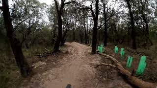
Red hill birthday loop, start at bottom car park work up the hill and across then down though the trails.

Detailed Description
Redhill is a 7 mile moderately popular expert route located near Mornington Peninsula Shire. This mountain bike only route. This route includes 12 trails. This route climbs 1,734 ft with a max elevation of 839 ft then descends -1,788 ft.

Trail Issues on Route

  • Closed: 1 trail (newest: Jun 20, 2026)
  • Minor Issue / Yellow: 1 trail (newest: Jun 13, 2026)
Local Trail Association
Local trail association
Red Hill Riders (www.redhillriders.com.au)
Please consider joining or donating to the local riding association to support trail development & maintenance.
Donate to earn trail karma!

Stats

  • Distance
    7 miles
  • Avg time
    1 hr 11 min
  • Altitude change
    -55 ft
  • Altitude min
    325 ft
  • Altitude start
    380 ft
  • Altitude end
    325 ft
  • Climb
    1,734 ft
  • Descent
    -1,788 ft
  • Grade
    -0.1%
  • Grade max
    -47.9%
  • Grade min
    52.4%
  • Distance climb
    4 miles
  • Distance down
    3 miles
  • Distance flat
    1,814 ft

27 Reviews & Comments


We hope you've been enjoying Trailforks!

Create a FREE account to view route comments and much more.

Trails in Route

Collins Track968 ft
East Link1,437 ft
Pine Climb3,074 ft
Rock Salt3,655 ft
Crits10 ft
Deadwoods46 ft
Crits5,066 ft
Deadwoods46 ft
Rock Salt4,180 ft
Spur Track62 ft
Fall Line2,408 ft

Details

no votes yet
close
3D
Trail Conditions
  • Unknown
  • Snow Groomed
  • Snow Packed
  • Snow Covered
  • Snow Cover Partial
  • Freeze/thaw Cycle
  • Icy
  • Prevalent Mud
  • Wet
  • Variable
  • Ideal
  • Dry
  • Very Dry
Trail Flow (Ridden Direction)
Trailforks scans users ridelogs to determine the most popular direction each trail is ridden. A good flowing trail network will have most trails flowing in a single direction according to their intension.
The colour categories are based on what percentage of riders are riding a trail in its intended direction.
  • > 96%
  • > 90%
  • > 80%
  • > 70%
  • > 50%
  • < 50%
  • bi-directional trail
  • no data
Trail Last Ridden
Trailforks scans ridelogs to determine the last time a trail was ridden.
  • < 2 days
  • < 1 week
  • < 2 weeks
  • < 1 month
  • < 6 months
  • > 6 months
Trail Ridden Direction
The intended direction a trail should be ridden.
  • Downhill Only
  • Downhill Primary
  • Both Directions
  • Uphill Primary
  • Uphill Only
  • One Direction
Contribute Details
Colors indicate trail is missing specified detail.
  • Description
  • Photos
  • Description & Photos
  • Videos
Trail Popularity ?
Trailforks scans ridelogs to determine which trails are ridden the most in the last 9 months. Trails are compared with nearby trails in the same city region with a possible 25 colour shades. Think of this as a heatmap, more rides = more kinetic energy = warmer colors.
  • most popular
  • popular
  • less popular
  • not popular
ATV/ORV/OHV Filter
Max Vehicle Width
inches
US Cell Coverage
Legend
cell carrier legend

Radar Time
Activity Recordings
Trailforks uses anonymized public activity data. ?
Activity Recordings
Trailforks uses anonymized public activity data. ?
Personal Heatmap
Activity Types
all / none
Options
2
Date range month
Winter Trails
Warning A routing network for winter maps does not exist. Selecting trails using the winter trails layer has been disabled.
Missing Trails
Most Popular
Least Popular
Trails are colored based on popularity. The more popular a trail is, the more red. Less popular trails trend towards green.
Jump Magnitude Heatmap
Heatmap of where riders jump on trails. Zoom in to see individual jumps, click circles to view jump details.
BC Backroad Status

Service Road Atlas is a free to use, community-driven service for viewing and creating reports on the numerous back-country service roads around B.C. and Alberta.

map legend
Slope Aspect
Direction the slope faces
Flat N NE E SE S SW W NW
Trails Deemphasized
Trails are shown in grey.
disable
Only show trails with no bike usage.
Enable
Suggested Layers
Based on selected activity type

    Save the current map location and zoom level as your default home location whenever this page is loaded.

    Save
    Trail transparency
    • Singletrack
    • Unpaved
    42
    43
    56
    43
    youtuber Red Hill Fall Line Updated August 2024
    Red Hill Fall Line Updated August 2024
    trail: Fall Line
    2:09 | 76 | comments: 0 | favs:
    Aug 31, 2024
    youtuber Deadwoods – Red Hill MTB
    Deadwoods – Red Hill MTB
    trail: Deadwoods
    3:12 | 758 | comments: 0 | favs:
    Aug 4, 2022

    Recent Trail Reports Along Route

    statustraildateconditiondescription
    East Link
    Jul 1, 2026 @ 7:35am (Australia/Melbourne)
    Jun 30, 2026
    Tree down across track after damn on pins side
    Crits
    Jun 21, 2026 @ 12:37pm (Australia/Melbourne)
    Jun 20, 2026
    Large tree down across trail, blocking trail
    Fall Line
    Jun 14, 2026 @ 10:08am (Australia/Melbourne)
    Jun 13, 2026
    trees down reporter
    Deadwoods
    Jan 4, 2026 @ 1:02pm (Australia/Melbourne)
    Jan 3, 2026
    Running well but dusty dry
    Rock Salt
    Oct 28, 2025 @ 7:43am (Australia/Melbourne)
    Oct 27, 2025
    more reports »
    • By Ldev & contributors
    • #8415 - 2,601 views

    Hit the Trail

    Open in App

    Get this route on your phone instantly.

    Download Route

    Save to wishlist, Garmin & download.