

Open in App
Get this route on your phone instantly.
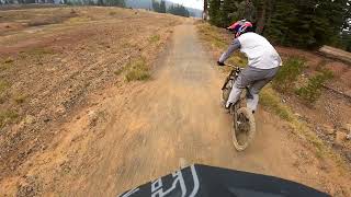
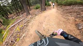
Built by Dirt Mechanics, professional downhill mountain biker Kyle Jameson, and the dedicated Mt. Bachelor Bike Park crew, Redline is an advanced, black diamond jump trail created from a downhill biker's dream with minimal pedaling and a variety of berm jumps, rollers, and table tops. Utilizing the natural terrain under Red Chair to create a gravity-fed, adrenaline-pumping ride down the mountain, Redline is a flowy jump trail that is unlike any other lift-served downhill trail in Oregon.


We hope you've been enjoying Trailforks!
Create a FREE account to view all route reviews and much more.
| 2 miles | |||||
| 1 mile | |||||
| 3,307 ft | |||||
| 2 miles | |||||
| 1 mile | |||||
| 1,739 ft | |||||
| 3,619 ft | |||||
| 2 miles | |||||
| 1 mile | |||||
| 3,543 ft | |||||
| 2 miles | |||||
| 1 mile | |||||
| 4,134 ft | |||||
| 1 mile | |||||
| 1,886 ft | |||||
| 3,202 ft | |||||
| 1 mile | |||||
| 3,199 ft |

Service Road Atlas is a free to use, community-driven service for viewing and creating reports on the numerous back-country service roads around B.C. and Alberta.
Save the current map location and zoom level as your default home location whenever this page is loaded.
Save