

27.5 miles
Distance
3,481 ft
Climb
-6,987 ft
Descent
1 mile
High Point
-3,505 ft
Altitude change
1,133 ft
Altitude min
4,650 ft
Altitude start
1,145 ft
Altitude end
-2.4%
Grade
-57.7%
Grade max
44%
Grade min
9 miles
Distance climb
16 miles
Distance down
2 miles
Distance flat

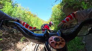
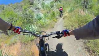
Route from Red Box up to Kenyon Devore, then down to West Fork Camp area. Back up 2N24 to Red Box and then descending Gabrielino all the way to JPL/Altadena.


Detailed Description
Super Kenyon Devore is a 27 mile popular expert route located near Pasadena California. This mountain bike only route. This route includes 4 trails. This route climbs 3,481 ft with a max elevation of 5,635 ft then descends -6,987 ft.
Tags
Rock gardens

Trail Issues on Route

  • Minor Issue / Yellow: 1 trail (newest: Sep 2, 2026)
Route Supporters

Local Trail Association

Local trail association
Mount Wilson Bicycling Association (mwba.org)
Please consider joining or donating to the local riding association to support trail development & maintenance.
Donate to earn trail karma!

Stats

  • Distance
    27 miles
  • Avg time
    7 hr 48 min
  • Altitude change
    -3,505 ft
  • Altitude min
    1,133 ft
  • Altitude start
    4,650 ft
  • Altitude end
    1,145 ft
  • Climb
    3,481 ft
  • Descent
    -6,987 ft
  • Grade
    -2.4%
  • Grade max
    -57.7%
  • Grade min
    44%
  • Distance climb
    9 miles
  • Distance down
    16 miles
  • Distance flat
    2 miles

23 Reviews & Comments


We hope you've been enjoying Trailforks!

Create a FREE account to view all route reviews and much more.

Details

Directions

  1. Bike south on Mount Wilson Red Box Road.
  2. Continue for 7 kilometers.
  3. Bike southeast on Mount Wilson Red Box Road.
  4. Continue for 50 meters.
  5. Bike northeast on Kenyon Devore Trail.
  6. Continue for 200 meters.
  7. Bike north on Kenyon Devore Trail.
  8. Continue for 4 kilometers.
  9. Bike north on Kenyon Devore Trail.
  10. Continue for 2.5 kilometers.
  11. Bike west on Rincon Red Box Fire Road.
  12. Continue for 1.5 kilometers.
  13. Bike west on Rincon Red Box Fire Road.
  14. Continue for 6 kilometers.
  15. Turn left to stay on Rincon Red Box Fire Road.
  16. Continue for 1.5 kilometers.
  17. Bike west on Rincon Red Box Fire Road.
  18. Continue for 100 meters.
  19. Bike north on Mount Wilson Red Box Road.
  20. Continue for 30 meters.
  21. Bike northwest on Gabrielino Trail (NRT).
  22. Continue for 60 meters.
  23. Bike south on Gabrielino Trail (NRT).
  24. Continue for 200 meters.
  25. Bike west on Gabrielino Trail (NRT).
  26. Continue for 7 kilometers.
  27. Bike southeast on Gabrielino Trail (NRT).
  28. Continue for less than 10 meters.
  29. Bike southeast on Gabrielino Trail (NRT).
  30. Continue for less than 10 meters.
  31. Bike north on Gabrielino Trail (NRT).
  32. Continue for less than 10 meters.
  33. Bike north on Upper Gabrielino Trail.
  34. Continue for less than 10 meters.
  35. Bike south on Upper Gabrielino Trail.
  36. Continue for 40 meters.
  37. Bike west on Upper Gabrielino Trail.
  38. Continue for 100 meters.
  39. Bike west on Upper Gabrielino Trail.
  40. Continue for 5 kilometers.
  41. Bike west on Upper Gabrielino Trail.
  42. Continue for 2.5 kilometers.
  43. Bike southwest on Upper Gabrielino Trail.
  44. Continue for 2 kilometers.
  45. Bike east on Lower Gabrielino Trail.
  46. Continue for 50 meters.
  47. Bike southeast on Lower Gabrielino Trail.
  48. Continue for 5 kilometers.
  49. Bike east on Lower Gabrielino Trail.
  50. Continue for 1 kilometer.
no votes yet
close
Trail transparency
  • Singletrack
Red Box To Switzer Picnic area
mtb
Red Box To Switzer Picnic area
23:08 | 47 | comments: 0 | favs:
May 13, 2026
Red Box To Switzer
mtb
Red Box To Switzer
28:47 | 41 | comments: 0 | favs:
May 12, 2026

Recent Trail Reports Along Route

statustraildateconditiondescription
Gabrielino Trail (NRT)
Oct 10, 2026 @ 7:04pm (America/Los_Angeles)
20 hours
Everything is in good shape.
Upper Gabrielino Trail
Sep 27, 2026 @ 1:19pm (America/Los_Angeles)
Sep 27, 2026
Just rode this trail today, very beautiful views when the climb starts, this trail is very long, not as short as you think it will take you, lot of dismounting needed but it’s not that overgrown, just really tiring
Kenyon Devore Trail
Sep 2, 2026 @ 3:41pm (America/Los_Angeles)
Sep 2, 2026
Tread is loose, but the trail is mostly clear. It’s hard to tell what’s solid and what’s soft on the edges. Definitely needs more traffic to pack down the loose dirt a bit, especially in spots that are a bit eroded. Fun but dicey
Gabrielino Trail (Kenyon-Devore Trail to West Fork CG)
Jun 9, 2026 @ 11:01pm (America/Los_Angeles)
Jun 9, 2026
Both sections between West Fork and Valley Forge trail camps are a bit overgrown. Some PO especially closer to West Fork. A bit of poodle dog. A few gully crossings require dismount. No deadfall.
more reports »
  • By erikhillardTF Pro LRCC & contributors
  • #57660 - 741 views

Hit the Trail

Open in App

Get this route on your phone instantly.

Download Route

Save to wishlist, Garmin & download.
