more stats
2,710 ft
Distance
15 ft
Climb
-82 ft
Descent
00:05:51
Avg time
-68 ft
Altitude change
1,249 ft
Altitude min
1,323 ft
Altitude max
1,323 ft
Altitude start
1,257 ft
Altitude end
-2.5%
Grade
-15.8%
Grade max
6.9%
Grade min
315 ft
Distance climb
1,142 ft
Distance down
1,237 ft
Distance flat
00:05:51
Avg time

2 1/2 Details

  • Activities
    • Mountain Bike
    • E-Bike
    • Hike
    • Trail Running
  • Riding Area
    Galbraith
    Bellingham, Washington
  • Difficulty Rating
  • Voted Difficulty
    Blue (2 votes)
  • Local Popularity
    70 in Mountain Biking [+]
    • 50 in E-Biking
    • 55 in Trail Running
    • 40 in Hiking
  • Global Ranking
    #88851 in Mountain Biking [+]
    • #57474 in E-Biking
    • #142766 in Trail Running
    • #152312 in Hiking
  • State Ranking
    #1,477 in Mountain Biking · Washington [+]
    • #868 in E-Biking
    • #4,248 in Trail Running
    • #5,147 in Hiking
  • Trail Type
    Singletrack
  • Bike Type
    AM, XC
  • Direction
    Both Directions
  • Climb Difficulty
    Green
  • Physical Rating
    Easy
  • Dogs Allowed
    Yes
  • eBike Allowed
  • Ride in Rain
    Yes

Meandering path that joins RD2000 to Over to Oly and finally Oly.
Uphill in the west direction

Tags
Rooty

Local Trail Association

Traditionally Indigenous Territory

Recent Activity on Trail

Past Week
  • 5 rides
  • 14 miles average
6 Months
  • 155 rides
  • 13 miles avg distance
All
  • 794 rides
  • Last: Nov 1, 2026
c1c2c3c4
January
February
March
April
May
June
July
August
September
October
November
December
update trails status or condition

2 1/2 Trail Reports

statusdatedescription
Jul 19, 2026 @ 9:26am (America/Los_Angeles)
Jul 19, 2026
reporter No issues - trail is clear and brushed
Jul 8, 2026 @ 3:10pm (America/Los_Angeles)
Jul 8, 2026
Jun 22, 2026 @ 2:51pm (America/Los_Angeles)
Jun 22, 2026
reporter Brushed
Jun 20, 2026 @ 12:36pm (America/Vancouver)
Jun 20, 2026
Okay (3) - needs brushing
Jun 11, 2026 @ 6:36pm (America/Los_Angeles)
Jun 11, 2026
reporter (4) roughly 100 yards at the lower and upper ends need brushing (especially near the top). The rest of the trail is in pretty good shape.
more »
Status:
on Jul 19, 2026
Ideal
Avg: 3.69 (20 votes)
Your vote: 0

view (3,031)
close
      Directions to 2-1-2 trailhead (48.720610, -122.410310)

      Photos

      4 more »
      mtb
      44 |
      Jan 8, 2021 @ 5:26pm
      Jan 8, 2021
      mtb
      90 |
      Sep 15, 2019 @ 8:41am
      Sep 15, 2019
      mtb
      90 |
      Sep 15, 2019 @ 8:40am
      Sep 15, 2019
      report
      mtb
      60 |
      May 14, 2023 @ 10:21am
      May 14, 2023

      Videos

      1 more »
      2 1/2 - Galbraith Mountain - Bellingham -...
      mtb
      3:27 | 224 | Aug 27, 2025 , Bellingham

      Routes with this trail

      ★ 3.5 • 83 miles • 13,789 ft • 474 • Loop •
      Should be a monster! This route covers every trail on Galbraith at least once. Some uphill trails are...
      ★ 4.5 • 9 miles • 1,132 ft • 27 • Loop •
      From south lot, mostly blue XC trail loop with unemployment line atomic dog descent.
      10 miles • 1,613 ft • 16 •
      Love pedaling? This route takes you on a less-traveled tour of Galbraith, with plenty of punchy technical...
      3.6 ★★★★★
      20 Ratings
      5 ★ 20%
      4 ★ 40%
      3 ★ 25%
      2 ★ 10%
      1 ★ 5%

      4 Reviews & Comments

      bcrowther99
      WASPS! 🐝 - warning: there are wasps at the entry of this trail, my wife got stung. She said there is a big stump at the trail start by the road where she was stung.
      Adamo11338
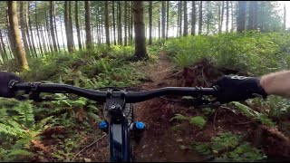
      This trail is classic old school NW single track. Tight and rooty, this trail will surprise you. Do not let your wheels drift too far into the ferns or you will end up upside down. If your first MTB was fully rigid (like me) you will enjoy this trip back to the 90's.
      Goolick
      Surprisingly technical - narrow with lots of large roots

      We hope you've been enjoying Trailforks!

      Create a FREE account to view all trail reviews and much more.

      • By kyleyoungtransition & contributors
      • #8711 - 3,942 views

      Frequently Asked Questions

      ▼ Where is 2 1/2 located?
      2 1/2 is located in Galbraith, Bellingham, Washington, United States. It is part of the Galbraith trail network. The trailhead is located at coordinates 48.72061, -122.41031.
      ▼ How hard is 2 1/2?
      2 1/2 is rated as Green difficulty. The physical rating is Easy. The average grade is 2.5%. The climb difficulty is rated Green.
      ▼ What is the elevation gain for 2 1/2?
      2 1/2 has 15 ft of elevation gain. The trail has 82 ft of elevation descent. The elevation ranges from 1,249 ft to 1,323 ft.
      ▼ Is 2 1/2 a point to point trail?
      2 1/2 is not a point to point trail. The direction is Both Directions. The trail type is singletrack.
      ▼ How long is 2 1/2?
      2 1/2 is 2,710 ft long. The trail type is singletrack.
      ▼ Are dogs allowed on 2 1/2?
      Yes, dogs are allowed on 2 1/2. Please keep dogs on a leash where required and clean up after them.
      ▼ When is the best time of year to ride 2 1/2?
      Based on activity log data, the most popular months to ride 2 1/2 are:
      • July (75 activities)
      • September (57 activities)
      • June (56 activities)
      Check the reports page for current trail conditions.
      ▼ How do I access 2 1/2? Where is the closest parking trailhead?
      The closest parking and trailhead locations to 2 1/2 are: View all parking locations in the area.
      ▼ How long does it take to ride 2 1/2?
      Based on recorded activities, it takes an average of 6 minutes to ride 2 1/2. The trail is 2,710 ft long. Actual times will vary based on fitness level, conditions, and pace. View recent activity logs for more details.
      ▼ How busy is 2 1/2?
      2 1/2 is a very popular trail. There have been 2,942 recorded activities on this trail. The trail has received 3,031 check-ins. View recent activity on this trail.

      Hit the Trail

      Open in App

      Get this trail on your phone instantly.

      open trail in app

      Download Trail

      Save to wishlist, Garmin & download.
      save the trail

      Find Related Routes

      Find routes and users activities that include this trail.
      find routes for this trail

      You must enter a description before submitting.