more stats
4,918 ft
Distance
165 ft
Climb
-123 ft
Descent
00:22:29
Avg time
43 ft
Altitude change
528 ft
Altitude min
694 ft
Altitude max
651 ft
Altitude start
696 ft
Altitude end
0.9%
Grade
-27%
Grade max
26.3%
Grade min
2,221 ft
Distance climb
2,077 ft
Distance down
617 ft
Distance flat
00:22:29
Avg time

Åsermarka Details

  • Activities
    • Mountain Bike
    • E-Bike
    • Winter Fat Bike
    • Hike
    • Trail Running
  • Riding Area
    Åsermarka
    Askim
  • Difficulty Rating
  • Local Popularity
    5 in Mountain Biking [+]
    • 5 in E-Biking
    • 5 in Trail Running
    • 5 in Hiking
  • Global Ranking
    #146606 in Mountain Biking [+]
    • #104199 in E-Biking
    • #133021 in Trail Running
    • #126378 in Hiking
  • Hiking SAC Scale
    T1 Hiking
  • Trail Type
    Singletrack
  • Bike Type
    AM, XC, Fat
  • Direction
    Both Directions
  • Climb Difficulty
    Blue
  • Physical Rating
    Hard
  • Trail Visibility
    Always easy to follow
  • Dogs Allowed
    Yes
  • eBike Allowed
    Yes up to Class 1
  • TTFs on Trail
    Ladder Bridge, Rock Garden
  • OSM Way

Norsk
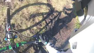
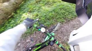
Stien begynner ganske lett ned over og går brattere og brattere nedover til man kommer til en sving som går nordover og ned gjennom en steinhage, over en bekk,
og gå videre oppover,så kommer man til et kryss, som går ned mot Glomma,så går det oppover og opp til den nordligste svingen,som er litt bratt,men de fleste skal klare å komme seg opp, så forsetter det med oppover bakke helt til en sving så er stien mindre teknisk, og forsetter ganske flatt med flere lengre rette strekninger, med noen noen områder med gjørme, som man kan sykle eller gå forbi, så etter den siste gjørma så forsetter stien lett till traktor veien.

English
The trail begins quite easily downhill and goes steeper and downhill until you reach a turn north-westerly and down a rock garden, over a stream,
and go upwards, then you get intersection that goes down towards Glomma, then it goes up and up to the northernmost turn, which is a little steep, but most will be able to get up, then it continues uphill until the turn is so the path is mid right technical and continues quite flat with several longer straight section, with some areas of mud, which you can cycle or walk past, so after the last mud, the trail continues to reach the tractor road.

Access Info

Norsk
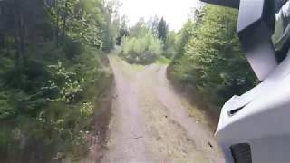
Hvis du kommer fra gul løype, følger du gule makering, det er en stor pil så bare å følge den, så er det noen meter til man kommer til et kryss, da tar du til venstre.

English
If you come from the yellow trail, you yellow the markings, It's a big arrow so just follow it, then it's a few meters until you reach across, then turn left.

Local Trail Association

Recent Activity on Trail

Past Week
  • 0 rides
  •  
6 Months
  • 0 rides
  •  
All
  • 3 rides
  • Last: Aug 20, 2023
update trails status or condition

Åsermarka Trail Reports

statusdatedescription
Oct 6, 2017 @ 12:52pm
Oct 6, 2017
reporter et tre har falt ned, men mulig å sykle under.
May 24, 2017 @ 5:26pm
May 24, 2017
reporter Large tree down across trail, blocking trail
more »
Status:
on Oct 6, 2017
Wet
Avg: 4.13 (1 votes)
Your vote: 0

view (6)
close
3D
Trail Conditions
  • Unknown
  • Snow Groomed
  • Snow Packed
  • Snow Covered
  • Snow Cover Partial
  • Freeze/thaw Cycle
  • Icy
  • Prevalent Mud
  • Wet
  • Variable
  • Ideal
  • Dry
  • Very Dry
Trail Flow (Ridden Direction)
Trailforks scans users ridelogs to determine the most popular direction each trail is ridden. A good flowing trail network will have most trails flowing in a single direction according to their intension.
The colour categories are based on what percentage of riders are riding a trail in its intended direction.
  • > 96%
  • > 90%
  • > 80%
  • > 70%
  • > 50%
  • < 50%
  • bi-directional trail
  • no data
Trail Last Ridden
Trailforks scans ridelogs to determine the last time a trail was ridden.
  • < 2 days
  • < 1 week
  • < 2 weeks
  • < 1 month
  • < 6 months
  • > 6 months
Trail Ridden Direction
The intended direction a trail should be ridden.
  • Downhill Only
  • Downhill Primary
  • Both Directions
  • Uphill Primary
  • Uphill Only
  • One Direction
Contribute Details
Colors indicate trail is missing specified detail.
  • Description
  • Photos
  • Description & Photos
  • Videos
Trail Popularity ?
Trailforks scans ridelogs to determine which trails are ridden the most in the last 9 months. Trails are compared with nearby trails in the same city region with a possible 25 colour shades. Think of this as a heatmap, more rides = more kinetic energy = warmer colors.
  • most popular
  • popular
  • less popular
  • not popular
ATV/ORV/OHV Filter
Max Vehicle Width
inches
US Cell Coverage
Legend
cell carrier legend

Radar Time
Activity Recordings
Trailforks uses anonymized public activity data. ?
Activity Recordings
Trailforks uses anonymized public activity data. ?
Personal Heatmap
Activity Types
all / none
Options
2
Date range month
Winter Trails
Warning A routing network for winter maps does not exist. Selecting trails using the winter trails layer has been disabled.
Missing Trails
Most Popular
Least Popular
Trails are colored based on popularity. The more popular a trail is, the more red. Less popular trails trend towards green.
Jump Magnitude Heatmap
Heatmap of where riders jump on trails. Zoom in to see individual jumps, click circles to view jump details.
BC Backroad Status

Service Road Atlas is a free to use, community-driven service for viewing and creating reports on the numerous back-country service roads around B.C. and Alberta.

map legend
Slope Aspect
Direction the slope faces
Flat N NE E SE S SW W NW
Trails Deemphasized
Trails are shown in grey.
disable
Only show trails with no bike usage.
Enable
Suggested Layers
Based on selected activity type

    Save the current map location and zoom level as your default home location whenever this page is loaded.

    Save
        Directions to asermarka trailhead (59.647090, 11.177110)

        Photos

        23 more »
        45 |
        Mar 12, 2018 @ 9:48am
        Mar 12, 2018
        34 |
        Oct 21, 2017 @ 9:47pm
        Oct 21, 2017
        30 |
        Nov 15, 2017 @ 2:07am
        Nov 15, 2017
        23 |
        Nov 9, 2017 @ 6:11pm
        Nov 9, 2017

        Videos

        4 more »
        youtuber 06.10.2017 Til sagbruket
        3:40 | 274 | Feb 22, 2018 , Askim
        youtuber 24 05 2017 P5 Åsermarka- Nordhytta,...
        512 | Jun 4, 2017 , Askim
        youtuber 24 05 2017 P4 Åsermarka
        355 | Jun 4, 2017 , Askim
        youtuber 06.10.2017 Åsermarka
        10:45 | 320 | Mar 12, 2018 , Askim

        Routes with this trail

        5.0 3 miles 346 ft 15 Point to Point
        Løypa er 5.2 km lang løype, med mange tekniske strekniger, etter du kommer det opp fra grus veien så er...

        Reviews / Comments

        No reviews yet, be the first to write a review or ask a question.
        Use trail reports to comment on trail conditions.


        We hope you've been enjoying Trailforks!

        Create a FREE account to view trail comments and much more.

        Frequently Asked Questions About Åsermarka

        Where is Åsermarka located?
        Åsermarka is located in Åsermarka, Askim, Norway. It is part of the Åsermarka trail network. The trailhead is located at coordinates 59.64709, 11.17711.
        How hard is Åsermarka?
        Åsermarka is rated as Blue difficulty. The physical rating is Hard. The average grade is 0.9%. The climb difficulty is rated Blue.
        What is the elevation gain for Åsermarka?
        Åsermarka has 50 m of elevation gain. The trail has 38 m of elevation descent. The elevation ranges from 161 m to 212 m.
        Is Åsermarka a point to point trail?
        Åsermarka is not a point to point trail. The direction is Both Directions. The trail type is singletrack.

        Hit the Trail

        Open in App

        Get this trail on your phone instantly.
        open trail in app

        Download Trail

        Save to wishlist, Garmin & download.
        save the trail

        Find Related Routes

        Find routes and users activities that include this trail.
        find routes for this trail

        You must enter a description before submitting.