Supporters, Builders, Maintainers & Land Managers of Big Kame Loop Trail
Big Kame Loop Details
-
Activities
- Mountain Bike
- Hike
- Trail Running
-
Riding AreaDTE Energy Foundation Trail
Chelsea, Michigan -
Difficulty Rating
-
Voted DifficultyBlue (2 votes)
-
Trail TypeSingletrack
-
Bike TypeAM
-
DirectionBoth Directions
-
Climb DifficultyBlue
-
Physical RatingModerate
-
Trail VisibilityAlways easy to follow
-
Dogs AllowedYes
-
eBike Allowed
-
TTFs on TrailBerm, Jump, Rock Garden, Roller Coaster
-
Global Ranking
-
Local Popularity90 in Mountain Biking [+]
- 5 in Trail Running
- 95 in Hiking
-
Land OwnerMichgan DNR
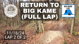
The 4.75 mi Big Kame loop is more technical with two large rock gardens and many small to large jumps. It has several small hills and one very large one with big jumps.
Access Info
All trail loops are directional based on day of the week. On Mondays, Wednesdays, Fridays and Sundays bikes travel clockwise on all loops, with foot traffic going counterclockwise. On Tuesdays, Thursdays and Saturdays, these directions are reversed for the respective users. In winter, parts of the trail system are groomed for “floatation use only” – fat tires, xc skis or snowshoes. Check the Facebook page for latest updates.
Disclaimer
This trail closes during wet/erosive conditions. Check the DTE Facebook page linked below for current conditions.
Local Trail Association
-
Please consider joining or donating to the local trail association to supportdonate to earn trail karma!
trail development & maintenance.
Traditionally Indigenous Territory
More Stats for Big Kame Loop mountain bike trail trail
-
Altitude change7 ft
-
Altitude min955 ft
-
Altitude max1,076 ft
-
Altitude start997 ft
-
Altitude end1,004 ft
-
Grade max-19.8%
-
Grade min22.6%
-
Distance climb1 mile
-
Distance down2 miles
-
Distance flat1 mile
-
Avg time00:27:20
-
Avg reverse time00:38:42
- view trail stats
- Unknown
- Snow Groomed
- Snow Packed
- Snow Covered
- Snow Cover Inadequate
- Freeze/thaw Cycle
- Icy
- Prevalent Mud
- Wet
- Variable
- Ideal
- Dry
- Very Dry
The colour categories are based on what percentage of riders are riding a trail in its intended direction.
- > 96%
- > 90%
- > 80%
- > 70%
- > 50%
- < 50%
- bi-directional trail
- no data
- < 2 days
- < 1 week
- < 2 weeks
- < 1 month
- < 6 months
- > 6 months
- Downhill Only
- Downhill Primary
- Both Directions
- Uphill Primary
- Uphill Only
- One Direction
- Description
- Photos
- Description & Photos
- Videos
- most popular
- popular
- less popular
- not popular
- mountain biking recent
- mountain biking (>6 month)
- hiking (1 year)
- moto (1 year)
- Downhill Ski
- Backcountry Ski
- Nordic Ski
- Snowmobile
Save the current map location and zoom level as your default home location whenever this page is loaded.
SaveBig Kame Loop Trail Reports
Recent Ridelog Activity on Trail
Past Week
- 0 rides
6 Months
- 214 rides
- 17 miles avg distance
All
- 4,557 rides
- Last: Aug 13, 2022
Photos
Routes with this trail
5 Reviews & Comments
-
+ 0


Videos

Nearby Trails
- Big Kame/green Emergency Access 312 ft
- Green Lake Loop Emergency Access 1,621 ft
- Green Lake Loop Emergency Access 1,788 ft
- Green Lake Loop 2,313 ft
- Green Lake M52 Access 2,313 ft
DTE Energy Foundation Trail
- embed Big Kame Loop trail on your website
- By rlamos & contributors
- #101646 - 6,322 views
- subscribe
- login to download gpx or kml files.