more stats
1.3 miles
Distance
602 ft
Climb
00:16:11
Avg time
602 ft
Altitude change
2,506 ft
Altitude min
3,108 ft
Altitude max
2,506 ft
Altitude start
3,107 ft
Altitude end
8.5%
Grade
-3.2%
Grade max
34.7%
Grade min
1 mile
Distance climb
125 ft
Distance down
253 ft
Distance flat
00:16:11
Avg time

Bottoms Up Details

  • Activities
    • Mountain Bike
    • E-Bike
    • Adaptive Bike
    • Winter Fat Bike
    • Hike
    • Trail Running
  • Riding Area
    Morning Mountain
    Nelson, British Columbia
  • Difficulty Rating
  • Local Popularity
    100 in Mountain Biking [+]
    • 100 in E-Biking
    • 90 in Trail Running
    • 90 in Hiking
    • 85 in Winter Fat Biking
    • 5 in Adaptive Biking
  • Global Ranking
    #13976 in Mountain Biking [+]
    • #2903 in E-Biking
    • #2405 in Trail Running
    • #62705 in Hiking
  • Trail Type
    Machine Groomed
  • Bike Type
    DH, AM, XC, Fat, Adaptive MTB
  • Direction
    Downhill Only[+]
    Popular Direction Shown
    • Downhill Only for E-Biking
    • Downhill Only for Trail Running
    • Downhill Only for Hiking
    • Downhill Only for Winter Fat Biking
  • Climb Difficulty
    Blue
  • Physical Rating
    Moderate
  • Season
    May-November
  • Dogs Allowed
    Yes
  • eBike Allowed
    Yes up to Class 1
  • TTFs on Trail
    Bridge

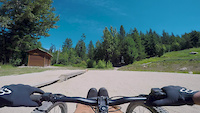
Locals rejoice. Our first grunt-free climb ever, on an easy ascent that zippers up the face of lower Morning Mountain and started the revolution of this neglected area into a must-ride trail system.

Adaptive Bike Info
aMTB Green Rating: Beginner features and moderate terrain.

Has a few tight uphill switchbacks that require a 3-point turn. May prove a little challenging for new adaptive riders with limited hand/hip function. The trail crew knows and it should be fixed for the 2024 season

Trail Supporters
Local Trail Association

Recent Activity on Trail

Past Week
  • 18 rides
  • 9 miles average
6 Months
  • 438 rides
  • 7 miles avg distance
All
  • 2,260 rides
  • Last: Sep 15, 2026
c1c2c3c4
January
February
March
April
May
June
July
August
September
October
November
December
Status:
on Sep 7, 2026
Ideal
Avg: 4.57 (34 votes)
Your vote: 0

view (15,718)
close
      Directions to bottoms-up trailhead (49.488630, -117.361060)

      Photos

      34 more »
      mtb
      586 |
      May 24, 2015 @ 11:36am
      May 24, 2015
      mtb
      91 |
      Jul 26, 2024 @ 7:33pm
      Jul 26, 2024
      mtb
      70 |
      Jul 26, 2024 @ 7:33pm
      Jul 26, 2024
      mtb
      302 |
      Apr 16, 2019 @ 4:49pm
      Apr 16, 2019

      Videos

      2 more »
      Morning Mountain || Ticks Dig Me || Nelson BC
      mtb
      7:28 | 808 | Sep 21, 2018 , Nelson
      Bottoms Up - Morning Mtn - Nelson B.C.
      mtb
      8:28 | 110 | Aug 23, 2023 , Nelson

      Routes with this trail

      9 miles 2,538 ft 3
      Round 4 of the Nelson 10 Spot Enduro Series Check in begins at 10am at Morning Mountain. Entry is $10 and...
      11 miles 2,816 ft 10 Loop
      Tech loop up and very high then down bear's den, highballer, and (double black).
      6 miles 1,867 ft 8 Loop
      Try your luck at poker and have fun with your friends and the bike community at this casual,...

      Trail Products

      4.7
      34 Ratings
      5 74%
      4 21%
      3 6%
      2
      1

      1 Review & Comments

      lpatterson lpatterson
      HEADS UP! Saturday 27th June: Tackle the Toad trail event will be using this trail from 6am - 6pm

      We hope you've been enjoying Trailforks!

      Create a FREE account to view all trail reviews and much more.

      • By zshipowickTF Pro & contributors
      • #20732 - 9,203 views

      Frequently Asked Questions

      Where is Bottoms Up located?
      Bottoms Up is located in Morning Mountain, Nelson, British Columbia, Canada. It is part of the Morning Mountain trail network. The trailhead is located at coordinates 49.48863, -117.36106.
      How hard is Bottoms Up?
      Bottoms Up is rated as Green difficulty. The physical rating is Moderate. The average grade is 8.5%. The climb difficulty is rated Blue.
      What is the elevation gain for Bottoms Up?
      Bottoms Up has 602 ft of elevation gain. The elevation ranges from 2,506 ft to 3,108 ft.
      Is Bottoms Up a point to point trail?
      Yes, Bottoms Up is a point to point trail. The direction is Downhill Only. The trail type is machine groomed.
      How long is Bottoms Up?
      Bottoms Up is 1.3 miles long. The trail type is machine groomed.
      Are dogs allowed on Bottoms Up?
      Yes, dogs are allowed on Bottoms Up. Please keep dogs on a leash where required and clean up after them.
      When is the best time of year to ride Bottoms Up?
      Based on activity log data, the most popular months to ride Bottoms Up are:
      • July (278 activities)
      • May (239 activities)
      • August (201 activities)
      Check the reports page for current trail conditions.
      How do I access Bottoms Up? Where is the closest parking trailhead?
      The closest parking and trailhead locations to Bottoms Up are: View all parking locations in the area.
      How long does it take to ride Bottoms Up?
      Based on recorded activities, it takes an average of 18 minutes to ride Bottoms Up. The trail is 1.3 miles long. Actual times will vary based on fitness level, conditions, and pace. View recent activity logs for more details.
      How busy is Bottoms Up?
      Bottoms Up is a very popular trail. There have been 9,654 recorded activities on this trail. The trail has received 15,718 check-ins. View recent activity on this trail.

      Hit the Trail

      Open in App

      Get this trail on your phone instantly.

      open trail in app

      Download Trail

      Save to wishlist, Garmin & download.
      save the trail

      Find Related Routes

      Find routes and users activities that include this trail.
      find routes for this trail

      You must enter a description before submitting.