more stats
3.5 miles
Distance
883 ft
Climb
-510 ft
Descent
00:31:48
Avg time
374 ft
Altitude change
5,116 ft
Altitude min
5,601 ft
Altitude max
5,116 ft
Altitude start
5,490 ft
Altitude end
2.024%
Grade
-44.392%
Grade max
83.599%
Grade min
2 miles
Distance climb
1 mile
Distance down
1,952 ft
Distance flat
00:31:48
Avg time

Trail Details

  • Activities
    • Mountain Bike
    • Hike
    • Trail Running
    • Snowshoe
  • Riding Area
    Provo Canyon
    Provo, Utah
  • Ref Number
    #2219
  • AKA
  • Difficulty Rating
  • Local Popularity
    85 in Mountain Biking [+]
    • 85 in Trail Running
    • 75 in Hiking
    • 5 in Snowshoeing
  • Global Ranking
    #113531 in Mountain Biking [+]
    • #85976 in Trail Running
    • #115344 in Hiking
    • #19789 in Snowshoeing
  • State Ranking
    #1,996 in Mountain Biking · Utah [+]
    • #1,861 in Trail Running
    • #2,568 in Hiking
    • #159 in Snowshoeing
  • Hiking SAC Scale
    T2 Mountain Hiking
  • Trail Type
    Singletrack
  • Bike Type
    AM
  • Direction
    Both Directions
  • Climb Difficulty
    Black Diamond
  • Physical Rating
    Moderate
  • Trail Visibility
    Always easy to follow
  • Dogs Allowed
    Yes
  • Land Owner
  • OSM Way

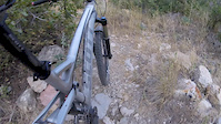
This trail climbs pretty steep, but the rock is fairly smooth and embedded. All rideable with some loose shale and pitches up at the top. A hard climb but fun.

Tags
CanyonLoose

Trail Supporters

Local Trail Association

Traditionally Indigenous Territory

Recent Activity on Trail

Past Week
  • 0 rides
  •  
6 Months
  • 31 rides
  • 16 miles avg distance
All
  • 203 rides
  • Last: Oct 15, 2026
update trails status or condition

Bonneville... Trail Reports

statusdatedescription
Aug 27, 2026 @ 6:30pm (America/Boise)
Aug 27, 2026
Jun 18, 2026 @ 1:16pm (America/Denver)
Jun 18, 2026
Jun 18, 2026 @ 1:15pm (America/Denver)
Jun 18, 2026
Trailbuilder here: Scrub Oak has been cut back and bench evaluated. Dry hardpack conditions. All holes have been filled; trail is in great condition.
May 9, 2026 @ 7:17am (America/Boise)
May 9, 2026
Sep 18, 2025 @ 2:05pm (America/Denver)
Sep 18, 2025
more »
Status:
on Aug 27, 2026
Ideal
Avg: 3.95 (14 votes)
Your vote: 0

view (1,734)
close
      Directions to bonneville-shoreline-trail-provo-canyon-south trailhead (40.338310, -111.607800)

      Photos

      21 more »
      mtb
      78 |
      May 18, 2024 @ 11:42am
      May 18, 2024
      mtb
      74 |
      May 18, 2024 @ 11:42am
      May 18, 2024
      mtb
      202 |
      Mar 3, 2019 @ 10:24am
      Mar 3, 2019
      mtb
      153 |
      Nov 2, 2017 @ 11:30am
      Nov 2, 2017

      Videos

      2 more »
      Secret Trail SLC
      mtb
      3:51 | 339 | Aug 18, 2016 , Provo
      State of the BST: Ep. 5 - Provo
      hike
      23:59 | 263 | Sep 6, 2021 , Provo

      Trail Lists

      Routes with this trail

      17 miles • 2,806 ft • 18 • Loop •
      The loop is in the shape of a rabbit.
      5 miles • 860 ft • 8 • Point to Point •
      A remarkably wild section of the BST, above the cities of Provo and Orem. The name seems odd, given that...
      54 miles • 9,391 ft • 11 •
      4.0 ★★★★★
      14 Ratings
      5 ★ 29%
      4 ★ 43%
      3 ★ 21%
      2 ★ 7%
      1 ★

      2 Reviews & Comments

      abef abef
      Great as a descent as well, although watch your speed on the tight turns as there is two-way traffic.

      We hope you've been enjoying Trailforks!

      Create a FREE account to view all trail reviews and much more.

      • By toddTF Pro Trailforks & contributors
      • #9397 - 5,297 views

      Frequently Asked Questions

      ▼ Where is Bonneville Shoreline Trail: Provo Canyon South located?
      Bonneville Shoreline Trail: Provo Canyon South is located in Provo Canyon, Provo, Utah, United States. It is part of the Provo Canyon trail network. The trailhead is located at coordinates 40.33831, -111.6078.
      ▼ How hard is Bonneville Shoreline Trail: Provo Canyon South?
      Bonneville Shoreline Trail: Provo Canyon South is rated as Blue difficulty. The physical rating is Moderate. The average grade is 2.024%. The climb difficulty is rated Black Diamond.
      ▼ What is the elevation gain for Bonneville Shoreline Trail: Provo Canyon South?
      Bonneville Shoreline Trail: Provo Canyon South has 883 ft of elevation gain. The trail has 510 ft of elevation descent. The elevation ranges from 5,116 ft to 5,601 ft.
      ▼ Is Bonneville Shoreline Trail: Provo Canyon South a point to point trail?
      Bonneville Shoreline Trail: Provo Canyon South is not a point to point trail. The direction is Both Directions. The trail type is singletrack.
      ▼ How long is Bonneville Shoreline Trail: Provo Canyon South?
      Bonneville Shoreline Trail: Provo Canyon South is 3.5 miles long. The trail type is singletrack.
      ▼ Are dogs allowed on Bonneville Shoreline Trail: Provo Canyon South?
      Yes, dogs are allowed on Bonneville Shoreline Trail: Provo Canyon South. Please keep dogs on a leash where required and clean up after them.
      ▼ How do I access Bonneville Shoreline Trail: Provo Canyon South? Where is the closest parking trailhead?
      The closest parking and trailhead locations to Bonneville Shoreline Trail: Provo Canyon South are: View all parking locations in the area.
      ▼ How long does it take to ride Bonneville Shoreline Trail: Provo Canyon South?
      Based on recorded activities, it takes an average of 32 minutes to ride Bonneville Shoreline Trail: Provo Canyon South. The trail is 3.5 miles long. Actual times will vary based on fitness level, conditions, and pace. View recent activity logs for more details.
      ▼ How busy is Bonneville Shoreline Trail: Provo Canyon South?
      Bonneville Shoreline Trail: Provo Canyon South is a very popular trail. There have been 1,701 recorded activities on this trail. The trail has received 1,734 check-ins. View recent activity on this trail.

      Hit the Trail

      Open in App

      Get this trail on your phone instantly.

      open trail in app

      Download Trail

      Save to wishlist, Garmin & download.
      save the trail

      Find Related Routes

      Find routes and users activities that include this trail.
      find routes for this trail

      You must enter a description before submitting.