more stats
2.9 miles
Distance
284 ft
Climb
-296 ft
Descent
00:41:48
Avg time
-10 ft
Altitude change
4,021 ft
Altitude min
4,141 ft
Altitude max
4,059 ft
Altitude start
4,049 ft
Altitude end
-0.1%
Grade
-21%
Grade max
21%
Grade min
1 mile
Distance climb
1 mile
Distance down
2,539 ft
Distance flat
00:41:48
Avg time

C.O.D. (Lower) Details

  • Activities
    • Mountain Bike
    • E-Bike
    • Hike
    • Trail Running
  • Riding Area
    Phil's
    Bend, Oregon
  • Difficulty Rating
  • Voted Difficulty
    Black Diamond (0 vote)
  • Local Popularity
    50 in Mountain Biking heatmap [+]
    • 35 in E-Biking
    • 35 in Trail Running
    • 35 in Hiking
  • Global Ranking
    #100009 in Mountain Biking [+]
    • #137968 in E-Biking
    • #156452 in Trail Running
    • #156577 in Hiking
  • State Ranking
    #991 in Mountain Biking · Oregon [+]
    • #924 in E-Biking
    • #2,276 in Trail Running
    • #2,363 in Hiking
  • Trail Type
    Singletrack
  • Direction
    Both Directions
  • Dogs Allowed
    Yes
  • eBike Allowed
    Yes up to Class 1
  • Land Owner
    USFS - Deschutes Ranger District

Fun and challenging in both directions with a couple of optional lower speed drops. When riding east on the trail keep your eye out for the roll-able rock drop feature on your right.

Tags
Drops

Local Trail Association

Recent Activity on Trail

Past Week
  • 3 rides
  • 16 miles average
6 Months
  • 44 rides
  • 16 miles avg distance
All
  • 696 rides
  • Last: Nov 14, 2026
c1c2c3c4
January
February
March
April
May
June
July
August
September
October
November
December
update trails status or condition

C.O.D. (Lower) Trail Reports

statusdatedescription
Nov 13, 2026 @ 3:07pm (America/Los_Angeles)
2 days
Trees down about a third of the way end of the trail
Oct 4, 2026 @ 10:25am (America/Los_Angeles)
Oct 4, 2026
Oct 1, 2026 @ 6:39pm (America/Los_Angeles)
Oct 1, 2026
Apr 18, 2026 @ 8:41am (America/Los_Angeles)
Apr 18, 2026
Tree down and fully across trail.
Mar 5, 2026 @ 3:59pm (America/Los_Angeles)
Mar 5, 2026
Tree fell halfway across the trail about a quarter mile south of the visitor center.
more »
Status:
on Nov 13, 2026
Avg: 4.06 (10 votes)
Your vote: 0

view (9,044)
close
      Directions to c-o-d--lower trailhead (43.999070, -121.405110)

      Photos

      12 more »
      mtb
      85 |
      Apr 29, 2026 @ 6:11pm
      Apr 29, 2026
      mtb
      240 |
      Jul 10, 2023 @ 4:26pm
      Jul 10, 2023
      mtb
      317 |
      Jul 10, 2023 @ 4:22pm
      Jul 10, 2023
      mtb
      414 |
      May 19, 2021 @ 10:10am
      May 19, 2021

      Videos

      4 more »
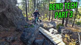
      Bend Has TECH?! COD & Grand Slam | Bend...
      mtb
      3:47 | 52 | Oct 5, 2026 , Bend
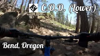
      C.O.D. (Lower) at Phil's Riding Area in Bend,...
      mtb
      8:34 | 570 | Sep 21, 2024 , Bend
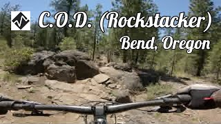
      C.O.D. (Rockstacker) at Phil's Riding Area in...
      mtb
      7:32 | 400 | Sep 7, 2024 , Bend
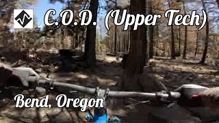
      C.O.D. (Upper Tech) at the Phil's Riding Area...
      mtb
      8:54 | 435 | Aug 31, 2024 , Bend

      Routes with this trail

      more »
      ★ 4.0 • 30 miles • 1,997 ft • 13 •
      Here in Bend the Whole Chimichanga offers a unique and unparalleled downhill experience of Central Oregon,...
      22 miles • 1,880 ft • 7 • Loop •
      Standard uphill routes to the top of the Phil's system, with a slight twist to start the downhill back to...
      34 miles • 3,146 ft • 10 •
      Lorem Ipsum is simply dummy text of the printing and typesetting industry. Lorem Ipsum has been the...

      Trail Products

      4.0 ★★★★★
      10 Ratings
      5 ★ 40%
      4 ★ 30%
      3 ★ 20%
      2 ★ 10%
      1 ★

      4 Reviews & Comments

      skyeriver8
      Bowhead reach does not go solo.
      Rad techy boulder gardens that require precise lines. 2 of which no matter what you have to high center on, but if your not worried about your undercarriage clamps then you can bash over them maybe. Not recommend though the you could need a new bike.
      But with a spotter is definitely a rad black just due to them boulder spots the rest is rad.
      This is one of the maybe two trails in bend that you can practice on to get ready for Moab stuff.
      If your on any other brand bike I’d say no go. My reach with 24” had this experience.
      20” I’d say it would be about 10 spotter spots needed and not fun. And anything wider would hang up on everything
      TryThese TryThese
      Large 12" tree still blocking part of trail as of 4/18

      We hope you've been enjoying Trailforks!

      Create a FREE account to view all trail reviews and much more.

      • By bradshawbs & contributors
      • #292280 - 2,969 views

      Frequently Asked Questions

      ▼ Where is C.O.D. (Lower) located?
      C.O.D. (Lower) is located in Phil's, Bend, Oregon, United States. It is part of the Phil's trail network. The trailhead is located at coordinates 43.99907, -121.40511.
      ▼ How hard is C.O.D. (Lower)?
      C.O.D. (Lower) is rated as Black Diamond difficulty. The average grade is 0.1%.
      ▼ What is the elevation gain for C.O.D. (Lower)?
      C.O.D. (Lower) has 284 ft of elevation gain. The trail has 296 ft of elevation descent. The elevation ranges from 4,021 ft to 4,141 ft.
      ▼ Is C.O.D. (Lower) a point to point trail?
      C.O.D. (Lower) is not a point to point trail. The direction is Both Directions. The trail type is singletrack.
      ▼ How long is C.O.D. (Lower)?
      C.O.D. (Lower) is 2.9 miles long. The trail type is singletrack.
      ▼ Are dogs allowed on C.O.D. (Lower)?
      Yes, dogs are allowed on C.O.D. (Lower). Please keep dogs on a leash where required and clean up after them.
      ▼ When is the best time of year to ride C.O.D. (Lower)?
      Based on activity log data, the most popular months to ride C.O.D. (Lower) are:
      • June (44 activities)
      • May (41 activities)
      • August (30 activities)
      Check the reports page for current trail conditions.
      ▼ How do I access C.O.D. (Lower)? Where is the closest parking trailhead?
      The closest parking and trailhead locations to C.O.D. (Lower) are: View all parking locations in the area.
      ▼ How long does it take to ride C.O.D. (Lower)?
      Based on recorded activities, it takes an average of 42 minutes to ride C.O.D. (Lower). The trail is 2.9 miles long. Actual times will vary based on fitness level, conditions, and pace. View recent activity logs for more details.
      ▼ How busy is C.O.D. (Lower)?
      C.O.D. (Lower) is a moderately popular trail. There have been 3,343 recorded activities on this trail. The trail has received 9,044 check-ins. View recent activity on this trail.

      Hit the Trail

      Open in App

      Get this trail on your phone instantly.

      open trail in app

      Download Trail

      Save to wishlist, Garmin & download.
      save the trail

      Find Related Routes

      Find routes and users activities that include this trail.
      find routes for this trail

      You must enter a description before submitting.