more stats
3,025 ft
Distance
6 ft
Climb
-180 ft
Descent
00:02:59
Avg time
-175 ft
Altitude change
1,109 ft
Altitude min
1,290 ft
Altitude max
1,283 ft
Altitude start
1,109 ft
Altitude end
-5.8%
Grade
-11.3%
Grade max
7.3%
Grade min
125 ft
Distance climb
2,818 ft
Distance down
85 ft
Distance flat
00:02:59
Avg time

Cardrona Details

  • Activities
    • Mountain Bike
    • E-Bike
    • Adaptive Bike
    • Hike
    • Trail Running
  • Riding Area
    Alice Lake & Highlands
    Squamish, British Columbia
  • Difficulty Rating
  • Local Popularity
    95 in Mountain Biking [+]
    • 95 in E-Biking
    • 80 in Trail Running
    • 70 in Hiking
    • 5 in Adaptive Biking
  • Global Ranking
    #3326 in Mountain Biking [+]
    • #2955 in E-Biking
    • #106116 in Trail Running
    • #127004 in Hiking
    • #729 in Adaptive Biking
  • Provincial Ranking
    #221 in Mountain Biking · British Columbia [+]
    • #289 in E-Biking
    • #6,073 in Trail Running
    • #6,965 in Hiking
    • #91 in Adaptive Biking
  • Trail Type
    Singletrack
  • Bike Type
    AM, XC, Adaptive MTB
  • Direction
    One Direction
    Popular Direction Shown
  • Physical Rating
    Easy
  • Trail Visibility
    Always easy to follow
  • Season
    all season
  • Dogs Allowed
    Yes
  • eBike Allowed
  • TTFs on Trail
    Berm, Jump, Roller Coaster
  • Ride in Rain
    Yes
  • Year Opened
    2023
  • Land Owner
    RSTBC

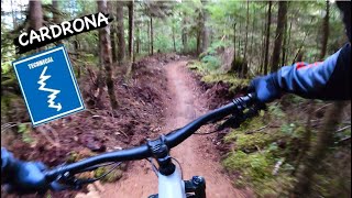
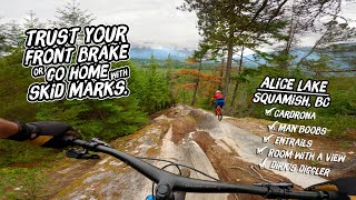
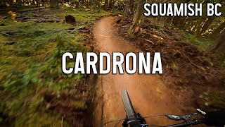
Part of Mikayla Martin's legacy, Cardrona is named after the ski resort in New Zealand where Mikayla won a gold medal in freestyle. The trail is built not only to be adaptive friendly, but also enjoyable for all levels of riders from beginner to expert. Plenty of fun corners and rollers to pump, jump or gap. Cardrona was built by Ride BC and planned / funded by SORCA through grant funding. Enjoy

Adaptive Bike Info
aMTB Blue Rating: Intermediate features and steeper terrain.

This trail was built with a 48" wide tread with a few sections down to 40". Please be mindful of the rollers. Enjoy!

Tags
BermsJumpsRollers
Trail Supporters
Local Trail Association
Traditionally Indigenous Territory

Recent Activity on Trail

Past Week
  • 15 rides
  • 18.3 km average
6 Months
  • 434 rides
  • 22.1 km avg distance
All
  • 1,619 rides
  • Last: Oct 10, 2026
c1c2c3c4
January
February
March
April
May
June
July
August
September
October
November
December
Status:
on Aug 29, 2026
Variable
Avg: 3.96 (21 votes)
Your vote: 0

view (8,319)
close
      Directions to cardrona trailhead (49.789340, -123.102340)

      Photos

      15 more »
      mtb
      230 |
      Jul 31, 2023 @ 8:31pm
      Jul 31, 2023
      report
      mtb
      66 |
      Oct 30, 2025 @ 1:17pm
      Oct 30, 2025
      report
      mtb
      51 |
      Oct 17, 2025 @ 1:10pm
      Oct 17, 2025
      report
      mtb
      84 |
      Oct 5, 2025 @ 5:41pm
      Oct 5, 2025

      Videos

      4 more »
      youtuber CARDRONA | Blue trail | Squamish - Alice Lake
      mtb
      0:50 | 779 | Dec 17, 2023 , Squamish
      Cardrona Alice Lake Squamish
      mtb
      2:27 | 426 | Jan 9, 2025 , Squamish
      Stumbling on a Brand New Trail
      mtb
      15:14 | 193 | Oct 9, 2023 , Squamish
      youtuber Cardrona - Squamish Mountain Biking
      mtb
      5:15 | 1077 | May 17, 2023 , Squamish

      Routes with this trail

      ★ 5.0 • 7 miles • 1,118 ft • 7 •
      Slippery Salmon > Cardrona > Cliff's Corners
      10 miles • 1,195 ft • 6 •
      50 Shade of Green > Cardrona > Wonderland
      10 miles • 1,392 ft • 7 •
      Mashiter > Upstream > Ed's Access > All About Yew > Northside Connector > Ed's Access >...
      4.0 ★★★★★
      22 Ratings
      5 ★ 41%
      4 ★ 27%
      3 ★ 23%
      2 ★ 5%
      1 ★ 5%

      6 Reviews & Comments

      PWinter
      GREEN. It’s too bad it’s graded “Blue” as it may deter beginner riders
      Juviticus
      Very mellow blue trail, only blue because of the number of doubles. I feel like turning the doubles into tabletops would make this trail even better for progression. The consequence of the doubles is they are very easy to case. Great addition to the area!
      anjulie
      This trail is so much fun! Amazing work trail builders!! I’m an average rider and I had an absolute hoot on this trail - no gap jumps for me but everything is rollable. Awesome alternative to Robs corners.

      We hope you've been enjoying Trailforks!

      Create a FREE account to view all trail reviews and much more.

      • By james529529TF Pro ECMBA & contributors
      • #576754 - 3,977 views

      Frequently Asked Questions

      ▼ Where is Cardrona located?
      Cardrona is located in Alice Lake & Highlands, Squamish, British Columbia, Canada. It is part of the Alice Lake & Highlands trail network. The trailhead is located at coordinates 49.78934, -123.10234.
      ▼ How hard is Cardrona?
      Cardrona is rated as Blue difficulty. The physical rating is Easy. The average grade is 5.8%.
      ▼ What is the elevation gain for Cardrona?
      Cardrona has 6 ft of elevation gain. The trail has 180 ft of elevation descent. The elevation ranges from 1,109 ft to 1,290 ft.
      ▼ Is Cardrona a point to point trail?
      Yes, Cardrona is a point to point trail. The direction is One Direction. The trail type is singletrack.
      ▼ How long is Cardrona?
      Cardrona is 3,025 ft long. The trail type is singletrack.
      ▼ Are dogs allowed on Cardrona?
      Yes, dogs are allowed on Cardrona. Please keep dogs on a leash where required and clean up after them.
      ▼ When is the best time of year to ride Cardrona?
      Cardrona is best visited during: all season.
      ▼ How do I access Cardrona? Where is the closest parking trailhead?
      The closest parking and trailhead locations to Cardrona are: View all parking locations in the area.
      ▼ How long does it take to ride Cardrona?
      Based on recorded activities, it takes an average of 3 minutes to ride Cardrona. The trail is 3,025 ft long. Actual times will vary based on fitness level, conditions, and pace. View recent activity logs for more details.
      ▼ How busy is Cardrona?
      Cardrona is a very popular trail. There have been 7,677 recorded activities on this trail. The trail has received 8,316 check-ins. View recent activity on this trail.

      Hit the Trail

      Open in App

      Get this trail on your phone instantly.

      open trail in app

      Download Trail

      Save to wishlist, Garmin & download.
      save the trail

      Find Related Routes

      Find routes and users activities that include this trail.
      find routes for this trail

      You must enter a description before submitting.