more stats
7.2 miles
Distance
281 ft
Climb
-630 ft
Descent
01:05:58
Avg time
-348 ft
Altitude change
5,472 ft
Altitude min
5,996 ft
Altitude max
5,891 ft
Altitude start
5,545 ft
Altitude end
-0.9%
Grade
-15.1%
Grade max
22.5%
Grade min
2 miles
Distance climb
3 miles
Distance down
2 miles
Distance flat
01:05:58
Avg time

Chisholm Details

  • Activities
    • Mountain Bike
    • E-Bike
    • Hike
    • Trail Running
  • Riding Area
    Horsethief
    Moab, Utah
  • Difficulty Rating
  • Voted Difficulty
    Blue (1 vote)
  • Local Popularity
    75 in Mountain Biking [+]
    • 80 in E-Biking
    • 50 in Trail Running
    • 60 in Hiking
  • Global Ranking
    #48251 in Mountain Biking [+]
    • #18023 in E-Biking
    • #143743 in Trail Running
    • #134173 in Hiking
  • State Ranking
    #913 in Mountain Biking · Utah [+]
    • #243 in E-Biking
    • #3,243 in Trail Running
    • #3,047 in Hiking
  • Trail Type
    Singletrack
  • Dogs Allowed
    Yes
  • eBike Allowed
    Yes up to Class 1
  • Land Owner
    BLM

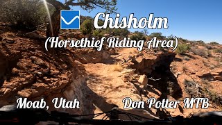
Chisolm connects the Horsethief riding area to Navajo Rocks. It's a great mix of different types of trail, from bench cut dirt to open slickrock to built rock ramps to desert singletrack. It may seem flat, but there's a significant drop from the 313 highway crossing to where it meets Big Lonely trail in Navajo Rocks.
Chisolm passes right by the BLM Horsethief Campground; there are a few short connector trails to access the campsite.

Tags
DesertRock slabs

Trail Supporters

Local Trail Association

Traditionally Indigenous Territory

Recent Activity on Trail

Past Week
  • 8 rides
  • 51 miles average
6 Months
  • 45 rides
  • 26 miles avg distance
All
  • 410 rides
  • Last: Oct 23, 2026
c1c2c3c4
January
February
March
April
May
June
July
August
September
October
November
December
update trails status or condition

Chisholm Trail Reports

Status:
on Oct 18, 2026
Ideal
Avg: 4.03 (29 votes)
Your vote: 0

view (2,099)
close
      Directions to chisholm trailhead (38.584800, -109.793080)

      Photos

      15 more »
      mtb
      38 |
      Oct 3, 2026 @ 3:26pm
      Oct 3, 2026
      mtb
      133 |
      Oct 23, 2025 @ 5:32pm
      Oct 23, 2025
      mtb
      151 |
      Oct 23, 2025 @ 5:31pm
      Oct 23, 2025
      mtb
      373 |
      May 11, 2022 @ 6:45am
      May 11, 2022

      Videos

      3 more »
      youtuber Best Intermediate MTB trail in Moab, UT - Chisholm
      mtb
      16:02 | 345 | Sep 12, 2025 , Moab
      Chisholm at the Horsethief Riding Area in...
      mtb
      48:05 | 257 | Jan 17, 2026 , Moab
      Chisholm - Horsethief - Moab - Utah
      mtb
      7:29 | 329 | Jun 3, 2024 , Moab

      Routes with this trail

      ★ 5.0 • 18 miles • 852 ft • 5 • Shuttled •
      Great shuttle ride. 18-19 miles total, mostly downhill. Leave a vehicle at lower Navajo Rocks parking lot,...
      ★ 2.5 • 28 miles • 2,215 ft • 7 • Loop •
      Great Loop recommended by Larry the Legend.
      24 miles • 2,037 ft • 4 •
      Linking some trails passing through or starting at Horsethief Camp.
      4.1 ★★★★★
      29 Ratings
      5 ★ 34%
      4 ★ 48%
      3 ★ 10%
      2 ★ 3%
      1 ★ 3%

      9 Reviews & Comments

      ScottMn1gV7
      Great trail but more than blue in spots. The trail builders were always looking to ride the bluffs above the many washes.
      mawiro57
      Fun XC trail, it's a blue trail, but more of a robin's egg blue. Nothing too technical for advanced beginners or lower intermediate riders. A great warmup for Falcon Flow & Kestrel Run.
      bluedog15 bluedog15
      Great XC trail ride several times from Horse Thief CG
      Label to link to other trails for a longer ride

      We hope you've been enjoying Trailforks!

      Create a FREE account to view all trail reviews and much more.

      • By canadakaTF Pro Trailforks & contributors
      • #36715 - 8,229 views

      Frequently Asked Questions

      ▼ Where is Chisholm located?
      Chisholm is located in Horsethief, Moab, Utah, United States. It is part of the Horsethief trail network. The trailhead is located at coordinates 38.5848, -109.79308.
      ▼ How hard is Chisholm?
      Chisholm is rated as Blue difficulty. The average grade is 0.9%.
      ▼ What is the elevation gain for Chisholm?
      Chisholm has 281 ft of elevation gain. The trail has 630 ft of elevation descent. The elevation ranges from 5,472 ft to 5,996 ft.
      ▼ How long is Chisholm?
      Chisholm is 7.2 miles long. The trail type is singletrack.
      ▼ Are dogs allowed on Chisholm?
      Yes, dogs are allowed on Chisholm. Please keep dogs on a leash where required and clean up after them.
      ▼ When is the best time of year to ride Chisholm?
      Based on activity log data, the most popular months to ride Chisholm are:
      • October (44 activities)
      • May (34 activities)
      • April (32 activities)
      Check the reports page for current trail conditions.
      ▼ How do I access Chisholm? Where is the closest parking trailhead?
      The closest parking and trailhead locations to Chisholm are: View all parking locations in the area.
      ▼ How long does it take to ride Chisholm?
      Based on recorded activities, it takes an average of 1 hour 6 minutes to ride Chisholm. The trail is 7.2 miles long. Actual times will vary based on fitness level, conditions, and pace. View recent activity logs for more details.
      ▼ How busy is Chisholm?
      Chisholm is a very popular trail. There have been 1,682 recorded activities on this trail. The trail has received 2,099 check-ins. View recent activity on this trail.

      Hit the Trail

      Open in App

      Get this trail on your phone instantly.

      open trail in app

      Download Trail

      Save to wishlist, Garmin & download.
      save the trail

      Find Related Routes

      Find routes and users activities that include this trail.
      find routes for this trail

      You must enter a description before submitting.