


Open in App
Get this trail on your phone instantly.

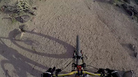
This loop has completely different difficulty levels and features depending where in the loop you are at and direction of travel. And rocks. Lots of rocks.
Section descriptions - mileage based on elevation chart for reference
(west parking lot) 0-1.4 mi: Two long rock chutes that drop from the south end of Ridgeline, heading down EB is less technical/committing than WB. Going up either would be strenuous to say the least.
1.4-2.25 mi: Long uphill, not too steep but starts out on some less pleasant rocks that eventually taper out and become easier to negotiate. Solid intermediate to ride down, not too technical.
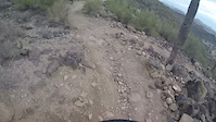
2.25-3.0 mi (east parking lot): Either direction this is probably solid black diamond to ride, large rock steps, dense rock gardens, steep. More difficult than Ridgeline when heading up.
3.0-3.6 mi: North of the east parking lot is a flat wide section that runs to the power line/canal trail, which is also smooth. Green difficulty.
3.6-5.7 mi (west parking lot): The north and west sides have a fairly consistent feel, lots of rocks to negotiate but generally rideable with the right line choice; good place to practice technical riding for somewhere like Sedona. Also a good workout with the elevation changes along the way (nothing too steep, longer sustained climbs along the way either direction). Also popular with hikers and trail runners.
| c1 | c2 | c3 | c4 |
|---|---|---|---|
January | February | March | April |
May | June | July | August |
September | October | November | December |

Service Road Atlas is a free to use, community-driven service for viewing and creating reports on the numerous back-country service roads around B.C. and Alberta.
Save the current map location and zoom level as your default home location whenever this page is loaded.
SaveWe hope you've been enjoying Trailforks!
Create a FREE account to view trail comments and much more.
You must enter a description before submitting.

