more stats
3.3 miles
Distance
794 ft
Climb
-1,431 ft
Descent
00:43:35
Avg time
-637 ft
Altitude change
2,183 ft
Altitude min
3,364 ft
Altitude max
2,878 ft
Altitude start
2,241 ft
Altitude end
-3.6%
Grade
-79.2%
Grade max
53.8%
Grade min
2 miles
Distance climb
2 miles
Distance down
266 ft
Distance flat
00:43:35
Avg time

Cloverpatch Trail Details

  • Activities
    • Mountain Bike
    • E-Bike
    • Hike
    • Trail Running
  • Riding Area
    Alpine Trails
    Oakridge, Oregon
  • Difficulty Rating
  • Local Popularity
    95 in Mountain Biking [+]
    • 90 in E-Biking
    • 5 in Trail Running
    • 85 in Hiking
  • Global Ranking
    #45108 in Mountain Biking [+]
    • #11275 in E-Biking
    • #279643 in Trail Running
    • #59871 in Hiking
  • Trail Type
    Singletrack
  • Bike Type
    XC
  • Direction
    Downhill Only
    Popular Direction Shown
  • Climb Difficulty
    Blue
  • Physical Rating
    Hard
  • Dogs Allowed
    Yes
  • eBike Allowed
    Yes up to Class 1
  • Ride in Rain
    Yes
  • Land Owner
    Willamette National Forest

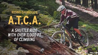
Usually ridden as part of a loop including nearby Alpine and Tire Mountain trails (various options exist). Some aerobic singletrack and converted double track climbs are followed by some great XC descending, some of which can be quite loose due to shale and unusually poor (for the area) soil. Makes for great fun.

Access Info

Ride Alpine trail until you hit the Tire Mountain junction shortly after Windy Pass, then climb/descend Tire Mtn until their is a well marked junction for the Cloverpatch trail on your left shortly before hitting the 5824 rd (if you hit this, you went slightly too far). Cloverpatch will eventually dump you out on another gravel road after a few miles. If you intend to climb back to Alpine to do the ATCA or Creampuff loop, you then descend down the road to your right until another big road on your left merges with that road. Follow the signs from there to the Cloverpatch-Alpine connector. Ride up the numerous switchbacks until you are on another gravel road. Take a left and climb a bit more. You will end up on the 5828 road and Alpine Trail will be on your left and right. Take the right to descend to your car.

Trail Supporters
Local Trail Association

Recent Activity on Trail

Past Week
  • 4 rides
  • 26 miles average
6 Months
  • 15 rides
  • 21 miles avg distance
All
  • 241 rides
  • Last: Jun 3, 2026
c1c2c3c4
January
February
March
April
May
June
July
August
September
October
November
December
Status:
on Oct 8, 2025
Ideal
Avg: 4.21 (14 votes)
Your vote: 0

view (1,293)
close
3D
Trail Conditions
  • Unknown
  • Snow Groomed
  • Snow Packed
  • Snow Covered
  • Snow Cover Partial
  • Freeze/thaw Cycle
  • Icy
  • Prevalent Mud
  • Wet
  • Variable
  • Ideal
  • Dry
  • Very Dry
Trail Flow (Ridden Direction)
Trailforks scans users ridelogs to determine the most popular direction each trail is ridden. A good flowing trail network will have most trails flowing in a single direction according to their intension.
The colour categories are based on what percentage of riders are riding a trail in its intended direction.
  • > 96%
  • > 90%
  • > 80%
  • > 70%
  • > 50%
  • < 50%
  • bi-directional trail
  • no data
Trail Last Ridden
Trailforks scans ridelogs to determine the last time a trail was ridden.
  • < 2 days
  • < 1 week
  • < 2 weeks
  • < 1 month
  • < 6 months
  • > 6 months
Trail Ridden Direction
The intended direction a trail should be ridden.
  • Downhill Only
  • Downhill Primary
  • Both Directions
  • Uphill Primary
  • Uphill Only
  • One Direction
Contribute Details
Colors indicate trail is missing specified detail.
  • Description
  • Photos
  • Description & Photos
  • Videos
Trail Popularity ?
Trailforks scans ridelogs to determine which trails are ridden the most in the last 9 months. Trails are compared with nearby trails in the same city region with a possible 25 colour shades. Think of this as a heatmap, more rides = more kinetic energy = warmer colors.
  • most popular
  • popular
  • less popular
  • not popular
ATV/ORV/OHV Filter
Max Vehicle Width
inches
US Cell Coverage
Legend
cell carrier legend

Radar Time
Activity Recordings
Trailforks uses anonymized public activity data. ?
Activity Recordings
Trailforks uses anonymized public activity data. ?
Personal Heatmap
Activity Types
all / none
Options
2
Date range month
Winter Trails
Warning A routing network for winter maps does not exist. Selecting trails using the winter trails layer has been disabled.
Missing Trails
Most Popular
Least Popular
Trails are colored based on popularity. The more popular a trail is, the more red. Less popular trails trend towards green.
Jump Magnitude Heatmap
Heatmap of where riders jump on trails. Zoom in to see individual jumps, click circles to view jump details.
BC Backroad Status

Service Road Atlas is a free to use, community-driven service for viewing and creating reports on the numerous back-country service roads around B.C. and Alberta.

map legend
Slope Aspect
Direction the slope faces
Flat N NE E SE S SW W NW
Trails Deemphasized
Trails are shown in grey.
disable
Only show trails with no bike usage.
Enable
Suggested Layers
Based on selected activity type

    Save the current map location and zoom level as your default home location whenever this page is loaded.

    Save
        Directions to cloverpatch-trail trailhead (43.839330, -122.556300)

        Photos

        14 more »
        525 |
        Apr 13, 2017 @ 8:24pm
        Apr 13, 2017
        192 |
        Aug 27, 2017 @ 7:19pm
        Aug 27, 2017
        193 |
        Aug 27, 2017 @ 7:19pm
        Aug 27, 2017
        135 |
        Aug 27, 2017 @ 7:20pm
        Aug 27, 2017

        Videos

        3 more »
        youtuber MTB Riding Alpine, Cloverpatch Climb & DH,...
        20:31 | 210 | Sep 7, 2023 , Oakridge
        RIDING OAKRIDGE OREGON'S A.T.C.A. TRAIL
        5:54 | 272 | Aug 2, 2023 , Oakridge
        7,000 Foot Descent Through Oregon's...
        7:38 | 442 | Oct 13, 2020 , Oakridge

        Routes with this trail

        3.7 24 miles 3,529 ft 7 Shuttled
        The trail that helped define backcountry riding in the Oregon Cascades. By the time you finally reach the...
        5.0 39 miles 7,372 ft 16
        If shuttling isn't available, loop option for ATCA
        4.0 45 miles 8,291 ft 10 Loop Race
        Since 1995, riders of all abilities have been testing themselves by taking on the Cascade Cream Puff....

        Trail Products

        1 Review & Comments


        We hope you've been enjoying Trailforks!

        Create a FREE account to view trail comments and much more.

        • By gbearce2001TF Pro & contributors
        • #30113 - 3,875 views

        Frequently Asked Questions About Cloverpatch Trail

        Where is Cloverpatch Trail located?
        Cloverpatch Trail is located in Alpine Trails, Oakridge, Oregon, United States. It is part of the Alpine Trails trail network. The trailhead is located at coordinates 43.83933, -122.5563.
        How hard is Cloverpatch Trail?
        Cloverpatch Trail is rated as Blue difficulty. The physical rating is Hard. The average grade is 3.6%. The climb difficulty is rated Blue.
        What is the elevation gain for Cloverpatch Trail?
        Cloverpatch Trail has 794 ft of elevation gain. The trail has 1,431 ft of elevation descent. The elevation ranges from 2,183 ft to 3,364 ft.
        Is Cloverpatch Trail a point to point trail?
        Yes, Cloverpatch Trail is a point to point trail. The direction is Downhill Only. The trail type is singletrack.

        Hit the Trail

        Open in App

        Get this trail on your phone instantly.
        open trail in app

        Download Trail

        Save to wishlist, Garmin & download.
        save the trail

        Find Related Routes

        Find routes and users activities that include this trail.
        find routes for this trail

        You must enter a description before submitting.