more stats
2.8 miles
Distance
111 ft
Climb
-1,429 ft
Descent
00:50:41
Avg time
-1,319 ft
Altitude change
3,407 ft
Altitude min
4,832 ft
Altitude max
4,726 ft
Altitude start
3,409 ft
Altitude end
-8.8%
Grade
-41.5%
Grade max
29.1%
Grade min
1,450 ft
Distance climb
2 miles
Distance down
709 ft
Distance flat
00:50:41
Avg time

Code 4 Details

  • Activities
    • Mountain Bike
    • E-Bike
    • Hike
    • Trail Running
  • Riding Area
    Penticton
    , British Columbia
  • Difficulty Rating
  • Global Ranking
    #118811 in Mountain Biking [+]
    • #102456 in E-Biking
    • #129028 in Trail Running
    • #122022 in Hiking
  • Hiking SAC Scale
    T1 Hiking
  • Trail Type
    Singletrack
  • Bike Type
    DH, AM
  • Physical Rating
    Hard
  • Season
    April - November
  • Dogs Allowed
    Yes
  • eBike Allowed
    Yes up to Class 1
  • TTFs on Trail
    A-Frame, Bridge, Drop, Jump, Gap Jump, Rock Face, Rock Garden, Skinny, Wallride
  • Ride in Rain
    Yes

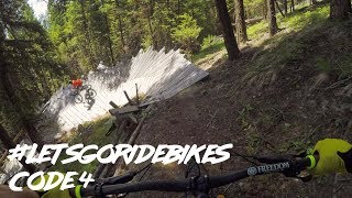
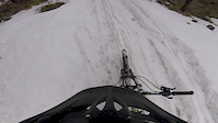
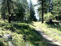
Used to be old school but after loads and loads of work by procrastinator, makripper, bobdigital and bobby. Fast, flowy, new school jumps, gaps, loose tech sections. basically all the mtb in one trail.
Fast and loose

This trail is unsanctioned.

Recent Activity on Trail

Past Week
  • 0 rides
  •  
6 Months
  • 5 rides
  • 11.8 km avg distance
All
  • 74 rides
  • Last: May 31, 2026
c1c2c3c4
January
February
March
April
May
June
July
August
September
October
November
December
update trails status or condition

Code 4 Trail Reports

statusdatedescription
Jul 31, 2025 @ 3:52pm
Jul 31, 2025
Sizable fallen tree blocking the trail shortly after the rock jump between the trees. Easy enough to walk over, but it comes up fairly quickly...
Jul 14, 2025 @ 4:55pm
Jul 14, 2025
Running great.
Apr 21, 2025 @ 8:35am
Apr 21, 2025
A couple snow patches at the very top, otherwise we cleared all downed trees and the dirt is prime.
Oct 31, 2024 @ 2:28pm
Oct 31, 2024
Jul 10, 2024 @ 5:03am
Jul 10, 2024
more »
Status:
on Jul 31, 2025
Ideal
Avg: 4.49 (9 votes)
Your vote: 0

view (106)
close
3D
Trail Conditions
  • Unknown
  • Snow Groomed
  • Snow Packed
  • Snow Covered
  • Snow Cover Partial
  • Freeze/thaw Cycle
  • Icy
  • Prevalent Mud
  • Wet
  • Variable
  • Ideal
  • Dry
  • Very Dry
Trail Flow (Ridden Direction)
Trailforks scans users ridelogs to determine the most popular direction each trail is ridden. A good flowing trail network will have most trails flowing in a single direction according to their intension.
The colour categories are based on what percentage of riders are riding a trail in its intended direction.
  • > 96%
  • > 90%
  • > 80%
  • > 70%
  • > 50%
  • < 50%
  • bi-directional trail
  • no data
Trail Last Ridden
Trailforks scans ridelogs to determine the last time a trail was ridden.
  • < 2 days
  • < 1 week
  • < 2 weeks
  • < 1 month
  • < 6 months
  • > 6 months
Trail Ridden Direction
The intended direction a trail should be ridden.
  • Downhill Only
  • Downhill Primary
  • Both Directions
  • Uphill Primary
  • Uphill Only
  • One Direction
Contribute Details
Colors indicate trail is missing specified detail.
  • Description
  • Photos
  • Description & Photos
  • Videos
Trail Popularity ?
Trailforks scans ridelogs to determine which trails are ridden the most in the last 9 months. Trails are compared with nearby trails in the same city region with a possible 25 colour shades. Think of this as a heatmap, more rides = more kinetic energy = warmer colors.
  • most popular
  • popular
  • less popular
  • not popular
ATV/ORV/OHV Filter
Max Vehicle Width
inches
US Cell Coverage
Legend
cell carrier legend

Radar Time
Activity Recordings
Trailforks uses anonymized public activity data. ?
Activity Recordings
Trailforks uses anonymized public activity data. ?
Personal Heatmap
Activity Types
all / none
Options
2
Date range month
Winter Trails
Warning A routing network for winter maps does not exist. Selecting trails using the winter trails layer has been disabled.
Missing Trails
Most Popular
Least Popular
Trails are colored based on popularity. The more popular a trail is, the more red. Less popular trails trend towards green.
Jump Magnitude Heatmap
Heatmap of where riders jump on trails. Zoom in to see individual jumps, click circles to view jump details.
BC Backroad Status

Service Road Atlas is a free to use, community-driven service for viewing and creating reports on the numerous back-country service roads around B.C. and Alberta.

map legend
Slope Aspect
Direction the slope faces
Flat N NE E SE S SW W NW
Trails Deemphasized
Trails are shown in grey.
disable
Only show trails with no bike usage.
Enable
Suggested Layers
Based on selected activity type

    Save the current map location and zoom level as your default home location whenever this page is loaded.

    Save
        Directions to code-4 trailhead (49.484510, -119.464650)

        Photos

        73 more »
        484 |
        Oct 24, 2014 @ 6:11pm
        Oct 24, 2014
        633 |
        Oct 24, 2014 @ 6:11pm
        Oct 24, 2014
        56 |
        Jul 14, 2025 @ 6:19pm
        Jul 14, 2025
        43 |
        Jul 14, 2025 @ 6:18pm
        Jul 14, 2025

        Videos

        15 more »
        youtuber Code 4 Carmi Penticton
        9:44 | 1183 | Jun 18, 2018 , Penticton
        youtuber Hitting all the big stuff on Code 4 |...
        12:26 | 565 | Jul 12, 2021 , Penticton
        Bog Run
        4:26 | 154 | Apr 30, 2017 , Penticton
        2 Gaps Ryan
        0:10 | 128 | Jul 24, 2013 , Penticton

        Trail Products

        6 Reviews & Comments


        We hope you've been enjoying Trailforks!

        Create a FREE account to view trail comments and much more.

        • #16224 - 5,375 views

        Frequently Asked Questions About Code 4

        Where is Code 4 located?
        Code 4 is located in Penticton, British Columbia, Canada. It is part of the Penticton trail network. The trailhead is located at coordinates 49.48451, -119.46465.
        How hard is Code 4?
        Code 4 is rated as Black Diamond difficulty. The physical rating is Hard. The average grade is 8.8%.
        What is the elevation gain for Code 4?
        Code 4 has 34 m of elevation gain. The trail has 436 m of elevation descent. The elevation ranges from 1,039 m to 1,473 m.
        How long is Code 4?
        Code 4 is 4.6 km long. The trail type is singletrack.

        Hit the Trail

        Open in App

        Get this trail on your phone instantly.
        open trail in app

        Download Trail

        Save to wishlist, Garmin & download.
        save the trail

        Find Related Routes

        Find routes and users activities that include this trail.
        find routes for this trail

        You must enter a description before submitting.