
more stats
4,531 ft
Distance
112 ft
Climb
-105 ft
Descent
00:15:56
Avg time
7 ft
Altitude change
830 ft
Altitude min
920 ft
Altitude max
831 ft
Altitude start
837 ft
Altitude end
0.2%
Grade
-17.9%
Grade max
12.9%
Grade min
1,969 ft
Distance climb
1,371 ft
Distance down
1,191 ft
Distance flat
00:15:56
Avg time

Customline Details

  • Activities
    • Mountain Bike
    • E-Bike
  • Riding Area
    Blue River Parkway
    Kansas City, MO, Missouri
  • Difficulty Rating
  • Local Popularity
    40 in Mountain Biking heatmap [+]
    • 85 in E-Biking
  • Global Ranking
    #112128 in Mountain Biking [+]
    • #108376 in E-Biking
  • State Ranking
    #354 in Mountain Biking · Missouri [+]
    • #233 in E-Biking
  • Trail Type
    Singletrack
  • Direction
    One Direction
  • Climb Difficulty
    Green
  • Physical Rating
    Moderate
  • Trail Visibility
    Always easy to follow
  • eBike Allowed
  • TTFs on Trail
    Drop, Jump, Gap Jump, Rock Garden, Other
  • Year Opened
    2020

Off-camber, rocky techy climb plus directional downhill trail with jumps/drops. Features can be ridden around or walked.

Majority is one direction single track. Rocky technical sections, however the elevation change during those sections is non existent. For the climbs it's all smooth and easy to climb. Fun features, high speeds, and a couple jumps. Even has a jump over an abandon vehicle.

Access Info

Typically park on the side of the road infront of the baseball fields, Pedal up closer to the bridge and you'll find a little trail leading you in. Once you ride up a little ways there's four different ways to go, for custom line it's the top right. Remember to sign the online waiver by scanning the QR code.

Disclaimer

*Online Waiver Required* Scan QR code at sight

Tags
BridgesDropsJumpsRock gardens

Local Trail Association

Recent Activity on Trail

Past Week
  • 2 rides
  • 9 miles average
6 Months
  • 9 rides
  • 7 miles avg distance
All
  • 115 rides
  • Last: Nov 10, 2026
c1c2c3c4
January
February
March
April
May
June
July
August
September
October
November
December
Status:
on Aug 8, 2026
Avg: 4.32 (3 votes)
Your vote: 0

view (2,752)
close
      Directions to customline trailhead (38.953170, -94.556860)

      Photos

      5 more »
      mtb
      375 |
      Nov 18, 2021 @ 6:40pm
      Nov 18, 2021
      mtb
      459 |
      Jan 8, 2021 @ 5:51am
      Jan 8, 2021
      mtb
      356 |
      Jul 8, 2020 @ 8:28pm
      Jul 8, 2020
      mtb
      424 |
      May 15, 2020 @ 9:11pm
      May 15, 2020

      Videos

      1 more »
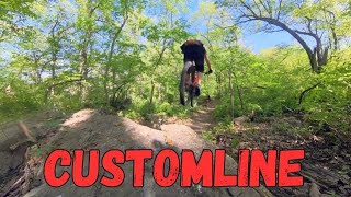
      Fast hits on Customline
      mtb
      0:57 | 431 | Oct 2, 2023 , Kansas City, MO

      Routes with this trail

      more »
      48 miles • 3,409 ft • 53 • Point to Point •
      Every trail in Blue River and Swope connected by Underworld.
      10 miles • 883 ft • 12 • Out & Back •
      We got a tough one tonight. The Grand Finale Is Here! This will be no easy task, come take a trip around...
      13 miles • 926 ft • 17 • Out & Back • Race •
      This is a good route that includes all of the most of the drops and jumps North of Minor Park. This is the...
      5.0 ★★★★★
      3 Ratings
      5 ★ 100%
      4 ★
      3 ★
      2 ★
      1 ★

      2 Reviews & Comments

      drthunder81 drthunder81
      Really fun, impressively well built trail that makes great use of the terrain. This one is a must ride for me every time I'm driving through KC.
      Jeffreygoose
      Pretty fun drop offs here and there’s a fun drop off that goes over an abandoned car on the trail that’s a lot of fun too. There’s some technical Rocky sections to approach the fun drop off area but over all lot of fun.

      We hope you've been enjoying Trailforks!

      Create a FREE account to view all trail reviews and much more.

      Nearby Trails

      • By CamDougTF Pro & contributors
      • #282954 - 2,179 views

      Frequently Asked Questions

      ▼ Where is Customline located?
      Customline is located in Blue River Parkway, Kansas City, MO, Missouri, United States. It is part of the Blue River Parkway trail network. The trailhead is located at coordinates 38.95317, -94.55686.
      ▼ How hard is Customline?
      Customline is rated as Black Diamond difficulty. The physical rating is Moderate. The average grade is 0.2%. The climb difficulty is rated Green.
      ▼ What is the elevation gain for Customline?
      Customline has 112 ft of elevation gain. The trail has 105 ft of elevation descent. The elevation ranges from 830 ft to 920 ft.
      ▼ Is Customline a point to point trail?
      Yes, Customline is a point to point trail. The direction is One Direction. The trail type is singletrack.
      ▼ How long is Customline?
      Customline is 4,531 ft long. The trail type is singletrack.
      ▼ Are dogs allowed on Customline?
      There is no information about dogs being allowed on Customline. Check with local trail managers or the trail page for the latest access rules.
      ▼ When is the best time of year to ride Customline?
      Based on activity log data, the most popular months to ride Customline are:
      • October (10 activities)
      • August (6 activities)
      • November (5 activities)
      Check the reports page for current trail conditions.
      ▼ How do I access Customline? Where is the closest parking trailhead?
      The closest parking and trailhead locations to Customline are: View all parking locations in the area.
      ▼ How long does it take to ride Customline?
      Based on recorded activities, it takes an average of 16 minutes to ride Customline. The trail is 4,531 ft long. Actual times will vary based on fitness level, conditions, and pace. View recent activity logs for more details.
      ▼ How busy is Customline?
      Customline is a moderately popular trail. There have been 1,209 recorded activities on this trail. The trail has received 2,752 check-ins. View recent activity on this trail.

      Hit the Trail

      Open in App

      Get this trail on your phone instantly.

      open trail in app

      Download Trail

      Save to wishlist, Garmin & download.
      save the trail

      Find Related Routes

      Find routes and users activities that include this trail.
      find routes for this trail

      You must enter a description before submitting.

