
more stats
469 ft
Distance
-23 ft
Descent
00:02:48
Avg time
-21 ft
Altitude change
2,877 ft
Altitude min
2,900 ft
Altitude max
2,900 ft
Altitude start
2,881 ft
Altitude end
-4.6%
Grade
-19.7%
Grade max
3.1%
Grade min
52 ft
Distance climb
272 ft
Distance down
141 ft
Distance flat
00:02:48
Avg time

D' Gscheide Line Details

  • Activities
    • Mountain Bike
    • E-Bike
  • Riding Area
  • Ref Number
    #8032
  • Difficulty Rating
  • Local Popularity
    90 in Mountain Biking [+]
    • 5 in E-Biking
  • Global Ranking
    #208711 in Mountain Biking [+]
    • #178253 in E-Biking
  • National Ranking
    #889 in Mountain Biking · Austria [+]
    • #732 in E-Biking
  • Trail Type
    Singletrack
  • Bike Type
    DH, AM
  • Direction
    Both Directions[+]
    • Both Directions for E-Biking
  • Trail Visibility
    Always easy to follow
  • eBike Allowed
  • TTFs on Trail
    Jump
  • Year Opened
    2026

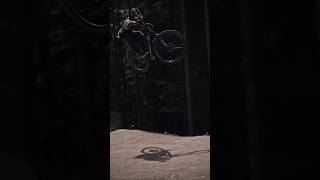
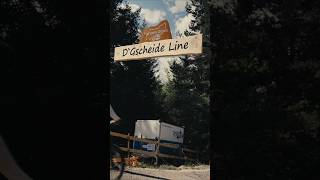
Die "D'Gscheide Line" in der "Trailarea Urisee" ist eine anspruchsvolle, schwarze "Experts Only" Jumpline. Die Strecke bestehend aus Berms mit Shark-Fins plus Gaps, einem Step-Down und 2x großen Kickern/Jumps gebaut aus Stahl-/Holz. Nach dem Shark-Fin und ersten Gaps kann als Variante mittels Transfersprung rechts in die rote "Andi Wolf Jumpline" übergesetzt werden. Die Strecke startet neben dem Portal der "D'Gmiatlichen Line", verläuft parallel zur roten "Andi Wolf Jumpline" und mündet nach dem letzten Kicker am Ende in diese ein.

Wichtiger Hinweis: Vor dem erstmaligen Befahren der schwarzen Jumpline muss die Strecke unbedingt zu Fuß besichtigt werden, um sämtliche Hindernisse und somit Gefahren gesehen zu haben!!

Disclaimer

Wearing a helmet is compulsory. Ride at your own risk.translate

Tags
BermsDropsJumps

Recent Activity on Trail

Past Week
  • 0 rides
  •  
6 Months
  • 6 rides
  • 5 miles avg distance
All
  • 6 rides
  • Last: Sep 12, 2026
update trails status or condition

D' Gscheide Line Trail Reports

no reports have been added for D' Gscheide Line yet, add a trail report.
Trail reports are used to indicate a trails current condition and inform builders and other users about any issues on a trail.
Status:
no votes yet
Your vote: 0

view (122)
close
      Directions to d--gscheide-line trailhead (47.498120, 10.737540)

      Photos

      7 more »
      mtb
      30 |
      Jun 30, 2026 @ 11:05am
      Jun 30, 2026
      mtb
      24 |
      Jun 30, 2026 @ 10:46am
      Jun 30, 2026
      mtb
      24 |
      Jun 30, 2026 @ 10:46am
      Jun 30, 2026
      mtb
      18 |
      Jun 30, 2026 @ 10:46am
      Jun 30, 2026

      Videos

      2 more »
      Season Opening 2026 & Einweihung...
      mtb
      0:19 | 32 | Jun 30, 2026 , Reutte
      Season Opening 2026 & Einweihung...
      mtb
      0:17 | 32 | Jun 30, 2026 , Reutte

      Reviews / Comments

      No reviews yet, be the first to write a review or ask a question.
      Use trail reports to comment on trail conditions.


      We hope you've been enjoying Trailforks!

      Create a FREE account to view all trail reviews and much more.

      Frequently Asked Questions

      ▼ Where is D' Gscheide Line located?
      D' Gscheide Line is located in Trailarea Urisee, Reutte, Austria. It is part of the Trailarea Urisee trail network. The trailhead is located at coordinates 47.49812, 10.73754.
      ▼ How hard is D' Gscheide Line?
      D' Gscheide Line is rated as Black difficulty. The average grade is 4.6%.
      ▼ What is the elevation gain for D' Gscheide Line?
      The trail has 23 ft of elevation descent. The elevation ranges from 2,877 ft to 2,900 ft.
      ▼ Is D' Gscheide Line a point to point trail?
      D' Gscheide Line is not a point to point trail. The direction is Both Directions. The trail type is singletrack.
      ▼ How long is D' Gscheide Line?
      D' Gscheide Line is 469 ft long. The trail type is singletrack.
      ▼ Are dogs allowed on D' Gscheide Line?
      There is no information about dogs being allowed on D' Gscheide Line. Check with local trail managers or the trail page for the latest access rules.
      ▼ How do I access D' Gscheide Line? Where is the closest parking trailhead?
      The closest parking and trailhead locations to D' Gscheide Line are: View all parking locations in the area.
      ▼ How long does it take to ride D' Gscheide Line?
      Based on recorded activities, it takes an average of 3 minutes to ride D' Gscheide Line. The trail is 469 ft long. Actual times will vary based on fitness level, conditions, and pace. View recent activity logs for more details.
      ▼ How busy is D' Gscheide Line?
      D' Gscheide Line is a very popular trail. There have been 10 recorded activities on this trail. The trail has received 122 check-ins. View recent activity on this trail.

      Hit the Trail

      Open in App

      Get this trail on your phone instantly.

      open trail in app

      Download Trail

      Save to wishlist, Garmin & download.
      save the trail

      Find Related Routes

      Find routes and users activities that include this trail.
      find routes for this trail

      You must enter a description before submitting.

