
more stats
4,544 ft
Distance
102 ft
Climb
-160 ft
Descent
00:11:52
Avg time
-58 ft
Altitude change
1,041 ft
Altitude min
1,175 ft
Altitude max
1,129 ft
Altitude start
1,070 ft
Altitude end
-1.3%
Grade
-22.4%
Grade max
23.6%
Grade min
1,604 ft
Distance climb
2,129 ft
Distance down
810 ft
Distance flat
00:11:52
Avg time

Dead End Loop Details

  • Activities
    • Mountain Bike
    • E-Bike
    • Hike
    • Trail Running
  • Riding Area
    Alice Lake & Highlands
    Squamish, British Columbia
  • Difficulty Rating
  • Local Popularity
    15 in Mountain Biking [+]
    • 20 in E-Biking
    • 20 in Trail Running
    • 5 in Hiking
  • Global Ranking
    #150546 in Mountain Biking [+]
    • #142271 in E-Biking
    • #158323 in Trail Running
    • #335996 in Hiking
  • Provincial Ranking
    #7,526 in Mountain Biking · British Columbia [+]
    • #6,888 in E-Biking
    • #9,884 in Trail Running
    • #13,697 in Hiking
  • Trail Type
    Singletrack
  • Bike Type
    AM, XC
  • Dogs Allowed
    Yes
  • eBike Allowed
    Yes up to Class 1

Dead End Loop is a small loop located at the end of Bob McIntosh trail and at the bottom of Made In The Shade. The trail can be ridden either direction. Climbing the Debris Barrier access roadwww.trailforks.com/trails/access-trail-813496/]access[/L] road at the end will take riders to the start of Man Boobs and Rob's Corners.

Tags

Local Trail Association

Traditionally Indigenous Territory

Recent Activity on Trail

Past Week
  • 1 rides
  • 14 miles average
6 Months
  • 3 rides
  • 19 miles avg distance
All
  • 199 rides
  • Last: Oct 23, 2026
c1c2c3c4
January
February
March
April
May
June
July
August
September
October
November
December
update trails status or condition

Dead End Loop Trail Reports

statusdatedescription
Sep 29, 2026 @ 4:57pm (America/Vancouver)
Sep 29, 2026
Aug 17, 2026 @ 6:11pm (America/Vancouver)
Aug 17, 2026
Closed for debris barrier rehab work
Aug 22, 2025 @ 1:55pm
Aug 22, 2025
Clearly not used. Overgrown in many places. No way out other than vertical loose fire road. Wouldn’t not go near this.
Jun 10, 2025 @ 7:10pm
Jun 10, 2025
reporter Not much signs of usage. lots of small debris, several small trees across trail. End of trail seems to be gone and overgrown, with new access road...
May 11, 2025 @ 12:01pm
May 11, 2025
Amazing shape. Beautiful area. Too bad about hydro clearcut and hike out.
more »
Status:
on Sep 29, 2026
Avg: 3.52 (15 votes)
Your vote: 0

view (1,858)
close
      Directions to dead-end-loop trailhead (49.793470, -123.100750)

      Photos

      15 more »
      mtb
      318 |
      Jun 6, 2015 @ 6:35pm
      Jun 6, 2015
      mtb
      194 |
      Dec 6, 2016 @ 9:20am
      Dec 6, 2016
      mtb
      257 |
      Dec 6, 2016 @ 9:20am
      Dec 6, 2016
      mtb
      357 |
      Jan 18, 2015 @ 7:14pm
      Jan 18, 2015

      Videos

      1 more »
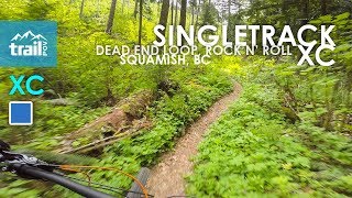
      youtuber Singletrack XC: Dead End Loop into Rock N'...
      mtb
      9:31 | 725 | Jul 5, 2019 , Squamish

      Routes with this trail

      ★ 2.0 • 11 miles • 1,807 ft • 10 •
      A nice intro to the Alice Lake zone, on some of the flowier Squamish Classics.
      ★ 3.7 • 33 miles • 5,978 ft • 43 • Loop • Race •
      This has been the racers favorite course for the last 5 years. 55 km's of the world finest singletrack...
      31 miles • 6,843 ft • 35 •
      portion of squamish 50k route
      3.4 ★★★★★
      15 Ratings
      5 ★ 13%
      4 ★ 33%
      3 ★ 27%
      2 ★ 27%
      1 ★

      2 Reviews & Comments

      maggiedurkin maggiedurkin
      All clear. A fun trail, very XC. Do not think it’s a blue at all, super straightforward. Would be a good spot for a beginner.
      DePita13
      Lots of fallen logs, trail can not be completed

      We hope you've been enjoying Trailforks!

      Create a FREE account to view all trail reviews and much more.

      • By canadakaTF Pro Trailforks & contributors
      • #3520 - 5,136 views

      Frequently Asked Questions

      ▼ Where is Dead End Loop located?
      Dead End Loop is located in Alice Lake & Highlands, Squamish, British Columbia, Canada. It is part of the Alice Lake & Highlands trail network. The trailhead is located at coordinates 49.79347, -123.10075.
      ▼ How hard is Dead End Loop?
      Dead End Loop is rated as Green difficulty. The average grade is 1.3%.
      ▼ What is the elevation gain for Dead End Loop?
      Dead End Loop has 102 ft of elevation gain. The trail has 160 ft of elevation descent. The elevation ranges from 1,041 ft to 1,175 ft.
      ▼ How long is Dead End Loop?
      Dead End Loop is 4,544 ft long. The trail type is singletrack.
      ▼ Are dogs allowed on Dead End Loop?
      Yes, dogs are allowed on Dead End Loop. Please keep dogs on a leash where required and clean up after them.
      ▼ How do I access Dead End Loop? Where is the closest parking trailhead?
      The closest parking and trailhead locations to Dead End Loop are: View all parking locations in the area.
      ▼ How long does it take to ride Dead End Loop?
      Based on recorded activities, it takes an average of 12 minutes to ride Dead End Loop. The trail is 4,544 ft long. Actual times will vary based on fitness level, conditions, and pace. View recent activity logs for more details.
      ▼ How busy is Dead End Loop?
      Dead End Loop is a less popular trail with lighter traffic. There have been 1,713 recorded activities on this trail. The trail has received 1,858 check-ins. View recent activity on this trail.

      Hit the Trail

      Open in App

      Get this trail on your phone instantly.

      open trail in app

      Download Trail

      Save to wishlist, Garmin & download.
      save the trail

      Find Related Routes

      Find routes and users activities that include this trail.
      find routes for this trail

      You must enter a description before submitting.