



more stats
3.5 miles
Distance
691 ft
Climb
-403 ft
Descent
00:38:13
Avg time
288 ft
Altitude change
4,431 ft
Altitude min
4,833 ft
Altitude max
4,455 ft
Altitude start
4,744 ft
Altitude end
1.563%
Grade
-18.587%
Grade max
19.167%
Grade min
2 miles
Distance climb
1 mile
Distance down
1,083 ft
Distance flat
00:38:13
Avg time

Dead Horse Loop Details

  • Activities
    • Mountain Bike
    • Hike
    • Trail Running
  • Riding Area
    Cottonwood Valley
    Las Vegas, Nevada
  • Difficulty Rating
  • Local Popularity
    85 in Mountain Biking [+]
    • 80 in Trail Running
    • 5 in Hiking
  • Global Ranking
    #63621 in Mountain Biking [+]
    • #109676 in Trail Running
    • #206451 in Hiking
  • State Ranking
    #321 in Mountain Biking · Nevada [+]
    • #581 in Trail Running
    • #1,086 in Hiking
  • Trail Type
    Singletrack
  • Direction
    Both Directions
    Popular Direction Shown
  • Climb Difficulty
    Blue
  • Physical Rating
    Easy
  • Dogs Allowed
    Yes

This trail is best ridden from the Parking lot, as it's easy to get lost coming from 3 mile smile the 1st time. This is the most common route which keeps you mostly on singletrack without grinding on double track.

Tags
LooseRocky

Trail Supporters

Local Trail Association

Recent Activity on Trail

Past Week
  • 2 rides
  • 10 miles average
6 Months
  • 33 rides
  • 17 miles avg distance
All
  • 354 rides
  • Last: Oct 25, 2026
update trails status or condition

Dead Horse Loop Trail Reports

Status:
on Feb 28, 2025
Very Dry
Avg: 3.65 (14 votes)
Your vote: 0

view (1,634)
close
      Directions to dead-horse-loop trailhead (35.995160, -115.453860)

      Photos

      41 more »
      mtb
      72 |
      Oct 3, 2024 @ 2:56pm
      Oct 3, 2024
      mtb
      76 |
      Oct 3, 2024 @ 2:56pm
      Oct 3, 2024
      mtb
      58 |
      Oct 3, 2024 @ 2:56pm
      Oct 3, 2024
      mtb
      55 |
      Sep 26, 2024 @ 8:54am
      Sep 26, 2024

      Videos

      2 more »
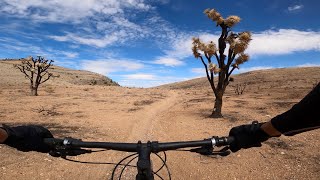
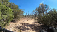
      Las Vegas MTB | Cottonwood Valley | Blue...
      mtb
      30:29 | 375 | Jan 7, 2023 , Las Vegas
      Dead Horse Point Loop
      mtb
      3:16 | 171 | Jun 13, 2021 , Las Vegas

      Routes with this trail

      ★ 3.7 • 14 miles • 1,573 ft • 5 •
      Great loop. Satan's is a climb which is a big grunt but leads to Vegas View and down The Smile and Badger...
      ★ 2.0 • 28 miles • 2,929 ft • 12 •
      Add on loop to make a more fun route of deadhorse+3 mile. Good elevation with some easy pedaling to end on.
      3.5 ★★★★★
      14 Ratings
      5 ★ 14%
      4 ★ 29%
      3 ★ 50%
      2 ★ 7%
      1 ★

      7 Reviews & Comments

      davidsoutside davidsoutside
      As other have mentioned, the beginning of this trail is what I label “exceptionally unfun.” The soil composition sucks, the trail is super boring with annoying rock gardens thrown in, its mostly uphill, the views are comparatively boring, etc. and then when you get into the junipers and red clay before Satans escalator it gets fun. If you just want to do 3 Mile, I’d take the fire road up from the upper parking lot honestly.
      AndrewcIKetR
      Easy trail with lots of great scenery. And there was actually a rotting horse corpse on the side of the trail today, so now you know how it got its name!(?)
      bizango-x bizango-x
      Not that bad. It is chunky but was expecting worse. We rode it as a climb. I liked going up this, doing the upper loop sections to the view point, then down three mile smile.

      We hope you've been enjoying Trailforks!

      Create a FREE account to view all trail reviews and much more.

      Frequently Asked Questions

      ▼ Where is Dead Horse Loop located?
      Dead Horse Loop is located in Cottonwood Valley, Las Vegas, Nevada, United States. It is part of the Cottonwood Valley trail network. The trailhead is located at coordinates 35.99516, -115.45386.
      ▼ How hard is Dead Horse Loop?
      Dead Horse Loop is rated as Blue difficulty. The physical rating is Easy. The average grade is 1.563%. The climb difficulty is rated Blue.
      ▼ What is the elevation gain for Dead Horse Loop?
      Dead Horse Loop has 691 ft of elevation gain. The trail has 403 ft of elevation descent. The elevation ranges from 4,431 ft to 4,833 ft.
      ▼ Is Dead Horse Loop a point to point trail?
      Dead Horse Loop is not a point to point trail. The direction is Both Directions. The trail type is singletrack.
      ▼ How long is Dead Horse Loop?
      Dead Horse Loop is 3.5 miles long. The trail type is singletrack.
      ▼ Are dogs allowed on Dead Horse Loop?
      Yes, dogs are allowed on Dead Horse Loop. Please keep dogs on a leash where required and clean up after them.
      ▼ How do I access Dead Horse Loop? Where is the closest parking trailhead?
      The closest parking and trailhead locations to Dead Horse Loop are: View all parking locations in the area.
      ▼ How long does it take to ride Dead Horse Loop?
      Based on recorded activities, it takes an average of 38 minutes to ride Dead Horse Loop. The trail is 3.5 miles long. Actual times will vary based on fitness level, conditions, and pace. View recent activity logs for more details.
      ▼ How busy is Dead Horse Loop?
      Dead Horse Loop is a very popular trail. There have been 1,687 recorded activities on this trail. The trail has received 1,634 check-ins. View recent activity on this trail.

      Hit the Trail

      Open in App

      Get this trail on your phone instantly.

      open trail in app

      Download Trail

      Save to wishlist, Garmin & download.
      save the trail

      Find Related Routes

      Find routes and users activities that include this trail.
      find routes for this trail

      You must enter a description before submitting.