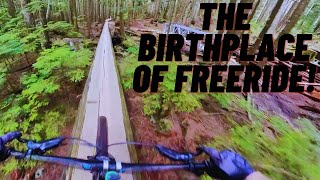
129 ft
Distance
5 ft
Climb
00:01:57
Avg time
Supporters, Builders, Maintainers & Land Managers of Deer John Trail

Deer John Details

  • Activities
    • Mountain Bike
    • Hike
    • Trail Running
  • Riding Area
    Mount Seymour
    North Vancouver, British Columbia
  • Difficulty Rating
  • Voted Difficulty
    Double Black Diamond (1 vote)
  • Trail Type
    Singletrack
  • Bike Type
    DH, AM
  • Direction
    Downhill Only
    Popular direction shown
  • Physical Rating
    Moderate
  • Dogs Allowed
    Yes
  • TTFs on Trail
    Drop, Gap Jump, Rock Face
  • Global Ranking
    #233 in Mountain Biking [+]
    • #22580 in Trail Running
    • #8278 in Hiking
  • Local Popularity
    60 in Mountain Biking [+]
    • 5 in Trail Running
    • 35 in Hiking
  • Land Owner
    CMHC

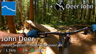
Short optional line off Upper John Deer featuring challenging rock rolls and a small gap jump/drop.

Access Info

Access from near start of John Deer, part way down Severed Dick

Local Trail Association
More Stats for Deer John mountain bike trail trail
  • Altitude change
    5 ft
  • Altitude min
    1,286 ft
  • Altitude max
    1,291 ft
  • Altitude start
    1,286 ft
  • Altitude end
    1,291 ft
  • Grade
    3.739%
  • Grade max
    2.529%
  • Grade min
    4.616%
  • Distance climb
    78 ft
  • Distance flat
    51 ft
  • Avg time
    00:01:57
  • Avg reverse time
    00:41:04
  • view trail stats
Status:
on Mar 6, 2023
Snow Covered
Avg: 4.55 (30 votes)
Your vote: 0

view (13,181)
close
3D
Trail Conditions
  • Unknown
  • Snow Groomed
  • Snow Packed
  • Snow Covered
  • Snow Cover Inadequate
  • Freeze/thaw Cycle
  • Icy
  • Prevalent Mud
  • Wet
  • Variable
  • Ideal
  • Dry
  • Very Dry
Trail Flow (Ridden Direction)
Trailforks scans users ridelogs to determine the most popular direction each trail is ridden. A good flowing trail network will have most trails flowing in a single direction according to their intension.
The colour categories are based on what percentage of riders are riding a trail in its intended direction.
  • > 96%
  • > 90%
  • > 80%
  • > 70%
  • > 50%
  • < 50%
  • bi-directional trail
  • no data
Trail Last Ridden
Trailforks scans ridelogs to determine the last time a trail was ridden.
  • < 2 days
  • < 1 week
  • < 2 weeks
  • < 1 month
  • < 6 months
  • > 6 months
Trail Ridden Direction
The intended direction a trail should be ridden.
  • Downhill Only
  • Downhill Primary
  • Both Directions
  • Uphill Primary
  • Uphill Only
  • One Direction
Contribute Details
Colors indicate trail is missing specified detail.
  • Description
  • Photos
  • Description & Photos
  • Videos
Trail Popularity ?
Trailforks scans ridelogs to determine which trails are ridden the most in the last 9 months. Trails are compared with nearby trails in the same city region with a possible 25 colour shades. Think of this as a heatmap, more rides = more kinetic energy = warmer colors.
  • most popular
  • popular
  • less popular
  • not popular
ATV/ORV/OHV Filter
Max Vehicle Width
inches

Radar Time
x Activity Recordings
Trailforks users anonymized public ridelogs from the past 6 months.
  • mountain biking recent
  • mountain biking (>6 month)
  • hiking (1 year)
  • moto (1 year)
Activity Recordings
Trailforks users anonymized public skilogs from the past 12 months.
  • Downhill Ski
  • Backcountry Ski
  • Nordic Ski
  • Snowmobile
Jump Magnitude Heatmap
Heatmap of where riders jump on trails. Zoom in to see individual jumps, click circles to view jump details.
Trails Deemphasized
Trails are shown in grey.
disable
Only show trails with NO bikes.
enable

Save the current map location and zoom level as your default home location whenever this page is loaded.

Save
      Directions to deer-john trailhead (49.335850, -122.981550)
      update trails status or condition

      Deer John Trail Reports

      statusdatedescription
      Mar 6, 2023 @ 5:52am
      Mar 6, 2023
      Dec 21, 2022 @ 3:52pm
      Dec 21, 2022
      Nov 30, 2022 @ 1:14pm
      Nov 30, 2022
      reporter
      Sep 3, 2022 @ 6:50pm
      Sep 3, 2022
      Transition for the drop is pretty blown out. Better to go a bit deep to avoid the rocks.
      Jul 9, 2022 @ 8:19am
      Jul 9, 2022
      view all reports »

      Recent Ridelog Activity on Trail

      Past Week
      • 1 rides
      • 10 miles avg distance
      6 Months
      • 81 rides
      • 21 miles avg distance
      All
      • 12,719 rides
      • Last: Mar 18, 2023

      Photos

      more »
      149 |
      May 11, 2020 @ 6:19pm
      May 11, 2020
      645 |
      Feb 21, 2017 @ 12:55am
      Feb 21, 2017
      963 |
      Nov 13, 2016 @ 4:06pm
      Nov 13, 2016
      1,124 |
      May 16, 2016 @ 12:10pm
      May 16, 2016
      | 5 comments

      Trail Lists

      Routes with this trail

      more »
      titledistance
      JD Loop4 miles
      Freehub Magazine: Boogieman Loop8 miles
      Seymour9 miles
      Bit of Flow on Seymour11 miles

      4 Reviews & Comments

      • + 1
      braydenharris (Jul 2, 2021 at 12:06)
      The rock roll is very fun! The drop is the best part, though.
      [Reply]
      • + 1
      vancity (Aug 28, 2020 at 6:58)
      This feature is very smooth. Traverse across the roll, aim down and let ‘er fly. The roll will give you the appropriate speed for the drop.
      [Reply]
      • + 1
      xTwoSnakesx (Jan 20, 2016 at 9:56)
      What's the best to route to take here? After the trail do people generally climb back up via GSM or do they return to Severed?
      [Reply]
      • + 2
      goodsirmartin SHORE CORPS (Jan 25, 2016 at 9:55)
      Best to ride up the climb after to avoid getting in the way of riders descending
      [Reply]


      Login or Sign Up to Comment

      Videos

      more »
      youtuber Fall Ride @ Mt Seymour, John Deer and Deer...
      10:37 | 609 | Nov 7, 2017 , North Vancouver
      youtuber New Bike vs The North Shore
      11:02 | 9 | Mar 22, 2023 , North Vancouver
      Corkscrew / Pingu / John Deer - Seymour |...
      15:50 | 119 | Mar 14, 2022 , North Vancouver
      Riding Some Of Seymour's Gnarly Tech With...
      20:39 | 100 | Nov 12, 2021 , North Vancouver
      • subscribe
      • flag
      • login to download gpx or kml files.