



Open in App
Get this trail on your phone instantly.

Official multi-use bidirectional gravel trail. The trail is open year-round to bikes as well as equestrian and pedestrian traffic. Bikes are required by OSU to yield to all other users.
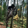
The trail starts with a series of punchy climbs and quick descents over roots and often quite loose gravel through the first half. The second half is all downhill, also with roots and gravel, and a few switchback-style turns. Mind your bars on the one tree gap – it's not exactly set up for modern wide-bar setups.
Extendo is often paired with Uproute and Road 6020 to make a short loop, which means it is most often ridden downhill.
Access the top of this trail from the top of Uproute, just alongside Road 680. Access the bottom of this trail from Road 6020, within a few hundred feet of Patterson Rd.

| c1 | c2 | c3 | c4 |
|---|---|---|---|
January | February | March | April |
May | June | July | August |
September | October | November | December |

Service Road Atlas is a free to use, community-driven service for viewing and creating reports on the numerous back-country service roads around B.C. and Alberta.
Save the current map location and zoom level as your default home location whenever this page is loaded.
SaveWe hope you've been enjoying Trailforks!
Create a FREE account to view all trail reviews and much more.
You must enter a description before submitting.

