

Open in App
Get this trail on your phone instantly.

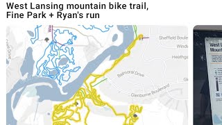
This southern portion of the West Lansing Trail is a mix of hardwoods and pines. The outbound trail (southbound) tracks along the Grand River, eventually crossing a drain via low bridge and climbs up to a high bank overlooking the river. As the trail reaches the southern end of Fine Park and begins its winding way north, there are a number of optional lines, some rock beds, skinnies and more. You'll drop into the drain again and cross it via a second low bridge and head back toward Glenburne Blvd and where the trail becomes 2-way for a short bit on it's way to Fulton Park.

Service Road Atlas is a free to use, community-driven service for viewing and creating reports on the numerous back-country service roads around B.C. and Alberta.
Save the current map location and zoom level as your default home location whenever this page is loaded.
Save
No reviews yet, be the first to write a review or ask a question.
Use trail reports to comment on trail conditions.
We hope you've been enjoying Trailforks!
Create a FREE account to view all trail reviews and much more.
 MMMBA & contributors
You must enter a description before submitting.

