2,927 ft
Distance
12 ft
Climb
-360 ft
Descent
00:02:24
Avg time
Supporters, Builders, Maintainers & Land Managers of Flow Coaster Trail
- past supporters
Starr Trail Solutions
2019Builder
Flow Coaster Details
-
Activities
- Mountain Bike
- E-Bike
-
Riding AreaThree Blind Mice
Penticton, British Columbia -
Difficulty Rating
-
Trail TypeSingletrack
-
Bike TypeDH, AM, XC, DJ
-
DirectionDownhill OnlyPopular direction shown
-
Physical RatingEasy
-
Trail VisibilityAlways easy to follow
-
Family FriendlyYes
-
Dogs AllowedYes
-
eBike AllowedYes up to Class 1
-
TTFs on TrailBerm, Jump
-
Global Ranking
-
Local Popularity100 in Mountain Biking [+]
- 100 in E-Biking
-
Year Opened2019
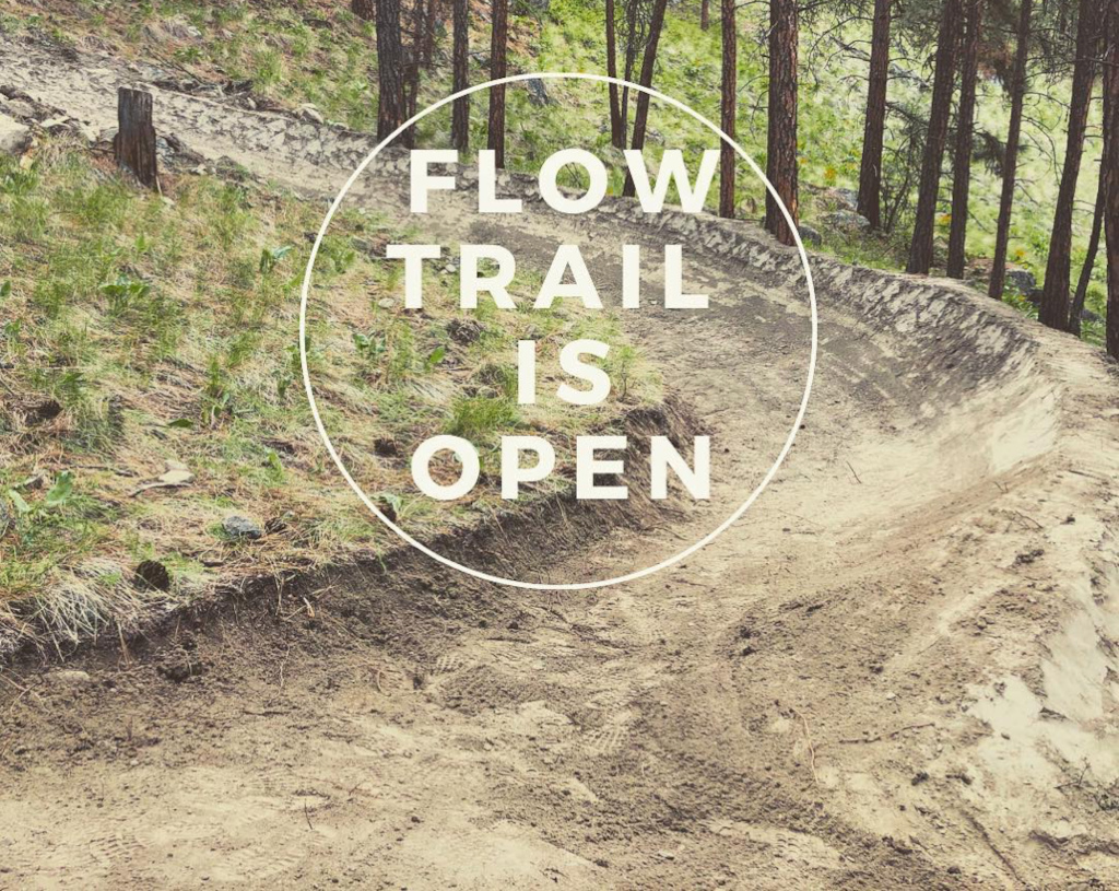
Newest addition to the Mice network. An easy flow trail that leads down to the Flow Coaster jump line or you can zip over to the continuation of it parallel to Tsweet Tsue.
Local Trail Association
-

-
Please consider joining or donating to the local trail association to supportdonate to earn trail karma!
trail development & maintenance.
Traditionally Indigenous Territory
More Stats for Flow Coaster mountain bike trail trail
-
Altitude change-355 ft
-
Altitude min1,839 ft
-
Altitude max2,194 ft
-
Altitude start2,194 ft
-
Altitude end1,841 ft
-
Grade-12.1%
-
Grade max-38.8%
-
Grade min6.9%
-
Distance climb167 ft
-
Distance down2,530 ft
-
Distance flat230 ft
-
Avg time00:02:24
-
Avg reverse time00:02:52
- view trail stats
close
-
Layers w
- Map Content
- More Layers
- Pro
- Pro
- Pro
- Pro
- Pro
- Pro
- Pro
- Pro
-
Upgrade to

3D
Trail Conditions
- Unknown
- Snow Groomed
- Snow Packed
- Snow Covered
- Snow Cover Partial
- Freeze/thaw Cycle
- Icy
- Prevalent Mud
- Wet
- Variable
- Ideal
- Dry
- Very Dry
Trail Flow (Ridden Direction)
Trailforks scans users ridelogs to determine the most popular direction each trail is ridden. A good flowing trail network will have most trails flowing in a single direction according to their intension.
The colour categories are based on what percentage of riders are riding a trail in its intended direction.
The colour categories are based on what percentage of riders are riding a trail in its intended direction.
- > 96%
- > 90%
- > 80%
- > 70%
- > 50%
- < 50%
- bi-directional trail
- no data
Trail Last Ridden
Trailforks scans ridelogs to determine the last time a trail was ridden.
- < 2 days
- < 1 week
- < 2 weeks
- < 1 month
- < 6 months
- > 6 months
Trail Ridden Direction
The intended direction a trail should be ridden.
- Downhill Only
- Downhill Primary
- Both Directions
- Uphill Primary
- Uphill Only
- One Direction
Contribute Details
Colors indicate trail is missing specified detail.
- Description
- Photos
- Description & Photos
- Videos
Trail Popularity ?
Trailforks scans ridelogs to determine which trails are ridden the most in the last 9 months.
Trails are compared with nearby trails in the same city region with a possible 25 colour shades.
Think of this as a heatmap, more rides = more kinetic energy = warmer colors.
- most popular
- popular
- less popular
- not popular
ATV/ORV/OHV Filter
Max Vehicle Width
inches
US Cell Coverage
Legend

Radar Time
x
Activity Recordings
Trailforks users anonymized public ridelogs from the past 6 months.
- mountain biking recent
- mountain biking (>6 month)
- hiking (1 year)
- moto (1 year)
Activity Recordings
Trailforks users anonymized public skilogs from the past 12 months.
- Downhill Ski
- Backcountry Ski
- Nordic Ski
- Snowmobile
Winter Trails
Warning
A routing network for winter maps does not exist. Selecting trails using the winter trails layer has been disabled.
x
Missing Trails
Most Popular
Least Popular
Trails are colored based on popularity. The more popular a trail is, the more red. Less popular trails trend towards green.
Jump Magnitude Heatmap
Heatmap of where riders jump on trails. Zoom in to see individual jumps, click circles to view jump details.
Trails Deemphasized
Trails are shown in grey.
Only show trails with NO bikes.
Save the current map location and zoom level as your default home location whenever this page is loaded.
Save
Directions to flow-coaster-180136 trailhead
(49.549020, -119.549680)
update trails status or condition
Flow Coaster Trail Reports
view all reports »
Recent Ridelog Activity on Trail
Past Week
- 31 rides
- 11 miles avg distance
6 Months
- 284 rides
- 11 miles avg distance
All
- 5,409 rides
- Last: May 19, 2024
Photos
more »
Routes with this trail
more »
Trail Products
We hope you've been enjoying Trailforks!
Create a FREE account to view trail comments and much more.
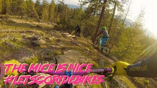
Videos
more »


Nearby Trails
- * Palomino 154 ft
- Chute Out 282 ft
- Deadhorse Extension 1,175 ft
- Skullcoaster 1,545 ft
- Deadhorse Extension 1,903 ft
- By 1partatatime
 PACA & contributors
 - #180136 - 5,580 views
- follow/subscribe
- login to download gpx or kml files.
You must enter a description before submitting.