more stats
2,421 ft
Distance
-174 ft
Descent
00:03:34
Avg time
-174 ft
Altitude change
1,662 ft
Altitude min
1,836 ft
Altitude max
1,836 ft
Altitude start
1,663 ft
Altitude end
-7.2%
Grade
-18.5%
Grade max
-0.4%
Grade min
2,297 ft
Distance down
125 ft
Distance flat
00:03:34
Avg time

FM Details

  • Activities
    • Dirtbike/Moto
  • Riding Area
    Tansky ORM Rec-Site
    Jordan River, British Columbia
  • Difficulty Rating
  • Local Popularity
    100 in Dirtbiking
  • Global Ranking
    #370 in Dirtbiking
  • Trail Type
    Singletrack
  • Physical Rating
    Moderate
  • Trail Visibility
    Always easy to follow
  • Season
    Mar-Nov
  • eBike Allowed
  • TTFs on Trail
    Bridge, Drop, Rock Garden
  • Land Owner
    RecSites & Trails BC

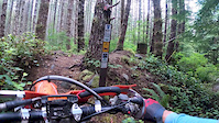
"Foggy Mountain" Flowy tech. Fast up top, loamy in the middle and fast, loose and rocky near the end.

Built by Dirtbikers VMC and VIDRA , modified by LARS NYBERG

Access Info

Drop in off of Where All The Fun Starts (#4).

Local Trail Association
Traditionally Indigenous Territory

Recent Activity on Trail

Past Week
  • 0 rides
  •  
6 Months
  • 11 rides
  • 14 miles avg distance
All
  • 66 rides
  •  
c1c2c3c4
January
February
March
April
May
June
July
August
September
October
November
December
update trails status or condition

FM Trail Reports

statusdatedescription
Oct 21, 2023 @ 6:06am
Oct 21, 2023
reporter In good condition
Oct 6, 2023 @ 2:36pm
Oct 6, 2023
reporter In good condition
Sep 17, 2023 @ 3:04am
Sep 17, 2023
reporter
Sep 16, 2023 @ 10:36am
Sep 16, 2023
reporter
Jul 17, 2022 @ 10:48am
Jul 17, 2022
reporter
more »
Status:
on Oct 21, 2023
Ideal
Avg: 4 (1 votes)
Your vote: 0

view (150)
close
3D
Trail Conditions
  • Unknown
  • Snow Groomed
  • Snow Packed
  • Snow Covered
  • Snow Cover Partial
  • Freeze/thaw Cycle
  • Icy
  • Prevalent Mud
  • Wet
  • Variable
  • Ideal
  • Dry
  • Very Dry
Trail Flow (Ridden Direction)
Trailforks scans users ridelogs to determine the most popular direction each trail is ridden. A good flowing trail network will have most trails flowing in a single direction according to their intension.
The colour categories are based on what percentage of riders are riding a trail in its intended direction.
  • > 96%
  • > 90%
  • > 80%
  • > 70%
  • > 50%
  • < 50%
  • bi-directional trail
  • no data
Trail Last Ridden
Trailforks scans ridelogs to determine the last time a trail was ridden.
  • < 2 days
  • < 1 week
  • < 2 weeks
  • < 1 month
  • < 6 months
  • > 6 months
Trail Ridden Direction
The intended direction a trail should be ridden.
  • Downhill Only
  • Downhill Primary
  • Both Directions
  • Uphill Primary
  • Uphill Only
  • One Direction
Contribute Details
Colors indicate trail is missing specified detail.
  • Description
  • Photos
  • Description & Photos
  • Videos
Trail Popularity ?
Trailforks scans ridelogs to determine which trails are ridden the most in the last 9 months. Trails are compared with nearby trails in the same city region with a possible 25 colour shades. Think of this as a heatmap, more rides = more kinetic energy = warmer colors.
  • most popular
  • popular
  • less popular
  • not popular
ATV/ORV/OHV Filter
Max Vehicle Width
inches
US Cell Coverage
Legend
cell carrier legend

Radar Time
Activity Recordings
Trailforks uses anonymized public activity data. ?
Activity Recordings
Trailforks uses anonymized public activity data. ?
Personal Heatmap
Activity Types
all / none
Options
2
Date range month
Winter Trails
Warning A routing network for winter maps does not exist. Selecting trails using the winter trails layer has been disabled.
Missing Trails
Most Popular
Least Popular
Trails are colored based on popularity. The more popular a trail is, the more red. Less popular trails trend towards green.
Jump Magnitude Heatmap
Heatmap of where riders jump on trails. Zoom in to see individual jumps, click circles to view jump details.
BC Backroad Status

Service Road Atlas is a free to use, community-driven service for viewing and creating reports on the numerous back-country service roads around B.C. and Alberta.

map legend
Slope Aspect
Direction the slope faces
Flat N NE E SE S SW W NW
Trails Deemphasized
Trails are shown in grey.
disable
Only show trails with no bike usage.
Enable
Suggested Layers
Based on selected activity type

    Save the current map location and zoom level as your default home location whenever this page is loaded.

    Save
        Directions to fm trailhead (48.465180, -124.045130)

        Photos

        No photos have been added for FM yet, add a photo.

        Videos

        1 more »
        2:29 | 142 | Sep 13, 2020 , Jordan River

        Routes with this trail

        5.0 10 miles 2,017 ft 11
        15 km Loop good for a short ride.
        8 miles 1,523 ft 13
        2023 wild west hare scramble loop
        7 miles 1,313 ft 9
        proposed course for the Wild West hare scramble. subject to change.

        Reviews / Comments

        No reviews yet, be the first to write a review or ask a question.
        Use trail reports to comment on trail conditions.


        We hope you've been enjoying Trailforks!

        Create a FREE account to view trail comments and much more.

        • By d-setTF Pro & contributors
        • #150860 - 1,293 views

        Frequently Asked Questions About FM

        Where is FM located?
        FM is located in Tansky ORM Rec-Site, Jordan River, British Columbia, Canada. It is part of the Tansky ORM Rec-Site trail network. The trailhead is located at coordinates 48.46518, -124.04513.
        How hard is FM?
        FM is rated as Black Diamond difficulty. The physical rating is Moderate. The average grade is 7.2%.
        What is the elevation gain for FM?
        The trail has 174 ft of elevation descent. The elevation ranges from 1,662 ft to 1,836 ft.
        How long is FM?
        FM is 2,421 ft long. The trail type is singletrack.

        Hit the Trail

        Open in App

        Get this trail on your phone instantly.
        open trail in app

        Download Trail

        Save to wishlist, Garmin & download.
        save the trail

        Find Related Routes

        Find routes and users activities that include this trail.
        find routes for this trail

        You must enter a description before submitting.