


Open in App
Get this trail on your phone instantly.

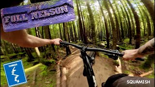
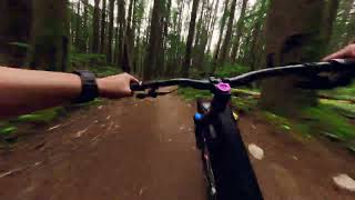
Full Nelson was constructed by Dream Wizards in conjunction with Anthill films and Red Bull with plenty of input from Brandon Semenuk. The trail is fast, Machine built with lots of rollers and variations to keep the challenge up. Just another fun way down the mountain. Cakewalk is a popular descent into the trail or climb the Legacy to access.
| c1 | c2 | c3 | c4 |
|---|---|---|---|
January | February | March | April |
May | June | July | August |
September | October | November | December |

Service Road Atlas is a free to use, community-driven service for viewing and creating reports on the numerous back-country service roads around B.C. and Alberta.
Save the current map location and zoom level as your default home location whenever this page is loaded.
SaveWe hope you've been enjoying Trailforks!
Create a FREE account to view trail comments and much more.
You must enter a description before submitting.

