
 Drop
DropOpen in App
Get this trail on your phone instantly.

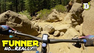
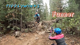
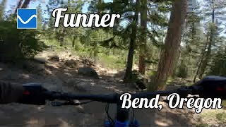
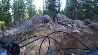
Funner is pretty darn fun ![]() From Wanoga, it starts low angle, open and flowy. Be prepared for some tech rocks, a slalom style turn section and some optional log rides. The second half has some bigger rock features, rock drops and challenging technical moves. Climbing Funner is a good option too, most of the time there is a dedicated climbing route, with a few two way sections, watch out for speeding downhillers because on the way down it feels DH specific
From Wanoga, it starts low angle, open and flowy. Be prepared for some tech rocks, a slalom style turn section and some optional log rides. The second half has some bigger rock features, rock drops and challenging technical moves. Climbing Funner is a good option too, most of the time there is a dedicated climbing route, with a few two way sections, watch out for speeding downhillers because on the way down it feels DH specific
a couple "mandatory" drops, look before you leap.
| c1 | c2 | c3 | c4 |
|---|---|---|---|
January | February | March | April |
May | June | July | August |
September | October | November | December |

Service Road Atlas is a free to use, community-driven service for viewing and creating reports on the numerous back-country service roads around B.C. and Alberta.
Save the current map location and zoom level as your default home location whenever this page is loaded.
SaveWe hope you've been enjoying Trailforks!
Create a FREE account to view trail comments and much more.
You must enter a description before submitting.

