more stats
2,815 ft
Distance
-245 ft
Descent
00:34:27
Avg time
-248 ft
Altitude change
991 ft
Altitude min
1,240 ft
Altitude max
1,240 ft
Altitude start
991 ft
Altitude end
-8.8%
Grade
-30.4%
Grade max
4%
Grade min
164 ft
Distance climb
2,087 ft
Distance down
561 ft
Distance flat
00:34:27
Avg time

Grasshopper Details

  • Activities
    • Mountain Bike
    • E-Bike
  • Riding Area
    Galbraith
    Bellingham, Washington
  • Difficulty Rating
  • Voted Difficulty
    Double Black Diamond (5 votes)
  • Local Popularity
    55 in Mountain Biking heatmap [+]
    • 40 in E-Biking
  • Global Ranking
    #96014 in Mountain Biking [+]
    • #72362 in E-Biking
  • State Ranking
    #1,589 in Mountain Biking · Washington [+]
    • #967 in E-Biking
  • Trail Type
    Singletrack
  • Bike Type
    DH, AM
  • Physical Rating
    Moderate
  • Dogs Allowed
    Yes
  • eBike Allowed
    Yes up to Class 1
  • TTFs on Trail
    Bridge, Drop, Jump, Gap Jump
  • Ride in Rain
    Yes

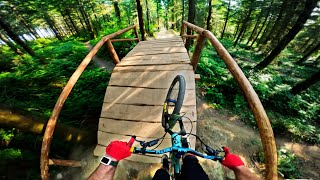
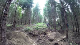
Don't let the name fool you, Grasshopper is one of Galbraith's premiere jump lines Poppy doubles will remind you of something between Crank it up and A-line if you've ever ridden in Whistler.

This is a great year around trail, however don't ride it after trail work has recently been done and it's still soft.

Tags
BridgesDropsJumps

Trail Supporters

Local Trail Association

Traditionally Indigenous Territory

Recent Activity on Trail

Past Week
  • 0 rides
  •  
6 Months
  • 37 rides
  • 13 miles avg distance
All
  • 280 rides
  • Last: Nov 5, 2026
c1c2c3c4
January
February
March
April
May
June
July
August
September
October
November
December
update trails status or condition

Grasshopper Trail Reports

statusdatedescription
Jun 30, 2026 @ 2:40pm (America/Los_Angeles)
Jun 30, 2026
reporter Little bit of moisture we've had has been great - trail is great shape - I rode the 'blue' side trail, but the double black jumps looked dialed!
May 21, 2026 @ 5:59pm (America/Los_Angeles)
May 21, 2026
reporter Back open with some updates on the first couple jumps! The Corkscrew at the bottom is still closed, but is actively being worked on.
Apr 30, 2026 @ 3:45pm (America/Los_Angeles)
Apr 30, 2026
Apr 30, 2026 @ 3:44pm (America/Los_Angeles)
Apr 30, 2026
Mar 2, 2026 @ 12:35pm (America/Los_Angeles)
Mar 2, 2026
reporter Closed for some maintenance and /larger projects
more »
Status:
on Jun 30, 2026
Ideal
Avg: 3.96 (22 votes)
Your vote: 0

view (1,260)
close
      Directions to grasshopper-9770 trailhead (48.717540, -122.412280)

      Photos

      27 more »
      mtb
      1,304 |
      May 20, 2016 @ 4:02pm
      May 20, 2016
      mtb
      101 |
      Oct 6, 2024 @ 8:15am
      Oct 6, 2024
      mtb
      94 |
      Jun 19, 2025 @ 5:09pm
      Jun 19, 2025
      mtb
      141 |
      Apr 24, 2024 @ 4:09pm
      Apr 24, 2024

      Videos

      9 more »
      Trying to find what's left of Grasshopper
      mtb
      20:36 | 1220 | Aug 9, 2024 , Bellingham
      youtuber Ibis Mojo 3 Bike Build Vlog Number 3 in 4K
      mtb
      6:23 | 2548 | Mar 9, 2018 , Bellingham
      Grasshopper Jump Testing with Scotty v6
      mtb
      2723 | May 20, 2015 , Bellingham
      Grasshopper and cedar dust jump session
      mtb
      0:37 | 775 | Oct 8, 2020 , Bellingham

      Trail Lists

      Routes with this trail

      more »
      ★ 5.0 • 6 miles • 1,131 ft • 19 • Loop •
      from birch street entrance up the ridge cedardust to the wall wall to el pollo el pollo to grass hopper...
      ★ 3.5 • 83 miles • 13,789 ft • 474 • Loop •
      Should be a monster! This route covers every trail on Galbraith at least once. Some uphill trails are...
      ★ 3.7 • 9 miles • 1,392 ft • 24 •
      To find the Cedar Dust Jumps...
      4.0 ★★★★★
      22 Ratings
      5 ★ 55%
      4 ★ 23%
      3 ★ 5%
      2 ★
      1 ★ 18%

      2 Reviews & Comments


      We hope you've been enjoying Trailforks!

      Create a FREE account to view all trail reviews and much more.

      • By kyleyoungtransition & contributors
      • #9770 - 12,205 views

      Frequently Asked Questions

      ▼ Where is Grasshopper located?
      Grasshopper is located in Galbraith, Bellingham, Washington, United States. It is part of the Galbraith trail network. The trailhead is located at coordinates 48.71754, -122.41228.
      ▼ How hard is Grasshopper?
      Grasshopper is rated as Double Black Diamond difficulty. The physical rating is Moderate. The average grade is 8.8%.
      ▼ What is the elevation gain for Grasshopper?
      The trail has 245 ft of elevation descent. The elevation ranges from 991 ft to 1,240 ft.
      ▼ How long is Grasshopper?
      Grasshopper is 2,815 ft long. The trail type is singletrack.
      ▼ Are dogs allowed on Grasshopper?
      Yes, dogs are allowed on Grasshopper. Please keep dogs on a leash where required and clean up after them.
      ▼ When is the best time of year to ride Grasshopper?
      Based on activity log data, the most popular months to ride Grasshopper are:
      • August (18 activities)
      • July (16 activities)
      • October (15 activities)
      Check the reports page for current trail conditions.
      ▼ How do I access Grasshopper? Where is the closest parking trailhead?
      The closest parking and trailhead locations to Grasshopper are: View all parking locations in the area.
      ▼ How long does it take to ride Grasshopper?
      Based on recorded activities, it takes an average of 34 minutes to ride Grasshopper. The trail is 2,815 ft long. Actual times will vary based on fitness level, conditions, and pace. View recent activity logs for more details.
      ▼ How busy is Grasshopper?
      Grasshopper is a moderately popular trail. There have been 1,243 recorded activities on this trail. The trail has received 1,260 check-ins. View recent activity on this trail.

      Hit the Trail

      Open in App

      Get this trail on your phone instantly.

      open trail in app

      Download Trail

      Save to wishlist, Garmin & download.
      save the trail

      Find Related Routes

      Find routes and users activities that include this trail.
      find routes for this trail

      You must enter a description before submitting.