more stats
1,598 ft
Distance
5 ft
Climb
-94 ft
Descent
00:05:13
Avg time
-89 ft
Altitude change
4,494 ft
Altitude min
4,588 ft
Altitude max
4,583 ft
Altitude start
4,495 ft
Altitude end
-5.5%
Grade
-52.7%
Grade max
2.5%
Grade min
246 ft
Distance climb
1,237 ft
Distance down
115 ft
Distance flat
00:05:13
Avg time

Jackson Details

  • Activities
    • Mountain Bike
    • E-Bike
    • Hike
    • Trail Running
  • Riding Area
    Amasa Back
    Moab, Utah
  • Difficulty Rating
  • Local Popularity
    75 in Mountain Biking [+]
    • 70 in E-Biking
    • 90 in Trail Running
    • 75 in Hiking
  • Global Ranking
    #61676 in Mountain Biking [+]
    • #40089 in E-Biking
    • #92941 in Trail Running
    • #128794 in Hiking
  • State Ranking
    #1,067 in Mountain Biking · Utah [+]
    • #474 in E-Biking
    • #2,012 in Trail Running
    • #2,900 in Hiking
  • Trail Type
    Singletrack
  • Bike Type
    AM
  • Direction
    Downhill Primary
    Popular Direction Shown
  • Climb Difficulty
    Blue
  • Physical Rating
    Hard
  • Season
    Spring, Summer, Fall
  • Dogs Allowed
    Yes
  • eBike Allowed
  • TTFs on Trail
    Rock Face
  • Land Owner
    BLM

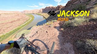
Jacksons trail is an advanced singletrack located in the Amasa Back area. It has a double black diamond rating and has also been classified as a Pro-Line. The trail has exposure and advanced technical features. The crux move is an off-camber rock shelf switchback, followed by a steep rolling drop into a tight right-hand corner. The trail can be accessed by riding up the Hymasa singletrack. At the last intersection on the Hymasa singetrack connect to the Amasa Back / Cliff Hangar jeep road. Continue up a mile to find the Jacksons' trailhead on the right. The creek at the bottom of the trail can be too high to cross during certain months. Check with a local bike shop or shuttle company for current conditions.

Tags
ExposureRock slabsShuttle access
Trail Supporters
  • BLM
    BLM
    Land Manager
Local Trail Association
Traditionally Indigenous Territory

Recent Activity on Trail

Past Week
  • 0 rides
  •  
6 Months
  • 17 rides
  • 14 miles avg distance
All
  • 158 rides
  • Last: Oct 11, 2026
c1c2c3c4
January
February
March
April
May
June
July
August
September
October
November
December
update trails status or condition

Jackson Trail Reports

statusdatedescription
Jan 10, 2025 @ 10:31am
Jan 10, 2025
reporter
Oct 6, 2024 @ 3:12pm
Oct 6, 2024
May 24, 2024 @ 9:13am
May 24, 2024
reporter Closed for the season! The Colorado River floods the bottom of the trail making it impassable until it gets back below 14k CFS.
Apr 20, 2024 @ 7:43am
Apr 20, 2024
Apr 15, 2023 @ 8:48pm
Apr 15, 2023
more »
Status:
on Jan 10, 2025
Dry
Avg: 4.26 (9 votes)
Your vote: 0

view (1,496)
close
      Directions to jackson trailhead (38.529330, -109.629020)

      Photos

      15 more »
      mtb
      95 |
      Apr 16, 2022 @ 2:55pm
      Apr 16, 2022
      mtb
      87 |
      Apr 12, 2022 @ 10:54am
      Apr 12, 2022
      mtb
      87 |
      Apr 12, 2022 @ 10:53am
      Apr 12, 2022
      mtb
      65 |
      Apr 12, 2022 @ 10:53am
      Apr 12, 2022

      Videos

      5 more »
      Jackson - Moab
      mtb
      20:21 | 91 | Apr 6, 2025 , Moab
      Jackson Trail | Moab
      mtb
      2:52 | 268 | Apr 24, 2021 , Moab
      Jackson got the best of me.
      mtb
      0:39 | 147 | Dec 10, 2019 , Moab
      Amasa Back, Rockstacker & Jackson trails
      mtb
      3:40 | 477 | Sep 3, 2012 , Moab

      Routes with this trail

      ★ 4.5 • 14 miles • 2,285 ft • 9 •
      Trying to link up Ahab and Jacksons. How hard could it be?
      Moab Double Down Featured
      ★ 3.0 • 14 miles • 2,239 ft • 9 • Loop •
      This is a double loop that serves up 2 of the best expert downhill trails in Moab. The first leg of the...
      ★ 4.0 • 15 miles • 2,052 ft • 17 • Loop •
      Hymasa to Pothole Arch to Ahab
      4.5 ★★★★★
      9 Ratings
      5 ★ 56%
      4 ★ 33%
      3 ★ 11%
      2 ★
      1 ★

      Reviews / Comments

      No reviews yet, be the first to write a review or ask a question.
      Use trail reports to comment on trail conditions.


      We hope you've been enjoying Trailforks!

      Create a FREE account to view all trail reviews and much more.

      • By toddTF Pro Trailforks & contributors
      • #8803 - 5,249 views

      Frequently Asked Questions

      ▼ Where is Jackson located?
      Jackson is located in Amasa Back, Moab, Utah, United States. It is part of the Amasa Back trail network. The trailhead is located at coordinates 38.52933, -109.62902.
      ▼ How hard is Jackson?
      Jackson is rated as Double Black Diamond difficulty. The physical rating is Hard. The average grade is 5.5%. The climb difficulty is rated Blue.
      ▼ What is the elevation gain for Jackson?
      Jackson has 5 ft of elevation gain. The trail has 94 ft of elevation descent. The elevation ranges from 4,494 ft to 4,588 ft.
      ▼ Is Jackson a point to point trail?
      Jackson is not a point to point trail. The direction is Downhill Primary. The trail type is singletrack.
      ▼ How long is Jackson?
      Jackson is 1,598 ft long. The trail type is singletrack.
      ▼ Are dogs allowed on Jackson?
      Yes, dogs are allowed on Jackson. Please keep dogs on a leash where required and clean up after them.
      ▼ When is the best time of year to ride Jackson?
      Jackson is best visited during: Spring, Summer, Fall.
      ▼ How do I access Jackson? Where is the closest parking trailhead?
      The closest parking and trailhead locations to Jackson are: View all parking locations in the area.
      ▼ How long does it take to ride Jackson?
      Based on recorded activities, it takes an average of 5 minutes to ride Jackson. The trail is 1,598 ft long. Actual times will vary based on fitness level, conditions, and pace. View recent activity logs for more details.
      ▼ How busy is Jackson?
      Jackson is a very popular trail. There have been 1,469 recorded activities on this trail. The trail has received 1,496 check-ins. View recent activity on this trail.

      Hit the Trail

      Open in App

      Get this trail on your phone instantly.

      open trail in app

      Download Trail

      Save to wishlist, Garmin & download.
      save the trail

      Find Related Routes

      Find routes and users activities that include this trail.
      find routes for this trail

      You must enter a description before submitting.