more stats
1,732 ft
Distance
-502 ft
Descent
00:05:16
Avg time
-502 ft
Altitude change
3,101 ft
Altitude min
3,603 ft
Altitude max
3,603 ft
Altitude start
3,100 ft
Altitude end
-29%
Grade
-60.7%
Grade max
-0.6%
Grade min
1,683 ft
Distance down
00:05:16
Avg time

Kush Details

  • Activities
    • Mountain Bike
    • Hike
    • Trail Running
  • Riding Area
    Whistler South CRA
    Whistler, British Columbia
  • Difficulty Rating
  • Voted Difficulty
    Double Black Diamond (2 votes)
  • Local Popularity
    65 in Mountain Biking [+]
    • 20 in Trail Running
    • 35 in Hiking
  • Global Ranking
    #47275 in Mountain Biking [+]
    • #120341 in Trail Running
    • #81612 in Hiking
  • Trail Type
    Singletrack
  • Bike Type
    DH, AM, XC
  • Direction
    Downhill Only
    Popular Direction Shown
  • Season
    May - October
  • Dogs Allowed
    Yes

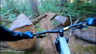
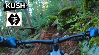
A short trail to add on after riding Kashmir. Comparable in difficulty and trail style to both Kashmir & Ride Don't Slide.

Access Info

After exiting Kashmir, ride up the road until the ski run. Kashmir starts on the rider's left side of the ski run when looking downside. Can be moderately difficult to see the trail depending on how high the grass has grown.

Local Trail Association

Recent Activity on Trail

Past Week
  • 0 rides
  •  
6 Months
  • 1 rides
  • 7 miles avg distance
All
  • 266 rides
  • Last: Jun 13, 2026
c1c2c3c4
January
February
March
April
May
June
July
August
September
October
November
December
update trails status or condition

Kush Trail Reports

statusdatedescription
Jun 14, 2026 @ 4:59pm (America/Vancouver)
Jun 14, 2026
Oct 20, 2025 @ 6:35pm (America/Vancouver)
Oct 20, 2025
Closed for the season, see you in 2026 :D \m/
Jul 20, 2025 @ 11:26am
Jul 20, 2025
reporter all clear
Jun 6, 2025 @ 1:56pm
Jun 6, 2025
Chainsaw tree size down at the start where you getting speed, one more after 100m
Nov 28, 2024 @ 7:38pm
Nov 28, 2024
more »
Status:
on Jun 14, 2026
Ideal
Avg: 4.27 (23 votes)
Your vote: 0

view (1,772)
close
3D
Trail Conditions
  • Unknown
  • Snow Groomed
  • Snow Packed
  • Snow Covered
  • Snow Cover Partial
  • Freeze/thaw Cycle
  • Icy
  • Prevalent Mud
  • Wet
  • Variable
  • Ideal
  • Dry
  • Very Dry
Trail Flow (Ridden Direction)
Trailforks scans users ridelogs to determine the most popular direction each trail is ridden. A good flowing trail network will have most trails flowing in a single direction according to their intension.
The colour categories are based on what percentage of riders are riding a trail in its intended direction.
  • > 96%
  • > 90%
  • > 80%
  • > 70%
  • > 50%
  • < 50%
  • bi-directional trail
  • no data
Trail Last Ridden
Trailforks scans ridelogs to determine the last time a trail was ridden.
  • < 2 days
  • < 1 week
  • < 2 weeks
  • < 1 month
  • < 6 months
  • > 6 months
Trail Ridden Direction
The intended direction a trail should be ridden.
  • Downhill Only
  • Downhill Primary
  • Both Directions
  • Uphill Primary
  • Uphill Only
  • One Direction
Contribute Details
Colors indicate trail is missing specified detail.
  • Description
  • Photos
  • Description & Photos
  • Videos
Trail Popularity ?
Trailforks scans ridelogs to determine which trails are ridden the most in the last 9 months. Trails are compared with nearby trails in the same city region with a possible 25 colour shades. Think of this as a heatmap, more rides = more kinetic energy = warmer colors.
  • most popular
  • popular
  • less popular
  • not popular
ATV/ORV/OHV Filter
Max Vehicle Width
inches
US Cell Coverage
Legend
cell carrier legend

Radar Time
Activity Recordings
Trailforks uses anonymized public activity data. ?
Activity Recordings
Trailforks uses anonymized public activity data. ?
Personal Heatmap
Activity Types
all / none
Options
2
Date range month
Winter Trails
Warning A routing network for winter maps does not exist. Selecting trails using the winter trails layer has been disabled.
Missing Trails
Most Popular
Least Popular
Trails are colored based on popularity. The more popular a trail is, the more red. Less popular trails trend towards green.
Jump Magnitude Heatmap
Heatmap of where riders jump on trails. Zoom in to see individual jumps, click circles to view jump details.
BC Backroad Status

Service Road Atlas is a free to use, community-driven service for viewing and creating reports on the numerous back-country service roads around B.C. and Alberta.

map legend
Slope Aspect
Direction the slope faces
Flat N NE E SE S SW W NW
Trails Deemphasized
Trails are shown in grey.
disable
Only show trails with no bike usage.
Enable
Suggested Layers
Based on selected activity type

    Save the current map location and zoom level as your default home location whenever this page is loaded.

    Save
        Directions to kush trailhead (50.079320, -122.988320)

        Photos

        23 more »
        404 |
        Aug 4, 2015 @ 11:34pm
        Aug 4, 2015
        488 |
        Aug 4, 2015 @ 11:49pm
        Aug 4, 2015
        176 |
        Aug 26, 2019 @ 10:06pm
        Aug 26, 2019
        287 |
        Dec 3, 2016 @ 9:12pm
        Dec 3, 2016

        Videos

        8 more »
        youtuber KUSH | Double black trail | Whistler Bikepark
        2:28 | 117 | Nov 28, 2023 , Whistler
        youtuber KUSH | Double black trail | Whistler
        2:50 | 196 | Nov 28, 2023 , Whistler
        youtuber Whistler Bike Park | Kush - Backcountry to...
        949 | Dec 15, 2017 , Whistler
        Part 2 Of The Best New Lap Down From Top Of...
        11:16 | 105 | Jul 26, 2023 , Whistler

        Trail Lists

        Routes with this trail

        5.0 8 miles 199 ft 12 Shuttled
        This is one of the best gravity laps you can possibly do in Whistler and is the next best thing you can do...
        5.0 7 miles 215 ft 9 Point to Point
        Maybe the best collection of technical singletrack descending in the entire Whistler valley, from the top...
        3.3 64 miles 16,935 ft 39
        Wait for any of the longer days in Summer and look to complete the 4 corners of Whistler - Top of the...

        Trail Products

        7 Reviews & Comments


        We hope you've been enjoying Trailforks!

        Create a FREE account to view trail comments and much more.

        Frequently Asked Questions About Kush

        Where is Kush located?
        Kush is located in Whistler South CRA, Whistler, British Columbia, Canada. It is part of the Whistler South CRA trail network. The trailhead is located at coordinates 50.07932, -122.98832.
        How hard is Kush?
        Kush is rated as Double Black Diamond difficulty. The average grade is 29%.
        What is the elevation gain for Kush?
        The trail has 153 m of elevation descent. The elevation ranges from 945 m to 1,098 m.
        Is Kush a point to point trail?
        Yes, Kush is a point to point trail. The direction is Downhill Only. The trail type is singletrack.

        Hit the Trail

        Open in App

        Get this trail on your phone instantly.
        open trail in app

        Download Trail

        Save to wishlist, Garmin & download.
        save the trail

        Find Related Routes

        Find routes and users activities that include this trail.
        find routes for this trail

        You must enter a description before submitting.