
more stats
2.3 miles
Distance
538 ft
Climb
-1,230 ft
Descent
00:23:28
Avg time
-692 ft
Altitude change
1,273 ft
Altitude min
2,280 ft
Altitude max
1,978 ft
Altitude start
1,286 ft
Altitude end
-56.216%
Grade max
26.369%
Grade min
4,509 ft
Distance climb
1 mile
Distance down
733 ft
Distance flat
00:23:28
Avg time

La Cava Details

  • Activities
    • Mountain Bike
    • E-Bike
    • Winter Fat Bike
    • Hike
    • Trail Running
  • Riding Area
  • AKA
    Monte Groppo
  • Difficulty Rating
  • Local Popularity
    95 in Mountain Biking [+]
    • 85 in E-Biking
    • 100 in Trail Running
    • 90 in Hiking
    • 5 in Winter Fat Biking
  • Global Ranking
    #35815 in Mountain Biking [+]
    • #17406 in E-Biking
    • #81403 in Trail Running
    • #206138 in Hiking
    • #2936 in Winter Fat Biking
  • National Ranking
    #3,459 in Mountain Biking · Italy [+]
    • #2,035 in E-Biking
    • #2,159 in Trail Running
    • #5,927 in Hiking
    • #20 in Winter Fat Biking
  • Trail Type
    Singletrack
  • Bike Type
    DH, AM, XC, Fat
  • Direction
    Downhill Only
    Popular Direction Shown
  • Climb Difficulty
    Blue
  • Physical Rating
    Moderate
  • Dogs Allowed
    Yes
  • eBike Allowed
    Yes up to Class 1
  • Ride in Rain
    Yes
  • Year Opened
    2014
  • Land Owner
    Comune di Terenzo

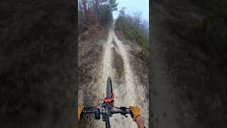
Classical singletrail in Calestano (Parma, IT). First steep ascent to top of monte Groppo with dirty terrain, then great downhill on narrow singletrack on rocks in the first section (gret view over middle Baganza Valley) then in the wood the surface becomes dirtier till the end (open gate). Pay attention to a very steep section before entering the wood.

Tags
Views

Recent Activity on Trail

Past Week
  • 1 rides
  • 34 miles average
6 Months
  • 6 rides
  • 17 miles avg distance
All
  • 88 rides
  • Last: Oct 17, 2026
c1c2c3c4
January
February
March
April
May
June
July
August
September
October
November
December
Status:
on Apr 18, 2026
Ideal
Avg: 4.13 (9 votes)
Your vote: 0

view (868)
close
      Directions to la-cava trailhead (44.630080, 10.145680)

      Photos

      21 more »
      mtb
      487 |
      Jan 14, 2016 @ 7:32am
      Jan 14, 2016
      mtb
      108 |
      Apr 21, 2024 @ 4:11am
      Apr 21, 2024
      mtb
      82 |
      Apr 21, 2024 @ 4:07am
      Apr 21, 2024
      mtb
      120 |
      Aug 3, 2022 @ 1:04pm
      Aug 3, 2022

      Videos

      4 more »
      La Cava Dh Calestano #mtb #mtblove #downhill...
      mtb
      2:16 | 70 | Feb 25, 2026 , Parma
      Cava e Canesano mtb
      mtb
      901 | Mar 16, 2017 , Parma
      Test di alcuni passaggi sul Trail 'La cava'
      mtb
      856 | Jan 25, 2016 , Parma
      Most scenic part of the trail (with a crash)
      mtb
      688 | Jan 18, 2015 , Parma

      Routes with this trail

      ★ 5.0 • 16 miles • 3,615 ft • 7 • Loop •
      Partenza principale PP: Calestano, Baita degli alpini Partenze alternative PA: Marzolara Colore: giallo...
      18 miles • 3,864 ft • 6 •
      Traccia 2024 del classico raduno mtb "Tartufo Bike" che si tiene da oltre 30 anni l'ultima domenica di...
      17 miles • 3,292 ft • 6 • Loop •
      Classico inanellalmento dei due trails più frequentati di Calestano: la Cava e Alpicella Trail. Partenza...

      Trail Events

      4.2 ★★★★★
      9 Ratings
      5 ★ 67%
      4 ★ 11%
      3 ★ 11%
      2 ★
      1 ★ 11%

      2 Reviews & Comments

      GABRI3RIDE GABRI3RIDE
      È un classico per chi fa mtb nella zona, sempre bella e divertente! Da sempre da percorrere in discesa , si sale dal lato di Marzolara e si scende verso Calestano si possono incontrare enduristi in moto
      endsenzfret
      Banale discesa Xc con un breve tratto enduro

      We hope you've been enjoying Trailforks!

      Create a FREE account to view all trail reviews and much more.

      • By CapatazTF Pro & contributors
      • #17274 - 3,916 views

      Frequently Asked Questions

      ▼ Where is La Cava located?
      La Cava is located in Calestano Bike Park, Parma, Italy. It is part of the Calestano Bike Park trail network. The trailhead is located at coordinates 44.63008, 10.14568.
      ▼ How hard is La Cava?
      La Cava is rated as Red difficulty. The physical rating is Moderate. The climb difficulty is rated Blue.
      ▼ What is the elevation gain for La Cava?
      La Cava has 538 ft of elevation gain. The trail has 1,230 ft of elevation descent. The elevation ranges from 1,273 ft to 2,280 ft.
      ▼ Is La Cava a point to point trail?
      Yes, La Cava is a point to point trail. The direction is Downhill Only. The trail type is singletrack.
      ▼ How long is La Cava?
      La Cava is 2.3 miles long. The trail type is singletrack.
      ▼ Are dogs allowed on La Cava?
      Yes, dogs are allowed on La Cava. Please keep dogs on a leash where required and clean up after them.
      ▼ When is the best time of year to ride La Cava?
      Based on activity log data, the most popular months to ride La Cava are:
      • November (9 activities)
      • October (5 activities)
      • March (3 activities)
      Check the reports page for current trail conditions.
      ▼ How do I access La Cava? Where is the closest parking trailhead?
      The closest parking and trailhead locations to La Cava are: View all parking locations in the area.
      ▼ How long does it take to ride La Cava?
      Based on recorded activities, it takes an average of 23 minutes to ride La Cava. The trail is 2.3 miles long. Actual times will vary based on fitness level, conditions, and pace. View recent activity logs for more details.
      ▼ How busy is La Cava?
      La Cava is a very popular trail. There have been 889 recorded activities on this trail. The trail has received 868 check-ins. View recent activity on this trail.

      Hit the Trail

      Open in App

      Get this trail on your phone instantly.

      open trail in app

      Download Trail

      Save to wishlist, Garmin & download.
      save the trail

      Find Related Routes

      Find routes and users activities that include this trail.
      find routes for this trail

      You must enter a description before submitting.

