
more stats
1.8 miles
Distance
16 ft
Climb
-1,377 ft
Descent
00:27:21
Avg time
-1,361 ft
Altitude change
8,044 ft
Altitude min
9,405 ft
Altitude max
9,405 ft
Altitude start
8,045 ft
Altitude end
-14%
Grade
-55.9%
Grade max
10.6%
Grade min
390 ft
Distance climb
2 miles
Distance down
446 ft
Distance flat
00:27:21
Avg time

Lichenbretter Details

  • Activities
    • Mountain Bike
    • E-Bike
    • Hike
    • Trail Running
  • Riding Area
  • AKA
    Säumerweg
  • Difficulty Rating
  • Voted Difficulty
    Black (1 vote)
  • Local Popularity
    90 in Mountain Biking heatmap [+]
    • 80 in E-Biking
    • 95 in Trail Running
    • 75 in Hiking
  • Global Ranking
    #93318 in Mountain Biking [+]
    • #114809 in E-Biking
    • #66360 in Trail Running
    • #90021 in Hiking
  • National Ranking
    #2,127 in Mountain Biking · Switzerland [+]
    • #3,905 in E-Biking
    • #1,949 in Trail Running
    • #2,888 in Hiking
  • Hiking SAC Scale
    T3 Demanding Mountain Hiking
  • Trail Type
    Singletrack
  • Bike Type
    AM
  • Direction
    Downhill Only
    Popular Direction Shown
  • Climb Difficulty
    Blue
  • Physical Rating
    Hard
  • Trail Visibility
    Sometimes hard to follow
  • Alpine Trail
    Yes
  • Dogs Allowed
    Yes
  • eBike Allowed
    Yes up to Class 1

No community description for Lichenbretter trail has been added yet!

AI Generated Description

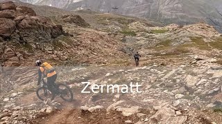
Lichenbretter is a highly rated 3 km popular black difficulty alpine singletrack trail located near Zermatt. Riders describe it as faint trail. This multi-use trail can be used downhill only and has a hard overall physical rating with a 5 m blue climb. Trail visibility is sometimes hard to follow. On average it takes 27 minutes to complete this trail.

This trail is unsanctioned.

Disclaimer

| Trail Etiquette | -Hikers have the right of way -Always yield for non-bike trail users (complete stop when crossing) -Anticipate other trail users -Let other trail users know you are coming -Leave no trace

Tags
AlpineFaint trail

Recent Activity on Trail

Past Week
  • 0 rides
  •  
6 Months
  • 15 rides
  • 24 miles avg distance
All
  • 56 rides
  • Last: Oct 12, 2026
c1c2c3c4
January
February
March
April
May
June
July
August
September
October
November
December
Status:
on Oct 4, 2026
Ideal
Avg: 4.53 (11 votes)
Your vote: 0

view (383)
close
      Directions to lichenbretter trailhead (45.970670, 7.726340)

      Photos

      24 more »
      mtb
      103 |
      Sep 14, 2025 @ 3:16pm
      Sep 14, 2025
      mtb
      103 |
      Sep 14, 2025 @ 3:15pm
      Sep 14, 2025
      mtb
      92 |
      Sep 14, 2025 @ 3:15pm
      Sep 14, 2025
      mtb
      89 |
      Sep 14, 2025 @ 3:15pm
      Sep 14, 2025

      Videos

      4 more »
      MTB Enduro/Trail 2k24 - Switzerland - Zermatt
      mtb
      3:05 | 272 | Aug 25, 2024 , Zermatt
      Zermatt - Lichenbretter
      mtb
      6:25 | 840 | Mar 6, 2021 , Zermatt
      Lichenbretter Trail  |  Zermatt, Switzerland ...
      mtb
      27:49 | 597 | Sep 16, 2020 , Zermatt
      youtuber EWS Zermatt Stage 3 Practice
      mtb
      13:43 | 944 | Apr 27, 2020 , Zermatt

      Routes with this trail

      more »
      4 miles • 35 ft • 6 • Point to Point •
      (Deutsche Übersetzung unten / Traduction Française ci-dessous) This fantastic Alpine trail starts at...
      ★ 4.0 • 34 miles • 15,271 ft • 34 • Race •
      EWS Round 8 2019 - Queen Stage: Stage 5
      4.8 ★★★★★
      11 Ratings
      5 ★ 82%
      4 ★ 18%
      3 ★
      2 ★
      1 ★

      3 Reviews & Comments

      HugoyLR9ga
      Indeed very technical with enduro tire with ultra soft gum it help a lot to be confident on this trail but you still need good skills to do it
      blaze-j blaze-j
      Very fun and varied trail. On slick rock sections it's often better to leave the official path and find a smoother line. I would rate the upper rocky part as black, not double black. Lower part is fast and flowy, blue rating. The trail never gets steep or exposed.
      zhmtb zhmtb
      This trail was part of an EWS stage in 2019. The first half of this trail is really technical with large boulders, very slick rock rolls (even in dry conditions), loose chunder and steep chunky sections. The second half is less steep and much more flowy (more of a single black diamond or blue rated segment) with part gravel and part sandy dirt.

      The first half of the trail require advanced MTB skills to savely get through. Beware of the slick rock surfaces which can be really treacherous also in dry conditions. I had a very unfortunate crash on one of them and managed to break my thumb in several places and tear a ligament...

      The Lichenbretter trail can be linked nicely together with the "Gandegghütte" and "Trockener Steg" trails at the top and the "Garten", "Furggbach" and "Üewenner" trails at the bottom to ride from Gandegghütte all the way down to Furi, which makes for 1160 meters of vertical descent.

      We hope you've been enjoying Trailforks!

      Create a FREE account to view all trail reviews and much more.

      • #222473 - 3,039 views

      Frequently Asked Questions

      ▼ Where is Lichenbretter located?
      Lichenbretter is located in Zermatt - Matterhorn, Zermatt, Switzerland. It is part of the Zermatt - Matterhorn trail network. The trailhead is located at coordinates 45.97067, 7.72634.
      ▼ How hard is Lichenbretter?
      Lichenbretter is rated as Black difficulty. The physical rating is Hard. The average grade is 14%. The climb difficulty is rated Blue.
      ▼ What is the elevation gain for Lichenbretter?
      Lichenbretter has 16 ft of elevation gain. The trail has 1,377 ft of elevation descent. The elevation ranges from 8,044 ft to 9,405 ft.
      ▼ Is Lichenbretter a point to point trail?
      Yes, Lichenbretter is a point to point trail. The direction is Downhill Only. The trail type is singletrack.
      ▼ How long is Lichenbretter?
      Lichenbretter is 1.8 miles long. The trail type is singletrack.
      ▼ Are dogs allowed on Lichenbretter?
      Yes, dogs are allowed on Lichenbretter. Please keep dogs on a leash where required and clean up after them.
      ▼ When is the best time of year to ride Lichenbretter?
      Based on activity log data, the most popular months to ride Lichenbretter are:
      • August (19 activities)
      • September (8 activities)
      • July (5 activities)
      Check the reports page for current trail conditions.
      ▼ How long does it take to ride Lichenbretter?
      Based on recorded activities, it takes an average of 27 minutes to ride Lichenbretter. The trail is 1.8 miles long. Actual times will vary based on fitness level, conditions, and pace. View recent activity logs for more details.
      ▼ How busy is Lichenbretter?
      Lichenbretter is a very popular trail. There have been 381 recorded activities on this trail. The trail has received 383 check-ins. View recent activity on this trail.

      Hit the Trail

      Open in App

      Get this trail on your phone instantly.

      open trail in app

      Download Trail

      Save to wishlist, Garmin & download.
      save the trail

      Find Related Routes

      Find routes and users activities that include this trail.
      find routes for this trail

      You must enter a description before submitting.

