more stats
1.6 miles
Distance
152 ft
Climb
-134 ft
Descent
00:11:53
Avg time
18 ft
Altitude change
1,136 ft
Altitude min
1,276 ft
Altitude max
1,137 ft
Altitude start
1,155 ft
Altitude end
0.2%
Grade
-11.3%
Grade max
17.6%
Grade min
3,245 ft
Distance climb
3,570 ft
Distance down
1,378 ft
Distance flat
00:11:53
Avg time

Lollygagger Details

  • Activities
    • Mountain Bike
    • E-Bike
    • Hike
    • Trail Running
  • Riding Area
    Duluth
    , Minnesota
  • AKA
  • Difficulty Rating
  • Voted Difficulty
    Green (3 votes)
  • Local Popularity
    85 in Mountain Biking [+]
    • 85 in E-Biking
    • 60 in Trail Running
    • 60 in Hiking
  • Global Ranking
    #49496 in Mountain Biking [+]
    • #32993 in E-Biking
    • #91206 in Trail Running
    • #81784 in Hiking
  • Hiking SAC Scale
    T1 Hiking
  • Trail Type
    Singletrack
  • Bike Type
    XC
  • Direction
    Both Directions
  • Climb Difficulty
    Blue
  • Physical Rating
    Moderate
  • Dogs Allowed
    Yes
  • eBike Allowed
  • Land Owner

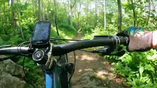
This is the easier, more accessible portion of Brewer Park trails. It is still very fun and gorgeous

Coming up from Haines Road toward the intersection with Home Brew, it is a substantial sustained climb. Heading back down, however, it's a beautifully flowing trail, featuring big banked turns.

From its easternmost intersection with Home Brew, Lollygagger snakes it's way southwest, winding through deep boreal and hardwood forest. It's slightly flowing, rolling, machine-built singletrack with moderate climbing and a few brief technical b-line options.

- Two-way traffic

Trail Supporters
Local Trail Association

Recent Activity on Trail

Past Week
  • 7 rides
  • 16 miles average
6 Months
  • 38 rides
  • 19 miles avg distance
All
  • 721 rides
  • Last: Jul 3, 2026
c1c2c3c4
January
February
March
April
May
June
July
August
September
October
November
December
update trails status or condition

Lollygagger Trail Reports

Status:
on Oct 9, 2025
Ideal
Avg: 4.54 (16 votes)
Your vote: 0

view (3,111)
close
3D
Trail Conditions
  • Unknown
  • Snow Groomed
  • Snow Packed
  • Snow Covered
  • Snow Cover Partial
  • Freeze/thaw Cycle
  • Icy
  • Prevalent Mud
  • Wet
  • Variable
  • Ideal
  • Dry
  • Very Dry
Trail Flow (Ridden Direction)
Trailforks scans users ridelogs to determine the most popular direction each trail is ridden. A good flowing trail network will have most trails flowing in a single direction according to their intension.
The colour categories are based on what percentage of riders are riding a trail in its intended direction.
  • > 96%
  • > 90%
  • > 80%
  • > 70%
  • > 50%
  • < 50%
  • bi-directional trail
  • no data
Trail Last Ridden
Trailforks scans ridelogs to determine the last time a trail was ridden.
  • < 2 days
  • < 1 week
  • < 2 weeks
  • < 1 month
  • < 6 months
  • > 6 months
Trail Ridden Direction
The intended direction a trail should be ridden.
  • Downhill Only
  • Downhill Primary
  • Both Directions
  • Uphill Primary
  • Uphill Only
  • One Direction
Contribute Details
Colors indicate trail is missing specified detail.
  • Description
  • Photos
  • Description & Photos
  • Videos
Trail Popularity ?
Trailforks scans ridelogs to determine which trails are ridden the most in the last 9 months. Trails are compared with nearby trails in the same city region with a possible 25 colour shades. Think of this as a heatmap, more rides = more kinetic energy = warmer colors.
  • most popular
  • popular
  • less popular
  • not popular
ATV/ORV/OHV Filter
Max Vehicle Width
inches
US Cell Coverage
Legend
cell carrier legend

Radar Time
Activity Recordings
Trailforks uses anonymized public activity data. ?
Activity Recordings
Trailforks uses anonymized public activity data. ?
Personal Heatmap
Activity Types
all / none
Options
2
Date range month
Winter Trails
Warning A routing network for winter maps does not exist. Selecting trails using the winter trails layer has been disabled.
Missing Trails
Most Popular
Least Popular
Trails are colored based on popularity. The more popular a trail is, the more red. Less popular trails trend towards green.
Jump Magnitude Heatmap
Heatmap of where riders jump on trails. Zoom in to see individual jumps, click circles to view jump details.
BC Backroad Status

Service Road Atlas is a free to use, community-driven service for viewing and creating reports on the numerous back-country service roads around B.C. and Alberta.

map legend
Slope Aspect
Direction the slope faces
Flat N NE E SE S SW W NW
Trails Deemphasized
Trails are shown in grey.
disable
Only show trails with no bike usage.
Enable
Suggested Layers
Based on selected activity type

    Save the current map location and zoom level as your default home location whenever this page is loaded.

    Save
        Directions to lollygagger trailhead (46.762840, -92.171770)

        Photos

        5 more »
        78 |
        Aug 8, 2022 @ 8:43pm
        Aug 8, 2022
        198 |
        Oct 11, 2019 @ 10:48am
        Oct 11, 2019
        320 |
        Jul 30, 2016 @ 3:51pm
        Jul 30, 2016
        213 |
        Jul 30, 2016 @ 3:50pm
        Jul 30, 2016

        Videos

        2 more »
        The Return to Haines on Lollygagger
        2:40 | 226 | Aug 3, 2022 , Duluth
        Slender James Classic Enduro 2021
        5:00 | | Mar 3, 2023 , Duluth

        Trail Lists

        Routes with this trail

        5.0 68 miles 4,537 ft 29 Loop
        This is a "bowtie" shaped route: you park in the middle (home base) and ride a loop to each side, covering...
        3.7 44 miles 3,406 ft 61 Point to Point
        2019 COGGS Gitchee Gumee Gallivant to be held September 19, 2019. For more information, visit...
        12 miles 1,310 ft 9
        Duluth Rocky Rumble Intermediate route

        Trail Products

        1 Review & Comments


        We hope you've been enjoying Trailforks!

        Create a FREE account to view trail comments and much more.

        Frequently Asked Questions About Lollygagger

        Where is Lollygagger located?
        Lollygagger is located in Duluth, Minnesota, United States. It is part of the Duluth trail network. The trailhead is located at coordinates 46.76284, -92.17177.
        How hard is Lollygagger?
        Lollygagger is rated as Green difficulty. The physical rating is Moderate. The average grade is 0.2%. The climb difficulty is rated Blue.
        What is the elevation gain for Lollygagger?
        Lollygagger has 152 ft of elevation gain. The trail has 134 ft of elevation descent. The elevation ranges from 1,136 ft to 1,276 ft.
        Is Lollygagger a point to point trail?
        Lollygagger is not a point to point trail. The direction is Both Directions. The trail type is singletrack.

        Hit the Trail

        Open in App

        Get this trail on your phone instantly.
        open trail in app

        Download Trail

        Save to wishlist, Garmin & download.
        save the trail

        Find Related Routes

        Find routes and users activities that include this trail.
        find routes for this trail

        You must enter a description before submitting.