

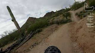

more stats
4.0 miles
Distance
319 ft
Climb
-423 ft
Descent
00:32:38
Avg time
-103 ft
Altitude change
1,722 ft
Altitude min
1,920 ft
Altitude max
1,834 ft
Altitude start
1,732 ft
Altitude end
-0.5%
Grade
-27.7%
Grade max
17.9%
Grade min
2 miles
Distance climb
2 miles
Distance down
2,106 ft
Distance flat
00:32:38
Avg time

Malpais Details

  • Activities
    • Mountain Bike
    • E-Bike
    • Horse
    • Hike
    • Trail Running
  • Riding Area
    San Tan Mountain Regional Park
    Queen Creek, Arizona
  • Difficulty Rating
  • Local Popularity
    35 in Mountain Biking [+]
    • 85 in E-Biking
    • 40 in Trail Running
    • 35 in Hiking
    • 5 in Horseback
  • Global Ranking
    #99463 in Mountain Biking [+]
    • #18683 in E-Biking
    • #93150 in Trail Running
    • #103668 in Hiking
  • Trail Type
    Sandy
  • Bike Type
    XC
  • Direction
    One Direction
    Popular Direction Shown
  • Climb Difficulty
    Black Diamond
  • Physical Rating
    Hard
  • Dogs Allowed
    Yes
  • eBike Allowed
    Yes up to Class 1

Beware! Most of this trail is in a deep sandy wash!! Bring your fatbike or ride it a day after a rain storm.

Trail Supporters
  • BLM
    BLM
    Land Manager
Local Trail Association
Traditionally Indigenous Territory

Recent Activity on Trail

Past Week
  • 0 rides
  •  
6 Months
  • 12 rides
  • 23 miles avg distance
All
  • 173 rides
  • Last: Sep 19, 2026
c1c2c3c4
January
February
March
April
May
June
July
August
September
October
November
December
update trails status or condition

Malpais Trail Reports

statusdatedescription
Jul 4, 2025 @ 5:18am
Jul 4, 2025
It's as good as it gets for this so called trail after the rain two nights ago.
Oct 20, 2024 @ 4:15pm
Oct 20, 2024
Glad I did it just to know not to do it ever again. Boring ride through soft dirt and sand 90% of the way. Just skip it
Mar 22, 2024 @ 8:20am
Mar 22, 2024
Lots of fun trail runs by beautiful cliff face through a wash. Riding it from South to North it feels like a downhill ride. If you ride the line...
Jul 29, 2023 @ 10:11pm
Jul 29, 2023
This trail is really a dry riverbed. I'd avoid it unless running 2.6+ tires and it just rained.
Feb 27, 2023 @ 11:56pm
Feb 27, 2023
Was well packed. Runnable for sure.
more »
Status:
on Jul 4, 2025
Dry
Avg: 2.83 (12 votes)
Your vote: 0

view (3,924)
close
      Directions to malpais trailhead (33.148660, -111.652200)

      Photos

      29 more »
      mtb
      20 |
      Jul 22, 2026 @ 9:17am
      Jul 22, 2026
      mtb
      29 |
      Jul 22, 2026 @ 9:17am
      Jul 22, 2026
      mtb
      25 |
      Jul 22, 2026 @ 9:17am
      Jul 22, 2026
      mtb
      22 |
      Jul 22, 2026 @ 9:17am
      Jul 22, 2026

      Videos

      1 more »
      San Tan Mountain Regional Park Malpais Trail
      mtb
      1:7:01 | 1257 | Sep 27, 2020 , Queen Creek

      Routes with this trail

      12 miles 904 ft 3 Loop
      -> Malapais ->
      8 miles 573 ft 3 Loop
      2.3
      12 Ratings
      5 8%
      4
      3 33%
      2 25%
      1 33%

      14 Reviews & Comments

      ChetEdinger
      1-5-26. I’ve ridden this twice in the last 3 weeks. The sand wash has a packed down single track that isn’t bad to ride. I would consider this a blue trail and not a black. I will be riding it more this winter.
      AdrianVelez AdrianVelez
      I will never understand how this sand wash trail is rated a black diamond.
      lryeln
      Yep, sandy wash from hell. Passed a local with an eFatty who said it sucked. Ride the San Tan loops often so I had to check the box. One and done.

      We hope you've been enjoying Trailforks!

      Create a FREE account to view all trail reviews and much more.

      • By schillingsworthTF Pro TRAILFORKS HTA & contributors
      • #20450 - 3,028 views

      Frequently Asked Questions

      Where is Malpais located?
      Malpais is located in San Tan Mountain Regional Park, Queen Creek, Arizona, United States. It is part of the San Tan Mountain Regional Park trail network. The trailhead is located at coordinates 33.14866, -111.6522.
      How hard is Malpais?
      Malpais is rated as Black Diamond difficulty. The physical rating is Hard. The average grade is 0.5%. The climb difficulty is rated Black Diamond.
      What is the elevation gain for Malpais?
      Malpais has 319 ft of elevation gain. The trail has 423 ft of elevation descent. The elevation ranges from 1,722 ft to 1,920 ft.
      Is Malpais a point to point trail?
      Yes, Malpais is a point to point trail. The direction is One Direction. The trail type is sandy.
      How long is Malpais?
      Malpais is 4.0 miles long. The trail type is sandy.
      Are dogs allowed on Malpais?
      Yes, dogs are allowed on Malpais. Please keep dogs on a leash where required and clean up after them.
      How do I access Malpais? Where is the closest parking trailhead?
      The closest parking and trailhead locations to Malpais are: View all parking locations in the area.
      How long does it take to ride Malpais?
      Based on recorded activities, it takes an average of 35 minutes to ride Malpais. The trail is 4.0 miles long. Actual times will vary based on fitness level, conditions, and pace. View recent activity logs for more details.
      How busy is Malpais?
      Malpais is a less popular trail with lighter traffic. There have been 2,999 recorded activities on this trail. The trail has received 3,924 check-ins. View recent activity on this trail.

      Hit the Trail

      Open in App

      Get this trail on your phone instantly.

      open trail in app

      Download Trail

      Save to wishlist, Garmin & download.
      save the trail

      Find Related Routes

      Find routes and users activities that include this trail.
      find routes for this trail

      You must enter a description before submitting.





