1,077 ft
Distance
-106 ft
Descent
00:01:33
Avg time
Meth Lab Details
-
Activities
- Mountain Bike
-
Riding AreaGalbraith
Bellingham, Washington -
Difficulty Rating
-
Trail TypeSingletrack
-
Bike TypeDH
-
Trail UsageBiking Only
-
DirectionDownhill OnlyPopular direction shown
-
Physical RatingEasy
-
Dogs AllowedYes
-
eBike Allowed
-
TTFs on TrailDrop, Jump, Skinny
-
Ride in RainYes
-
Global Ranking#1168 in Mountain Biking
-
Local Popularity95 in Mountain Biking
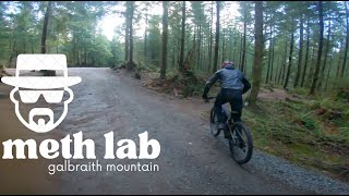
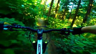
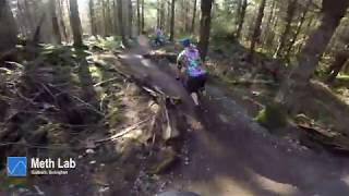
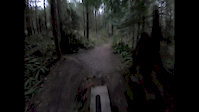
Short trail with some berms, small drops, jumps and a braided "choose your own adventure" fall line section in the middle.
Access Info
Not signed. Shares trail entrance with Dog Patch. Small trail head on the left 10ft off the road. Another unmapped trail splits off it to the left a little ways in.
Local Trail Association
-
Please consider joining or donating to the local trail association to supportdonate to earn trail karma!
trail development & maintenance.
Traditionally Indigenous Territory
More Stats for Meth Lab mountain bike trail trail
-
Altitude change-106 ft
-
Altitude min834 ft
-
Altitude max941 ft
-
Altitude start941 ft
-
Altitude end834 ft
-
Grade-9.866%
-
Grade max-31.193%
-
Grade min-6.143%
-
Distance down1,055 ft
-
Avg time00:01:33
-
Avg reverse time00:03:21
- view trail stats
close
Trail Conditions
- Unknown
- Snow Groomed
- Snow Packed
- Snow Covered
- Freeze/thaw Cycle
- Icy
- Prevalent Mud
- Wet
- Variable
- Ideal
- Dry
- Very Dry
Trail Ridden Direction
Trailforks scans users ridelogs to determine the most popular direction each trail is ridden. A good flowing trail network will have most trails flowing in a single direction according to their intension.
The colour categories are based on what percentage of riders are riding a trail in its intended direction.
- > 96%
- > 90%
- > 80%
- > 70%
- > 50%
- < 50%
Trail Last Ridden
Trailforks scans ridelogs to determine the last time a trail was ridden.
- < 2 days
- < 1 week
- < 2 weeks
- < 1 month
- < 6 months
- > 6 months
Trail Ridden Direction
The intended direction a trail should be ridden.
- Downhill Only
- Downhill Primary
- Both Directions
- Uphill Primary
- Uphill Only
- One Direction
Contribute Details
Colors indicate trail is missing specified detail.
- Description
- Photos
- Description & Photos
- Videos
Trail Popularity ?
Trailforks scans ridelogs to determine which trails are ridden the most in the last 9 months.
Trails are compared with nearby trails in the same city region with a possible 25 colour shades.
Think of this as a heatmap, more rides = more kinetic energy = warmer colors.
- most popular
- popular
- less popular
- not popular
ATV/ORV/OHV Filter
Max Vehicle Width
inches
Radar Time
LEGEND
Trail Difficulties
Trail Report Status
- Access Road/Trail
- White
- Green
- Blue
- Black
- Double Black Diamond
Trail Report Status
- Clear / Green
- Minor Issue / Yellow
- Significant Issue / Amber
- Closed
- Land Owner Overlay
- Wilderness (typically no bikes in USA)
- BLM (public)
- USFS (Wildlife sanctuaries darker than usfs)
- State land
- Indigenous
- Military
Trail Conditions
- Unknown
- Snow Groomed
- Snow Packed
- Snow Covered
- Freeze/thaw Cycle
- Icy
- Prevalent Mud
- Wet
- Variable
- Ideal
- Dry
- Very Dry
- Map Markers
Trail Head
Photo
Directory Listing
Riding Area
TTF
Parking
Viewpoint
Information
Warning
Directions
Sight
Restrooms
eBike Charging Point
Water Fountain/Source
Gate
Trail Sign
Table or Bench
Ladder
Stairs
Bridge
Boardwalk
Camping
Cabin
Lodge
Bear Cache
Dock
Ranger Station
Summit
Other
Directions to meth-lab trailhead
(48.708890, -122.416930)
update trails status or condition
Meth Lab Trail Reports
view all reports »
Recent Ridelog Activity on Trail
Past Week
- 34 rides
- 9 miles avg distance
6 Months
- 776 rides
- 10 miles avg distance
All
- 5,398 rides
Photos
more »
Routes with this trail
more »
Reviews / Comments
No reviews yet, be the first to write a review or ask a question.
Use trail reports to comment on trail conditions.
Videos
more »
Nearby Trails
- Rd 2020 66 ft
- Road 2030 371 ft
- Rank Advancement 581 ft
- Pipeline / Gate And Switch Connector 1,624 ft
- Dog Patch 1,959 ft
- embed Meth Lab trail on your website
- By kyleyoungtransition & contributors
- #8615 - 2,333 views
- subscribe
- login to download gpx or kml files.
Open trail in mobile app