more stats
3,504 ft
Distance
47 ft
Climb
-86 ft
Descent
00:07:09
Avg time
-37 ft
Altitude change
926 ft
Altitude min
1,010 ft
Altitude max
985 ft
Altitude start
948 ft
Altitude end
-1%
Grade
-21.9%
Grade max
12.1%
Grade min
1,332 ft
Distance climb
1,516 ft
Distance down
656 ft
Distance flat
00:07:09
Avg time

Missing Link Details

  • Activities
    • Mountain Bike
    • Hike
    • Trail Running
  • Riding Area
    Laguna Coast Wilderness Park
    Laguna Beach, California
  • Difficulty Rating
  • Voted Difficulty
    Blue (3 votes)
  • Local Popularity
    100 in Mountain Biking [+]
    • 100 in Trail Running
    • 90 in Hiking
  • Global Ranking
    #32309 in Mountain Biking [+]
    • #2661 in Trail Running
    • #3496 in Hiking
  • Trail Type
    Singletrack
  • Bike Type
    AM, XC
  • Direction
    Both Directions
    Popular Direction Shown
  • Climb Difficulty
    Blue
  • Physical Rating
    Easy
  • Trail Visibility
    Always easy to follow
  • TTFs on Trail
    Drop, Jump, Rock Garden
  • Land Owner
    Laguna Canyon Foundation

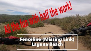
Fun little trail usually approached from morro ridge road with a slight climb up where there is a sort of lookout over the entire park, beautiful view all the way to the ocean. then you drop down a fun descent that is fast and swoopy, usually followed up with continuation on fence line, also swoopy.

Access Info

can access from 133, up willow, up bonmer ridge, up morro road.

Local Trail Association
Traditionally Indigenous Territory

Recent Activity on Trail

Past Week
  • 16 rides
  • 16 miles average
6 Months
  • 258 rides
  • 14 miles avg distance
All
  • 2,505 rides
  • Last: Jun 28, 2026
c1c2c3c4
January
February
March
April
May
June
July
August
September
October
November
December
update trails status or condition

Missing Link Trail Reports

Status:
on Jun 5, 2026
Dry
Avg: 4.07 (21 votes)
Your vote: 0

view (21,971)
close
3D
Trail Conditions
  • Unknown
  • Snow Groomed
  • Snow Packed
  • Snow Covered
  • Snow Cover Partial
  • Freeze/thaw Cycle
  • Icy
  • Prevalent Mud
  • Wet
  • Variable
  • Ideal
  • Dry
  • Very Dry
Trail Flow (Ridden Direction)
Trailforks scans users ridelogs to determine the most popular direction each trail is ridden. A good flowing trail network will have most trails flowing in a single direction according to their intension.
The colour categories are based on what percentage of riders are riding a trail in its intended direction.
  • > 96%
  • > 90%
  • > 80%
  • > 70%
  • > 50%
  • < 50%
  • bi-directional trail
  • no data
Trail Last Ridden
Trailforks scans ridelogs to determine the last time a trail was ridden.
  • < 2 days
  • < 1 week
  • < 2 weeks
  • < 1 month
  • < 6 months
  • > 6 months
Trail Ridden Direction
The intended direction a trail should be ridden.
  • Downhill Only
  • Downhill Primary
  • Both Directions
  • Uphill Primary
  • Uphill Only
  • One Direction
Contribute Details
Colors indicate trail is missing specified detail.
  • Description
  • Photos
  • Description & Photos
  • Videos
Trail Popularity ?
Trailforks scans ridelogs to determine which trails are ridden the most in the last 9 months. Trails are compared with nearby trails in the same city region with a possible 25 colour shades. Think of this as a heatmap, more rides = more kinetic energy = warmer colors.
  • most popular
  • popular
  • less popular
  • not popular
ATV/ORV/OHV Filter
Max Vehicle Width
inches
US Cell Coverage
Legend
cell carrier legend

Radar Time
Activity Recordings
Trailforks uses anonymized public activity data. ?
Activity Recordings
Trailforks uses anonymized public activity data. ?
Personal Heatmap
Activity Types
all / none
Options
2
Date range month
Winter Trails
Warning A routing network for winter maps does not exist. Selecting trails using the winter trails layer has been disabled.
Missing Trails
Most Popular
Least Popular
Trails are colored based on popularity. The more popular a trail is, the more red. Less popular trails trend towards green.
Jump Magnitude Heatmap
Heatmap of where riders jump on trails. Zoom in to see individual jumps, click circles to view jump details.
BC Backroad Status

Service Road Atlas is a free to use, community-driven service for viewing and creating reports on the numerous back-country service roads around B.C. and Alberta.

map legend
Slope Aspect
Direction the slope faces
Flat N NE E SE S SW W NW
Trails Deemphasized
Trails are shown in grey.
disable
Only show trails with no bike usage.
Enable
Suggested Layers
Based on selected activity type

    Save the current map location and zoom level as your default home location whenever this page is loaded.

    Save
        Directions to missing-link-42844 trailhead (33.591650, -117.783030)

        Photos

        19 more »
        34 |
        Oct 8, 2023 @ 2:45pm
        Oct 8, 2023
        56 |
        May 22, 2023 @ 12:34pm
        May 22, 2023
        41 |
        May 22, 2023 @ 12:34pm
        May 22, 2023
        43 |
        Mar 7, 2023 @ 10:58am
        Mar 7, 2023

        Videos

        11 more »
        youtuber Fenceline (Missing Link) MTB Trail | Laguna Canyon
        14:39 | 347 | Jun 9, 2020 , Laguna Beach
        Missing Link and Fence Line
        6:05 | 83 | Mar 15, 2025 , Laguna Beach
        Fenceline/Missing Link - Crystal Cove MTB | 4k...
        4:46 | 121 | Jun 11, 2024 , Laguna Beach
        SoCal Fun at Laguna Ridge (T&A) and Lizard...
        18:29 | 129 | Jan 18, 2024 , Laguna Beach

        Routes with this trail

        3.5 11 miles 1,520 ft 7
        Laguna Coast Wilderness Park is another fun riding location closer to the beach in Orange County, much...
        5.0 27 miles 3,783 ft 24 Loop
        Take a tour through 3 different outdoor parks with this route! Nothing too difficult here- as long as you...
        5.0 9 miles 1,457 ft 9 Loop
        Short route to connect Moro Ridge Rd to Rattlesnake

        7 Reviews & Comments


        We hope you've been enjoying Trailforks!

        Create a FREE account to view trail comments and much more.

        • By IcarusOnFireTF Pro & contributors
        • #42844 - 3,888 views

        Frequently Asked Questions About Missing Link

        Where is Missing Link located?
        Missing Link is located in Laguna Coast Wilderness Park, Laguna Beach, California, United States. It is part of the Laguna Coast Wilderness Park trail network. The trailhead is located at coordinates 33.59165, -117.78303.
        How hard is Missing Link?
        Missing Link is rated as Blue difficulty. The physical rating is Easy. The average grade is 1%. The climb difficulty is rated Blue.
        What is the elevation gain for Missing Link?
        Missing Link has 14 m of elevation gain. The trail has 26 m of elevation descent. The elevation ranges from 282 m to 308 m.
        Is Missing Link a point to point trail?
        Missing Link is not a point to point trail. The direction is Both Directions. The trail type is singletrack.

        Hit the Trail

        Open in App

        Get this trail on your phone instantly.
        open trail in app

        Download Trail

        Save to wishlist, Garmin & download.
        save the trail

        Find Related Routes

        Find routes and users activities that include this trail.
        find routes for this trail

        You must enter a description before submitting.