more stats
2,136 ft
Distance
-105 ft
Descent
00:03:01
Avg time
-103 ft
Altitude change
1,274 ft
Altitude min
1,379 ft
Altitude max
1,379 ft
Altitude start
1,276 ft
Altitude end
-4.8%
Grade
-17.4%
Grade max
2.4%
Grade min
171 ft
Distance climb
1,434 ft
Distance down
535 ft
Distance flat
00:03:01
Avg time

Monkey Boy Details

  • Activities
    • Mountain Bike
    • E-Bike
    • Hike
    • Trail Running
  • Riding Area
    The Hydrocut
    Kitchener-Waterloo, Ontario
  • Difficulty Rating
  • Voted Difficulty
    Blue (1 vote)
  • Local Popularity
    100 in Mountain Biking [+]
    • 95 in E-Biking
    • 90 in Trail Running
    • 100 in Hiking
  • Global Ranking
    #1909 in Mountain Biking [+]
    • #13079 in E-Biking
    • #35005 in Trail Running
    • #3453 in Hiking
  • Trail Type
    Singletrack
  • Bike Type
    XC
  • Physical Rating
    Easy
  • Trail Visibility
    Always easy to follow
  • eBike Allowed
    Yes up to Class 1
  • Land Owner

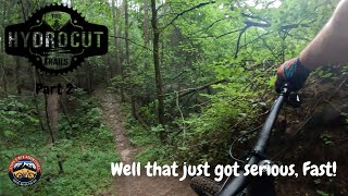
Great down hill from the Map Kiosk. Loads of flow with a great sweeping corner at the end. Keep the flow going all the way back to the Glasgow Lot.

Trail Supporters
Local Trail Association

Recent Activity on Trail

Past Week
  • 43 rides
  • 18.9 km average
6 Months
  • 179 rides
  • 17.8 km avg distance
All
  • 4,880 rides
  • Last: Jun 5, 2026
c1c2c3c4
January
February
March
April
May
June
July
August
September
October
November
December
update trails status or condition

Monkey Boy Trail Reports

Status:
on May 22, 2026
Ideal
Avg: 4.39 (38 votes)
Your vote: 0

view (30,064)
close
3D
Trail Conditions
  • Unknown
  • Snow Groomed
  • Snow Packed
  • Snow Covered
  • Snow Cover Partial
  • Freeze/thaw Cycle
  • Icy
  • Prevalent Mud
  • Wet
  • Variable
  • Ideal
  • Dry
  • Very Dry
Trail Flow (Ridden Direction)
Trailforks scans users ridelogs to determine the most popular direction each trail is ridden. A good flowing trail network will have most trails flowing in a single direction according to their intension.
The colour categories are based on what percentage of riders are riding a trail in its intended direction.
  • > 96%
  • > 90%
  • > 80%
  • > 70%
  • > 50%
  • < 50%
  • bi-directional trail
  • no data
Trail Last Ridden
Trailforks scans ridelogs to determine the last time a trail was ridden.
  • < 2 days
  • < 1 week
  • < 2 weeks
  • < 1 month
  • < 6 months
  • > 6 months
Trail Ridden Direction
The intended direction a trail should be ridden.
  • Downhill Only
  • Downhill Primary
  • Both Directions
  • Uphill Primary
  • Uphill Only
  • One Direction
Contribute Details
Colors indicate trail is missing specified detail.
  • Description
  • Photos
  • Description & Photos
  • Videos
Trail Popularity ?
Trailforks scans ridelogs to determine which trails are ridden the most in the last 9 months. Trails are compared with nearby trails in the same city region with a possible 25 colour shades. Think of this as a heatmap, more rides = more kinetic energy = warmer colors.
  • most popular
  • popular
  • less popular
  • not popular
ATV/ORV/OHV Filter
Max Vehicle Width
inches
US Cell Coverage
Legend
cell carrier legend

Radar Time
Activity Recordings
Trailforks uses anonymized public activity data. ?
Activity Recordings
Trailforks uses anonymized public activity data. ?
Personal Heatmap
Activity Types
all / none
Options
2
Date range month
Winter Trails
Warning A routing network for winter maps does not exist. Selecting trails using the winter trails layer has been disabled.
Missing Trails
Most Popular
Least Popular
Trails are colored based on popularity. The more popular a trail is, the more red. Less popular trails trend towards green.
Jump Magnitude Heatmap
Heatmap of where riders jump on trails. Zoom in to see individual jumps, click circles to view jump details.
BC Backroad Status

Service Road Atlas is a free to use, community-driven service for viewing and creating reports on the numerous back-country service roads around B.C. and Alberta.

map legend
Slope Aspect
Direction the slope faces
Flat N NE E SE S SW W NW
Trails Deemphasized
Trails are shown in grey.
disable
Only show trails with no bike usage.
Enable
Suggested Layers
Based on selected activity type

    Save the current map location and zoom level as your default home location whenever this page is loaded.

    Save
        Directions to monkey-boy trailhead (43.426770, -80.589080)

        Photos

        2 more »
        57 |
        Oct 23, 2024 @ 5:23pm
        Oct 23, 2024
        283 |
        Sep 18, 2020 @ 11:47pm
        Sep 18, 2020

        Videos

        9 more »
        Went so fast on Monkey Boy I jumped going up...
        32:34 | 0 | Jun 5, 2026 , Kitchener-Waterloo
        The Hydrocut Part 2
        12:41 | 17 | Feb 8, 2026 , Kitchener-Waterloo
        We take Monkey Boy on a Wild MTB Group Ride |...
        55:32 | 34 | Aug 14, 2025 , Kitchener-Waterloo
        We take Monkey Boy during Huge Group Ride for...
        22:57 | 67 | Aug 30, 2024 , Kitchener-Waterloo

        Trail Lists

        Routes with this trail

        3.0 13 miles 1,233 ft 22 Loop
        The most popular loop that hits all of the singletrack trails available at the Hydrocut. Frankenstein,...
        5.0 13 miles 1,222 ft 35 Loop
        The Hydrocut is running an official Time Trial this year using Strava. The course has been set. It was...
        5.0 6 miles 516 ft 23 Loop
        This route maximizes downhill trails while minimizing uphill trails. Before riding out, ride Adam's Run if...

        3 Reviews & Comments


        We hope you've been enjoying Trailforks!

        Create a FREE account to view trail comments and much more.

        Frequently Asked Questions About Monkey Boy

        Where is Monkey Boy located?
        Monkey Boy is located in The Hydrocut, Kitchener-Waterloo, Ontario, Canada. It is part of the The Hydrocut trail network. The trailhead is located at coordinates 43.42677, -80.58908.
        How hard is Monkey Boy?
        Monkey Boy is rated as Blue difficulty. The physical rating is Easy. The average grade is 4.8%.
        What is the elevation gain for Monkey Boy?
        The trail has 32 m of elevation descent. The elevation ranges from 388 m to 420 m.
        How long is Monkey Boy?
        Monkey Boy is 651.0 m long. The trail type is singletrack.

        Hit the Trail

        Open in App

        Get this trail on your phone instantly.
        open trail in app

        Download Trail

        Save to wishlist, Garmin & download.
        save the trail

        Find Related Routes

        Find routes and users activities that include this trail.
        find routes for this trail

        You must enter a description before submitting.