more stats
1.5 miles
Distance
-662 ft
Descent
00:04:59
Avg time
-662 ft
Altitude change
1,156 ft
Altitude min
1,817 ft
Altitude max
1,817 ft
Altitude start
1,155 ft
Altitude end
-8.6%
Grade
-40.5%
Grade max
-0.7%
Grade min
1 mile
Distance down
30 ft
Distance flat
00:04:59
Avg time

Monko Details

  • Activities
    • Mountain Bike
    • E-Bike
  • Riding Area
    Parc du Mont-Comi
    Mont-Joli, Quebec
  • Ref Number
    #5
  • Difficulty Rating
  • Voted Difficulty
    Green (1 vote)
  • Local Popularity
    85 in Mountain Biking [+]
    • 100 in E-Biking
  • Global Ranking
    #23063 in Mountain Biking [+]
    • #17887 in E-Biking
  • Trail Type
    Machine Groomed
  • Bike Type
    DH, AM, XC
  • Climb Difficulty
    Green
  • Trail Visibility
    Always easy to follow
  • Family Friendly
    Yes
  • eBike Allowed
    Yes up to Class 1
  • TTFs on Trail
    Berm, Bridge, Roller Coaster
  • Year Opened
    2020
  • Land Owner

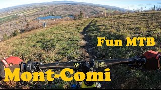
Découvrez ou redécouvrez, la star incontestée de nos sentiers Remise à neuf pour 2025, cette piste machine built offre un flow incomparable, de la vitesse, des berms et des rollers spectaculaires . Que vous fassiez vos premiers tours de roue ou que vous soyez un expert de la vitesse, La Monko est une valeur sûre qui garantit le sourire à chaque descente !

Le grand chef Monko a toujours su veiller sur sa communauté tout en s'assurant que chacun d'entre eux puissent être heureux
Un clin d’œil a nos ancêtres de la tribu Mitis qui furent les premiers à fouler ce sol et profiter des biens faits que peux nous apporter la nature.

Bike Park

Local Trail Association
Traditionally Indigenous Territory

Recent Activity on Trail

Past Week
  • 0 rides
  •  
6 Months
  • 0 rides
  •  
All
  • 98 rides
  • Last: Jun 4, 2026
c1c2c3c4
January
February
March
April
May
June
July
August
September
October
November
December
Status:
on May 31, 2026
Variable
Avg: 4.41 (6 votes)
Your vote: 0

view (1,107)
close
3D
Trail Conditions
  • Unknown
  • Snow Groomed
  • Snow Packed
  • Snow Covered
  • Snow Cover Partial
  • Freeze/thaw Cycle
  • Icy
  • Prevalent Mud
  • Wet
  • Variable
  • Ideal
  • Dry
  • Very Dry
Trail Flow (Ridden Direction)
Trailforks scans users ridelogs to determine the most popular direction each trail is ridden. A good flowing trail network will have most trails flowing in a single direction according to their intension.
The colour categories are based on what percentage of riders are riding a trail in its intended direction.
  • > 96%
  • > 90%
  • > 80%
  • > 70%
  • > 50%
  • < 50%
  • bi-directional trail
  • no data
Trail Last Ridden
Trailforks scans ridelogs to determine the last time a trail was ridden.
  • < 2 days
  • < 1 week
  • < 2 weeks
  • < 1 month
  • < 6 months
  • > 6 months
Trail Ridden Direction
The intended direction a trail should be ridden.
  • Downhill Only
  • Downhill Primary
  • Both Directions
  • Uphill Primary
  • Uphill Only
  • One Direction
Contribute Details
Colors indicate trail is missing specified detail.
  • Description
  • Photos
  • Description & Photos
  • Videos
Trail Popularity ?
Trailforks scans ridelogs to determine which trails are ridden the most in the last 9 months. Trails are compared with nearby trails in the same city region with a possible 25 colour shades. Think of this as a heatmap, more rides = more kinetic energy = warmer colors.
  • most popular
  • popular
  • less popular
  • not popular
ATV/ORV/OHV Filter
Max Vehicle Width
inches
US Cell Coverage
Legend
cell carrier legend

Radar Time
Activity Recordings
Trailforks uses anonymized public activity data. ?
Activity Recordings
Trailforks uses anonymized public activity data. ?
Personal Heatmap
Activity Types
all / none
Options
2
Date range month
Winter Trails
Warning A routing network for winter maps does not exist. Selecting trails using the winter trails layer has been disabled.
Missing Trails
Most Popular
Least Popular
Trails are colored based on popularity. The more popular a trail is, the more red. Less popular trails trend towards green.
Jump Magnitude Heatmap
Heatmap of where riders jump on trails. Zoom in to see individual jumps, click circles to view jump details.
BC Backroad Status

Service Road Atlas is a free to use, community-driven service for viewing and creating reports on the numerous back-country service roads around B.C. and Alberta.

map legend
Slope Aspect
Direction the slope faces
Flat N NE E SE S SW W NW
Trails Deemphasized
Trails are shown in grey.
disable
Only show trails with no bike usage.
Enable
Suggested Layers
Based on selected activity type

    Save the current map location and zoom level as your default home location whenever this page is loaded.

    Save
        Directions to monko trailhead (48.465640, -68.205970)

        Photos

        15 more »
        165 |
        Aug 1, 2020 @ 5:28pm
        Aug 1, 2020
        139 |
        Jul 20, 2020 @ 2:54am
        Jul 20, 2020
        31 |
        Feb 27, 2026 @ 11:46am
        Feb 27, 2026
        47 |
        Feb 27, 2026 @ 11:46am
        Feb 27, 2026

        Videos

        2 more »
        De grandes nouveautées au Mont-Comi par FunMTB
        13:02 | 204 | Nov 18, 2021 , Mont-Joli
        My run
        4:26 | 84 | Jul 1, 2021 , Mont-Joli

        2 Reviews & Comments


        We hope you've been enjoying Trailforks!

        Create a FREE account to view trail comments and much more.

        • By StephaneMarceauTF Pro TRAILFORKS & contributors
        • #89780 - 2,634 views

        Frequently Asked Questions About Monko

        Where is Monko located?
        Monko is located in Parc du Mont-Comi, Mont-Joli, Quebec, Canada. It is part of the Parc du Mont-Comi trail network. The trailhead is located at coordinates 48.46564, -68.20597.
        How hard is Monko?
        Monko is rated as Green difficulty. The average grade is 8.6%. The climb difficulty is rated Green.
        What is the elevation gain for Monko?
        Monko has 1 m of elevation gain. The trail has 203 m of elevation descent. The elevation ranges from 352 m to 554 m.
        How long is Monko?
        Monko is 2.3 km long. The trail type is machine groomed.

        Hit the Trail

        Open in App

        Get this trail on your phone instantly.
        open trail in app

        Download Trail

        Save to wishlist, Garmin & download.
        save the trail

        Find Related Routes

        Find routes and users activities that include this trail.
        find routes for this trail

        You must enter a description before submitting.