
Open in App
Get this trail on your phone instantly.

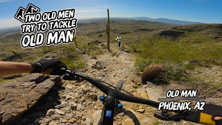
A steep, primitive, unmaintained trail that is unlike the comparatively well traveled and well "groomed" South Mountain standards like Javelina, Geronimo, Beverly and National.
Note that this social trail is currently unsanctioned, but it is planned to be adopted in coming years as part of the Corona de Loma Loop according to the South Mountain Trails Master Plan.
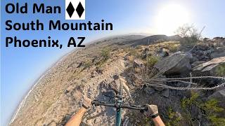
Steep drop in from the amazing vantage point just above the National saddle. Head right at the fast fork, then a slight uphill over some technical rock formations before you begin the first major descent.
Once you start downhill over the first large, undulating rock slabs, expect a very loose tread with minimal grip and must make moves at speed.
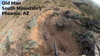
The first feature is a steep rock roll into a small rock garden followed by an immediate 90° right hander. Scout first, lots of wheel traps off the fast line.
The second feature is a slow semi-uphill 90° right into a very steep, jagged rock chute. Again, a precise line is key, and you only have split second to dial it in.
A few more narrow rock gardens brings you to a VERY exposed basalt boulder field. Not clear if there is a real rideable route through this high consequence section, but any miscalculation will result in a several hundred foot tumble off the east face of the mountain. Use extreme caution - remember, you are in a very remote part of the park with little traffic should you eat it.
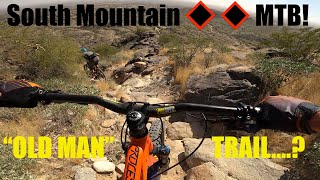
Just after this segment, you'll hit a 45° switch back that heads into the steepest sustained downhill stretch of this trail. Also happens to be the loosest, with a surface of 100% shale shards. Enjoy sliding down this and watch the few boulders sticking up near the middle of the run.
After that, you'll enter a very straightforward section of moderately technical trail that heads toward Secret Trail before linking up with Desert Classic. This section through the top of the canyon into Secret is great singletrack, and the trail is much grippier and faster, though the rocks are much sharper.
This trail is unsanctioned.
| c1 | c2 | c3 | c4 |
|---|---|---|---|
January | February | March | April |
May | June | July | August |
September | October | November | December |

Service Road Atlas is a free to use, community-driven service for viewing and creating reports on the numerous back-country service roads around B.C. and Alberta.
Save the current map location and zoom level as your default home location whenever this page is loaded.
SaveWe hope you've been enjoying Trailforks!
Create a FREE account to view trail comments and much more.
You must enter a description before submitting.

