more stats
860 ft
Distance
-60 ft
Descent
00:00:50
Avg time
-60 ft
Altitude change
551 ft
Altitude min
612 ft
Altitude max
611 ft
Altitude start
551 ft
Altitude end
-7%
Grade
-18.6%
Grade max
0.9%
Grade min
46 ft
Distance climb
623 ft
Distance down
190 ft
Distance flat
00:00:50
Avg time

Orange Peels Details

  • Activities
    • Mountain Bike
    • E-Bike
    • Hike
    • Trail Running
  • Riding Area
    Cumberland trail network
    Cumberland, British Columbia
  • Difficulty Rating
  • Local Popularity
    95 in Mountain Biking heatmap [+]
    • 95 in E-Biking
    • 45 in Trail Running
    • 55 in Hiking
  • Global Ranking
    #32643 in Mountain Biking [+]
    • #11425 in E-Biking
    • #150731 in Trail Running
    • #141215 in Hiking
  • Provincial Ranking
    #1,612 in Mountain Biking · British Columbia [+]
    • #732 in E-Biking
    • #9,046 in Trail Running
    • #8,189 in Hiking
  • Trail Type
    Singletrack
  • Direction
    Downhill Primary
    Popular Direction Shown
  • Dogs Allowed
    Yes
  • eBike Allowed
  • TTFs on Trail
    Drop

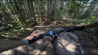
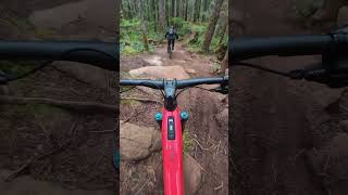
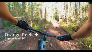
A great downhill trail to finish a trail experince on. Its short and sweet with some drops and fast turns. There are some natural jumps at the bottom of the trail and Orange Peels merges into a multi use area, so be aware of speed and other trail users when exiting the trail. Please note this trail is a downhill primary trail and it is advised not to ascend this Orange Peels. This trail is designated a Gravity trail.

Tags
DropsJumps

Local Trail Association

Recent Activity on Trail

Past Week
  • 7 rides
  • 11 miles average
6 Months
  • 672 rides
  • 11 miles avg distance
All
  • 5,591 rides
  • Last: Nov 14, 2026
c1c2c3c4
January
February
March
April
May
June
July
August
September
October
November
December
update trails status or condition

Orange Peels Trail Reports

statusdatedescription
Nov 14, 2026 @ 11:34am (America/Vancouver)
1 day
Nov 14, 2026 @ 9:02am (America/Vancouver)
2 days
Nov 13, 2026 @ 4:58pm (America/Vancouver)
2 days
clear tree a Top, at junction with Black hole
Nov 7, 2026 @ 6:02pm (America/Vancouver)
Nov 7, 2026
reporter Sml tree down on Orange peels approach trail, not on orange peels.
Oct 31, 2026 @ 7:32pm (America/Vancouver)
Oct 31, 2026
Wet and good
more »
Status:
on Nov 14, 2026
Wet
Avg: 4.27 (34 votes)
Your vote: 0

view (30,379)
close
      Directions to orange-peels trailhead (49.613690, -125.034900)

      Photos

      13 more »
      mtb
      69 |
      Nov 7, 2025 @ 1:54pm
      Nov 7, 2025
      mtb
      177 |
      Feb 7, 2022 @ 6:59pm
      Feb 7, 2022
      mtb
      258 |
      Dec 22, 2020 @ 10:45pm
      Dec 22, 2020
      report
      mtb
      11 |
      Nov 7, 2026 @ 5:02pm
      Nov 7, 2026

      Videos

      11 more »
      200+ km's of Mountain Biking Trails |...
      mtb
      13:55 | 315 | Jul 27, 2025 , Cumberland
      The best 60 second trail in Cumberland
      mtb
      0:45 | 151 | Nov 4, 2024 , Cumberland
      Orange Peels - Cumberland
      mtb
      0:18 | 245 | Mar 17, 2024 , Cumberland
      RAW: Cumberland XC with Cam McCallum
      mtb
      0:57 | 377 | Feb 2, 2022 , Cumberland

      Routes with this trail

      more »
      63 miles • 10,635 ft • 85 •
      Attempted route for 100 trails in a day - would recommend, just not during a heatwave. Special thanks to...
      6 miles • 1,137 ft • 10 •
      bucket to broadway, intro to cumberland
      15 miles • 3,211 ft • 34 • Race •
      Come join us for our 5th and final race of the year! Enduro means you can pedal up with your friends at...
      4.3 ★★★★★
      34 Ratings
      5 ★ 53%
      4 ★ 35%
      3 ★ 6%
      2 ★ 3%
      1 ★ 3%

      2 Reviews & Comments

      ripzone
      Since the re-route and smoothing out of this trail it has gone even further up my list! One of the best trails in the network due to its time to reach: fun ratio.

      We hope you've been enjoying Trailforks!

      Create a FREE account to view all trail reviews and much more.

      • By canadakaTF Pro Trailforks & contributors
      • #58535 - 4,543 views

      Frequently Asked Questions

      ▼ Where is Orange Peels located?
      Orange Peels is located in Cumberland trail network, Cumberland, British Columbia, Canada. It is part of the Cumberland trail network trail network. The trailhead is located at coordinates 49.61369, -125.0349.
      ▼ How hard is Orange Peels?
      Orange Peels is rated as Black Diamond difficulty. The average grade is 7%.
      ▼ What is the elevation gain for Orange Peels?
      The trail has 60 ft of elevation descent. The elevation ranges from 551 ft to 612 ft.
      ▼ Is Orange Peels a point to point trail?
      Orange Peels is not a point to point trail. The direction is Downhill Primary. The trail type is singletrack.
      ▼ How long is Orange Peels?
      Orange Peels is 860 ft long. The trail type is singletrack.
      ▼ Are dogs allowed on Orange Peels?
      Yes, dogs are allowed on Orange Peels. Please keep dogs on a leash where required and clean up after them.
      ▼ How do I access Orange Peels? Where is the closest parking trailhead?
      The closest parking and trailhead locations to Orange Peels are: View all parking locations in the area.
      ▼ How long does it take to ride Orange Peels?
      Based on recorded activities, it takes an average of 1 minute to ride Orange Peels. The trail is 860 ft long. Actual times will vary based on fitness level, conditions, and pace. View recent activity logs for more details.
      ▼ How busy is Orange Peels?
      Orange Peels is a very popular trail. There have been 29,308 recorded activities on this trail. The trail has received 30,379 check-ins. View recent activity on this trail.

      Hit the Trail

      Open in App

      Get this trail on your phone instantly.

      open trail in app

      Download Trail

      Save to wishlist, Garmin & download.
      save the trail

      Find Related Routes

      Find routes and users activities that include this trail.
      find routes for this trail

      You must enter a description before submitting.