
more stats
2,933 ft
Distance
2 ft
Climb
-142 ft
Descent
00:02:48
Avg time
-140 ft
Altitude change
519 ft
Altitude min
659 ft
Altitude max
659 ft
Altitude start
518 ft
Altitude end
-4.8%
Grade
-16.7%
Grade max
3.9%
Grade min
157 ft
Distance climb
1,926 ft
Distance down
850 ft
Distance flat
00:02:48
Avg time

Packwood Flow Details

  • Activities
    • Mountain Bike
  • Riding Area
    Rock Hollow
    Wildwood, Missouri
  • Difficulty Rating
  • Voted Difficulty
    Blue (2 votes)
  • Local Popularity
    80 in Mountain Biking
  • Global Ranking
    #3438 in Mountain Biking
  • State Ranking
    #11 in Mountain Biking · Missouri
  • Trail Type
    Machine Groomed
  • Bike Type
    DH, AM, DJ
  • Climb Difficulty
    Green
  • Physical Rating
    Moderate
  • Trail Visibility
    Always easy to follow
  • Season
    April-October
  • TTFs on Trail
    Berm, Drop, Jump, Gap Jump
  • Year Opened
    2021
  • Land Owner

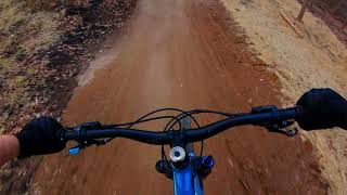
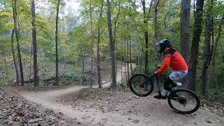
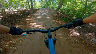
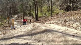
A machine cut and groomed blue flow/jump line, bikes only, Downhill Only. Includes nice berms, rollers, tabletops, some some gaps, and a nice step-up at the end with a huge berm to roll in. You can climb back up via the main Bluff view trail, or the steep climbing trail connected to the North side of the line.

Access Info

Drop in from the rock pedestal, it’s the south facing drop-in. ONLY DROP IN WHEN THERE IS NO CONSTRUCTION IN PROGRESS

Disclaimer

Bikes only, DH only.

Tags
BermsDropsJumpsRollers

Local Trail Association

Recent Activity on Trail

Past Week
  • 3 rides
  • 10 miles average
6 Months
  • 61 rides
  • 14 miles avg distance
All
  • 501 rides
  • Last: Oct 26, 2026
c1c2c3c4
January
February
March
April
May
June
July
August
September
October
November
December
update trails status or condition

Packwood Flow Trail Reports

statusdatedescription
Jul 26, 2024 @ 1:30pm
Jul 26, 2024
Rain has left the trail with lots of rock exposed but you're still able to have lots of speed. Rain has left patches of mud that can be avoided.
Jun 9, 2024 @ 11:12am
Jun 9, 2024
May 24, 2024 @ 1:04am
May 24, 2024
Apr 7, 2024 @ 6:09am
Apr 7, 2024
Trail is in bad shape after the heavy rain. a lot of dirt has been removed and exposed lots of rock. Trail is very rough and not very flowy. You...
Mar 27, 2024 @ 4:05pm
Mar 27, 2024
tree down after step up
more »
Status:
on Jul 26, 2024
Variable
Avg: 4.32 (3 votes)
Your vote: 0

view (3,934)
close
      Directions to packwood-flow trailhead (38.547600, -90.619580)

      Photos

      12 more »
      mtb
      94 |
      Dec 5, 2022 @ 4:16pm
      Dec 5, 2022
      mtb
      135 |
      Oct 29, 2022 @ 11:22am
      Oct 29, 2022
      mtb
      136 |
      Dec 24, 2021 @ 5:57pm
      Dec 24, 2021
      mtb
      114 |
      Nov 30, 2021 @ 11:48am
      Nov 30, 2021

      Videos

      5 more »
      Brand New Trail at Bluff View - GHB Downhill...
      mtb
      0:20 | 598 | Dec 25, 2021 , Wildwood
      Packwood Edit
      mtb
      3:01 | 315 | Dec 24, 2021 , Wildwood
      Best Flow Trail in STL
      mtb
      3:43 | 407 | Dec 19, 2021 , Wildwood
      Bluffview MTB DH Trail
      mtb
      5:31 | 444 | Nov 30, 2021 , Wildwood

      Routes with this trail

      9 miles • 921 ft • 2 • Point to Point • Race •
      Route for the Zombiewood Enduro. Stages will be done twice, in 1-2-3-4-1-2-3-4 order.
      5.0 ★★★★★
      3 Ratings
      5 ★ 100%
      4 ★
      3 ★
      2 ★
      1 ★

      4 Reviews & Comments

      E1z9bU
      Best flow trail in stl, no competition. Send it as fast as your abilities can handle!

      We hope you've been enjoying Trailforks!

      Create a FREE account to view all trail reviews and much more.

      • By E1z9bU & contributors
      • #488688 - 2,012 views

      Frequently Asked Questions

      ▼ Where is Packwood Flow located?
      Packwood Flow is located in Rock Hollow, Wildwood, Missouri, United States. It is part of the Rock Hollow trail network. The trailhead is located at coordinates 38.5476, -90.61958.
      ▼ How hard is Packwood Flow?
      Packwood Flow is rated as Blue difficulty. The physical rating is Moderate. The average grade is 4.8%. The climb difficulty is rated Green.
      ▼ What is the elevation gain for Packwood Flow?
      Packwood Flow has 2 ft of elevation gain. The trail has 142 ft of elevation descent. The elevation ranges from 519 ft to 659 ft.
      ▼ How long is Packwood Flow?
      Packwood Flow is 2,933 ft long. The trail type is machine groomed.
      ▼ Are dogs allowed on Packwood Flow?
      There is no information about dogs being allowed on Packwood Flow. Check with local trail managers or the trail page for the latest access rules.
      ▼ When is the best time of year to ride Packwood Flow?
      Packwood Flow is best visited during: April-October.
      ▼ How do I access Packwood Flow? Where is the closest parking trailhead?
      The closest parking and trailhead locations to Packwood Flow are: View all parking locations in the area.
      ▼ How long does it take to ride Packwood Flow?
      Based on recorded activities, it takes an average of 3 minutes to ride Packwood Flow. The trail is 2,933 ft long. Actual times will vary based on fitness level, conditions, and pace. View recent activity logs for more details.
      ▼ How busy is Packwood Flow?
      Packwood Flow is a very popular trail. There have been 2,553 recorded activities on this trail. The trail has received 3,934 check-ins. View recent activity on this trail.

      Hit the Trail

      Open in App

      Get this trail on your phone instantly.

      open trail in app

      Download Trail

      Save to wishlist, Garmin & download.
      save the trail

      Find Related Routes

      Find routes and users activities that include this trail.
      find routes for this trail

      You must enter a description before submitting.

