

Open in App
Get this trail on your phone instantly.

Norsk (English below):
Forlengelse av den legendariske "Påskestien"
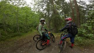
"Påskeekstra" er en utfordrende og teknisk sti med bratte, røffe partier fulle av røtter og steiner. Perfekt for erfarne syklister som liker krevende terreng. Fulldempet terrengsykkel anbefales, men ikke et must.
Fra Espeset (til toppen av Påskeekstra)
Kjør eller shuttle til toppen av Espeset (vendepunktet ved enden av asfaltveien). Fortsett rett fram på grusveien, og ta første skogsvei til venstre. Passer gjennom en grind og tråkk bratt oppover til veien flater ut. I stikrysset, hold venstre. Stien tar av til høyre kort tid etter krysset.
Fra Bringenattveien (til nedre del av Påskeekstra)
Foretrekker du å sykle hele veien til toppen, er dette beste rute. Følg veien fra Nesbyen sentrum mot Tunhovd. Etter den første stigningen ut av sentrum, flater veien ut og krysser Rukkedøla via en bro. Rett etter broen, sving høyre og følg grusveien oppover gjennom flere svinger. Etter ca. 4 km når du toppen. Passér stien merket "Bringenatten" på høyre side og fortsett 50 meter videre. Stien Påskeekstra starter på høyre side.
English:
Extension trail above the legendary "Påskestien" (Easter Trail)
"Påskeekstra" is a challenging, technical ride featuring rough and steep sections with roots and rocks. Ideal for experienced cyclists who enjoy demanding terrain. A full-suspension mountain bike is highly recommended.
From Espeset (to reach the top of Påskeekstra)
Drive or shuttle to the top of Espeset (the turnaround area at the end of the paved road). Continue straight along the gravel road, then take the first forest road on the left. Pass through a gate and pedal steeply uphill until the road flattens out. At the junction, keep left. The trail branches off to the right shortly after the junction.
From Bringenattveien (to reach the lower half of Påskeekstra)
If you prefer to bike all the way to the top, this is the best route. Follow the road from Nesbyen center toward Tunhovd. After the initial climb out of the center, the road levels out and crosses the Rukkedøla river via a bridge. Just after the bridge, turn right and follow the gravel road uphill through a series of turns. After about 4 km, you will reach the top. Pass the trail marked "Bringenatten" on the right and continue for another 50 meters. The Påskeekstra trail starts on the right side.
| c1 | c2 | c3 | c4 |
|---|---|---|---|
January | February | March | April |
May | June | July | August |
September | October | November | December |


Service Road Atlas is a free to use, community-driven service for viewing and creating reports on the numerous back-country service roads around B.C. and Alberta.
Save the current map location and zoom level as your default home location whenever this page is loaded.
SaveWe hope you've been enjoying Trailforks!
Create a FREE account to view all trail reviews and much more.
 H Rides & contributors
You must enter a description before submitting.

