


more stats
5,200 ft
Distance
-1,223 ft
Descent
00:12:39
Avg time
-1,223 ft
Altitude change
542 ft
Altitude min
1,765 ft
Altitude max
1,765 ft
Altitude start
541 ft
Altitude end
-23.5%
Grade
-104.6%
Grade max
-2.9%
Grade min
5,200 ft
Distance down
00:12:39
Avg time

Påskestien Details

  • Activities
    • Mountain Bike
    • E-Bike
  • Riding Area
  • AKA
    Stage 4 Enduro 2017
  • Difficulty Rating
  • Local Popularity
    75 in Mountain Biking [+]
    • 75 in E-Biking
  • Global Ranking
    #94966 in Mountain Biking [+]
    • #101614 in E-Biking
  • National Ranking
    #590 in Mountain Biking · Norway [+]
    • #826 in E-Biking
  • Trail Type
    Singletrack
  • Bike Type
    DH, AM
  • Direction
    Downhill Primary
    Popular Direction Shown
  • Physical Rating
    Hard
  • Trail Visibility
    Always easy to follow
  • Dogs Allowed
    Yes
  • eBike Allowed
    Yes up to Class 1
  • Ride in Rain
    Yes

Norsk (English below):
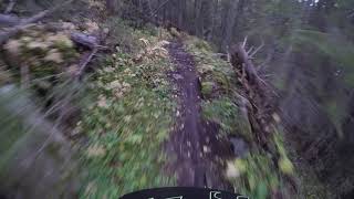
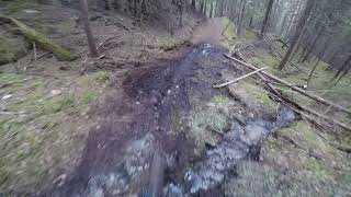
En klassiker i Nesbyen Best når det er tørt – røttene kan bli glatte. Stien har god flyt og gir en fartsfylt, berg-og-dalbanefølelse, selv om noen partier er røffe og tekniske.

Viktig: Ikke parker på privat eiendom der stien ender. Bruk parkering langs Alfarvegen eller i sentrum.

Tre alternative tilkomstruter:
1️⃣ Sykle (eller shuttle) opp grusveien noen hundre meter nord for der stien ender.
2️⃣ Sykle opp Bringenattvegen / Lyshøgdvegen fra Rukkedalen til starten av Påskeekstra, og følg videre til Påskestien.
3️⃣ Sykle fra toppen av Espeset, via Påskeekstra.

Fra sentrum, sykle eller shuttle langs Alfarvegen mot Gol. Ved en stor fylling eller rasvern, ta til venstre og hold venstre. Etter andre 180-graders sving, ta første vei til venstre. Du kan kjøre et stykke opp til veien blir for bratt og røff. Derfra blir det bratt – gå eller sykle. Når veien flater ut etter ca. 100 m i gjengrodd terreng, starter stien bratt ned til venstre.

English:
A classic in Nesbyen! Best when dry—roots can be slippery. The trail is fast and flowy, with some rough, technical parts and a roller-coaster feel.

Important: Do not park on private property where the trail ends. Use parking along Alfarvegen or in the town center.

Three alternative access routes:
1️⃣ Ride (or shuttle) up the gravel road a few hundred meters north of the trail end.
2️⃣ Ride up Bringenattvegen / Lyshøgdvegen from Rukkedalen to Påskeekstra, then continue to Påskestien.
3️⃣ Ride from the top of Espeset via Påskeekstra trail.

From town, bike or shuttle along Alfarvegen towards Gol. At a large embankment or landslide barrier, turn left and keep left. After the second hairpin turn, take the first left. You can drive partway until the road gets too steep and rough. From there, push or ride. When the road flattens after ~100 m of overgrowth, the trail drops steeply to the left.

Tags
FlowyShuttle access

Recent Activity on Trail

Past Week
  • 0 rides
  •  
6 Months
  • 2 rides
  • 7 miles avg distance
All
  • 26 rides
  • Last: Sep 26, 2026
c1c2c3c4
January
February
March
April
May
June
July
August
September
October
November
December
update trails status or condition

Påskestien Trail Reports

statusdatedescription
Aug 12, 2025 @ 8:22am
Aug 12, 2025
Two Small tree down across trail, can navigate over or around
Jul 17, 2025 @ 10:18am
Jul 17, 2025
Jun 7, 2025 @ 11:21am
Jun 7, 2025
Two trees, otw. 2025.
May 2, 2024 @ 11:19am
May 2, 2024
There is tree fallen in mid section. Easy to spot.
Sep 10, 2023 @ 4:33am
Sep 10, 2023
Still wet after heavy rains of last month. One tree fallen to the trail but I couldn’t take it out with bare hands.
more »
Status:
on Aug 12, 2025
Ideal
Avg: 4.07 (11 votes)
Your vote: 0

view (229)
close
      Directions to paskestien trailhead (60.581340, 9.073270)

      Photos

      3 more »
      mtb
      144 |
      Dec 10, 2024 @ 3:36am
      Dec 10, 2024
      mtb
      180 |
      Aug 21, 2021 @ 6:20am
      Aug 21, 2021
      mtb
      127 |
      Aug 21, 2021 @ 6:18am
      Aug 21, 2021

      Videos

      4 more »
      Wait for it..
      mtb
      0:38 | 269 | Sep 16, 2021 , My City
      Påskestien | Nesbyen | Bratt singletrack
      mtb
      7:44 | 571 | Sep 3, 2020 , My City
      Nesbyen Trail Camp 2018/Påskestien
      mtb
      5:30 | 394 | May 17, 2019 , My City
      Påskestien Nesbyen
      mtb
      5:29 | 822 | May 17, 2019 , My City
      4.2 ★★★★★
      11 Ratings
      5 ★ 45%
      4 ★ 36%
      3 ★ 9%
      2 ★ 9%
      1 ★

      2 Reviews & Comments

      Roq
      Rough but mostly interesting except som straight down runs in a rut . The whole trail is within the woods - steep and rocky with no longer flat sections.

      We hope you've been enjoying Trailforks!

      Create a FREE account to view all trail reviews and much more.

      • By larsstorheimTF Pro H Rides & contributors
      • #183853 - 1,824 views

      Frequently Asked Questions

      ▼ Where is Påskestien located?
      Påskestien is located in Nesbyen sentrum, Norway. It is part of the Nesbyen sentrum trail network. The trailhead is located at coordinates 60.58134, 9.07327.
      ▼ How hard is Påskestien?
      Påskestien is rated as Black difficulty. The physical rating is Hard. The average grade is 23.5%.
      ▼ What is the elevation gain for Påskestien?
      The trail has 1,223 ft of elevation descent. The elevation ranges from 542 ft to 1,765 ft.
      ▼ Is Påskestien a point to point trail?
      Påskestien is not a point to point trail. The direction is Downhill Primary. The trail type is singletrack.
      ▼ How long is Påskestien?
      Påskestien is 5,200 ft long. The trail type is singletrack.
      ▼ Are dogs allowed on Påskestien?
      Yes, dogs are allowed on Påskestien. Please keep dogs on a leash where required and clean up after them.
      ▼ When is the best time of year to ride Påskestien?
      Based on activity log data, the most popular months to ride Påskestien are:
      • June (7 activities)
      • July (7 activities)
      • August (3 activities)
      Check the reports page for current trail conditions.
      ▼ How do I access Påskestien? Where is the closest parking trailhead?
      The closest parking and trailhead locations to Påskestien are: View all parking locations in the area.
      ▼ How long does it take to ride Påskestien?
      Based on recorded activities, it takes an average of 13 minutes to ride Påskestien. The trail is 5,200 ft long. Actual times will vary based on fitness level, conditions, and pace. View recent activity logs for more details.
      ▼ How busy is Påskestien?
      Påskestien is a very popular trail. There have been 231 recorded activities on this trail. The trail has received 229 check-ins. View recent activity on this trail.

      Hit the Trail

      Open in App

      Get this trail on your phone instantly.

      open trail in app

      Download Trail

      Save to wishlist, Garmin & download.
      save the trail

      Find Related Routes

      Find routes and users activities that include this trail.
      find routes for this trail

      You must enter a description before submitting.


